
Places I've Been... By State
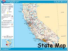
California
| Southern California | Yosemite Area |
|
|
|
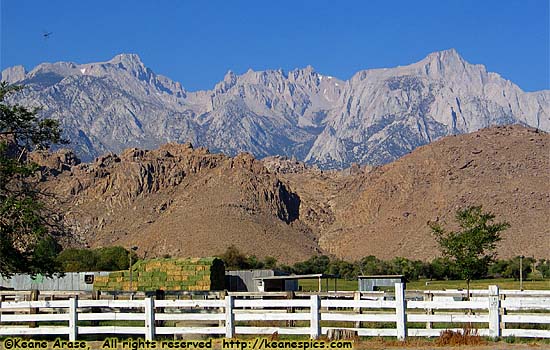
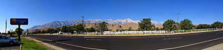
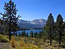
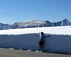
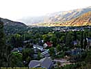
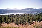
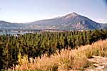
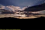
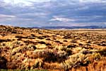
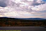
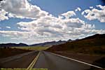
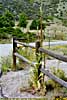
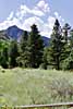
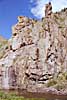
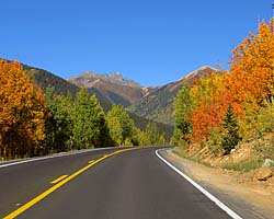
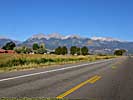
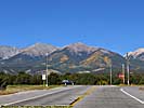
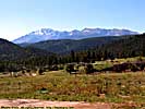
| The Sierra Nevada Mountains, along US-395 around Lone Pine |
I was there in 1969 with my parents on a rare, out-of-state vacation. However, when you're a kid, you go where the parents go. Granted, we did go to Disneyland and Marineland, but it was a short stay before going to San Francisco for a couple of days then to my grandparents place for a couple of weeks in Sacramento. Looking back (hindsight), we were close enough to Yosemite for a day trip, but never went, though I wonder how much I would have appreciated it back then. So what if I probably didn't even know what a National Park was, much less a Yosemite. It might have kick started my days of Road Tripping by a decade or two. I blame my parents.
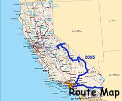
I was back in 2005 (yes, it only took me 36 years to get back to the West Coast), on my second longest Road Trip out West. As much as I was in Southern California on this trip, there were two places I really wanted to go. Disneyland and Death Valley, about two of the most opposite places on the comfort scale. Also included here are pictures from Disneyland and Marineland of the Pacific taken in 1969.
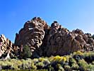
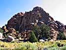
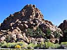
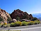
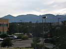
California - Southern California
| Death Valley National Park | |
|---|---|
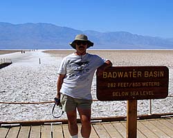 |
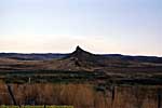
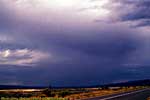
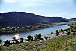
Death Valley National Park is the poster child for the term "Hostile Environment". We were there in September, and it was still 105 degrees (41 for you Celsius types) in the shade. In the rain shadow of three mountain chains and depressed into a large basin, Death Valley is it the driest place in the northern hemisphere, and the lowest point in the western hemisphere. That was enough tourist bait to get me there! |
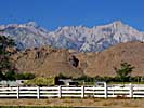
| Near Lone Pine, California / 45 Images. Visited Sep 2005. | |
| Disneyland Resort | |
|---|---|
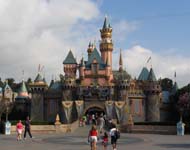 |
Disneyland Resort was to be our mid-2005 Road Trip break. Three days and three nights are the other "Happiest Place On Earth". As a Disney World veteran, it was an interesting experience visiting the park that Walt built. And the one he didn't.
|
| Anaheim, California / 107 Images. Visited Sep 2005. | |
| Grand Californian | |
|---|---|
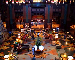 |
The Grand Californian at Disneyland is the top tier hotel at Disneyland. No room interiors, but there are images of the lobby. This link will take you to the Disneyland page. |
| Disneyland, California / 15 Images. Visited Sep 2005. | |
| Disneyland Park in 1969 | |
|---|---|
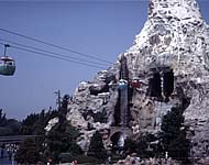 |
I was at Disneyland Park in 1969 for a day, and most of the memories of that trip were probably wiped out by my many visits to Magic Kingdom and definitely wiped out by a half century dying brain cells. One thing I do know, it pretty much looks nothing like Disneyland today. If you want to put things in perspective, Buzz Aldrin stepped on the moon a couple of days before this Disneyland visit. |
| Anaheim, California / 64 Images. Visited July, 1969. | |
| Marineland Of The Pacific in 1969 | |
|---|---|
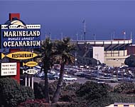 |
My visit to Marineland Of The Pacific in 1969 would have been completely over-shadowed by my trip Disneyland, and I remember few things from that trip to Disneyland. Thus, I remember even fewer things from Marineland. To be fair, we do have a local Oceanarium/Dolphin Show, so it wouldn't have been a completely unique experience. For those that remember it, this is a memory that hasn't existed in decades. |
| Palos Verdes, California / 43 Images. Visited July, 1969. | |
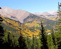
California - Yosemite Area
The next three links are Yosemite and the area just East of the Park.
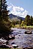
| Yosemite National Park | |
|---|---|
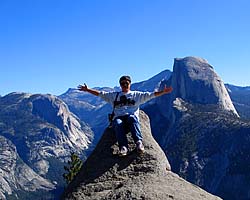 |
Yosemite National Park actually turned out to be a more impressive park that I thought it would be when planning the trip. That's what you get for watching the Travel Channel. The park is full of superlatives, from granite mountains to the waterfalls to the peaceful meadows to the truly immense sequoias. This park is definitely in my must visit list... |
| East Central California / 77 Images. Visited Sep 2005. | |
| Wawona (Yosemite National Park) | |
|---|---|
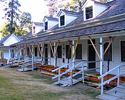 |
Wawona is a historic hotel in the park, close to the Mariposa Grove of Sequoias. I had to pay an extra $55 for a room with a bathroom, but totally worth it when the next morning it was in the 30's and I didn't have to freeze my buns off. The images for Wawona reside on the Yosemite National Park page. |
| Yosemite National Park, California / 5 Images. Visited Sep 2005. | |
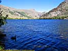
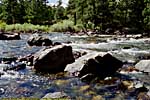
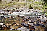
| Mono Lake | |
|---|---|
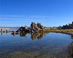 |
Mono Lake is one of the oldest, continuously existing lakes in North America. It is also a basin, which means there is no water outlet, so the salts leeched out of the surrounding mountains make the lake 2.5 times as salty, and 80 times more alkaline than the oceans. An interesting indigenous insect, the Alkali Fly lives here. They're so thick that the ground looks dark ahead of you, but the darkness moves out of the way as you approach. Ugh. |
| Near Lee Vining, California / 33 Images. Visited Sep 2005. | |
Pictures
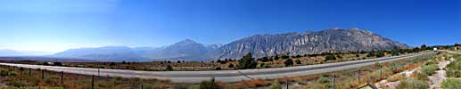
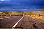
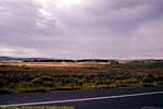
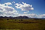
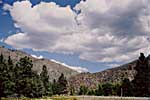
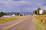
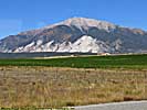
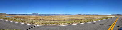
US-395 follows the Eastern rain shadow of the Sierra Nevada Mountains, and drove it from Death Valley to Yosemite.It runs through Lone Pine (and Bishop), where countless numbers of movies and television programs were filmed.
US-395, California
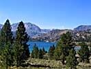
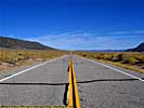
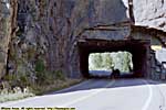
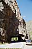
California State Route 120 crosses the Sierras through Yosemite (it's also known as the Tioga Pass Road), and continues to the East, where once past Mono Lake winds its way around the hills through pine forests and desert scrub and really serves as a short cut to Benton and further East. It's a road everyone should have a chance to drive.
California State Route 120 East of Yosemite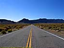
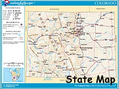
Colorado
| The Colorado River | Northern Colorado | Central Colorado | Southern Colorado |
|
|
|
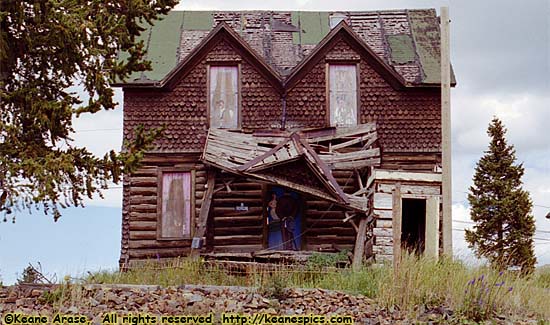
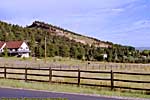
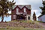
| A fixer-upper near Cripple Creek. It just needs some minor repairs... |
While Colorado is known as a mountain state (it is home to 56 fourteeners, or mountains that reach a peak height of 14,000 feet or more), the Eastern half is as flat as a pancake. And just about as exciting.
However, once your past the dividing line created by I-25, the entire character of the state changes from flat and boring to some of the most spectacular scenery in America as you climb up into the Rockies and the Colorado Plateau.
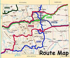
I've travelled in Colorado mostly East-West, so I'm splitting Colorado into four parts.
- The Colorado River, and the sights along the way downstream.
- Northern Colorado. Dinosaur National Monument and US-287.
- Central Colorado, which mostly follows US-50/US-24 from Western Colorado to Colorado Springs.
- Southern Colorado, which mostly follows US-160 from I-25 to Four Corners.
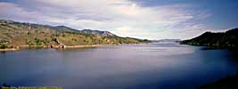
The Colorado River
The source of the Colorado River is in Rocky Mountain National Park, and follows a broad valley between two mountain chains to the South. Not far out of the park, the river turns to the Southwest, and meanders through the Rockies until it merges with the Eagle River.
I-70 follows the Eagle River West of US-24, and continues to follow the Colorado after the merge, almost all the way to the Utah border. Along the way, it passes through Glenwood Springs, and passes close to Colorado National Monument in Grand Junction.
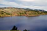
| Colorado River | |
|---|---|
 |
The Colorado River starts as a small stream in Rocky Mountain National Park, and gathers hundreds of other streams and rivers along the way to become the lifeline of the Southwest, providing water, electricity and recreation to millions in the five states the river flows through or touches. I've actually followed the river in one form or another, from Rocky Mountain National Park to Grand Canyon. I've also done more river miles on the Colorado than any other river... |
| Colorado, Utah and Arizona / 55 Images. Visited Sep 2005, Sep 2008. | |
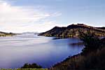
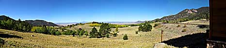
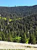
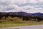
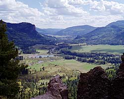
The premier park in Colorado (and source of the Colorado River) is Rocky Mountain National Park. It was my first proof that things are a bit different at 12,000 feet in altitude. And of the three times I've been to the park, I've encountered snow twice (not counting the permanent snow packs), once bad enough to delay my trip by a couple of hours.
| Rocky Mountain National Park | |
|---|---|
 |
Rocky Mountain National Park is pretty much the very definition of the phrase "Purple Mountain Majesty". The views in this park are mind-boggling as you try to wrap you head around the scale of the scenery you're looking at. And more than that, it's the birthplace of the Colorado River, and two of the most scenic roads you'll ever want to drive. Let me also say that I've encountered snow twice in this park, in September. |
| Near Estes, CO / 177 Images. Visited Sep 1997(1), Sep 1997(2), Jul 2005, Sep 2008. | |
After the confluence of the Colorado and Eagle rivers, I-70 follows the Colorado through the Rockies, sometimes through a river valley so narrow that the Eastbound and Westbound lanes stack on top of each other rather than existing side-by-side.
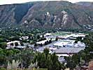
About 25 miles past the confluence, is Glenwood Springs.
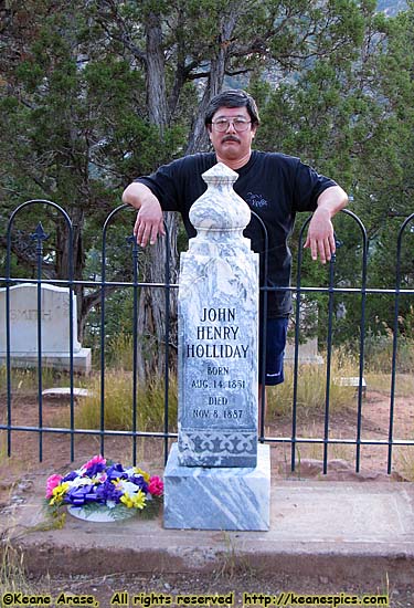
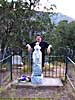
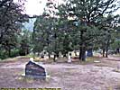
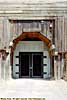
Lynwood Cemetery (Glenwood Springs, Colorado)
|
| Me and Doc... |
It was my second visit to Glenwood Springs (an overnight stay, just like the first) where we found a small tourist kiosk that had a map on where to find Lynwood Cemetery. Clearly a visit to Doc was in order. What the map we got failed to tell us, was the cemetery was on the canyon rim, which meant a few hundred foot climb in elevation when you're already at 6,000 feet...
It's said the original records were destroyed, and they don't know exactly where Doc's buried, but I suspect they do, and just don't want anyone digging him up.
2008 was after my trip to Tombstone, so this was clearly a must do. I'd probably go find Wyatt Earp, but he's buried in Los Angeles someplace, not very high on my list of places to visit.
Glenwood Springs / Lynwood Cemetery
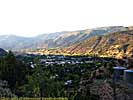
After passing by a number of smaller towns down I-70, all of which may have been railroad supply towns a hundred years ago (the railroad also follows the Colorado River), you get to the next large city of Grand Junction, which may have been named for the junction of two rail lines, or the junction of the Colorado and the Gunnison River.
Nearby here is Colorado National Monument, perhaps the next big Colorado River Park, except the Colorado doesn't touch any portion of the Monument...
| Colorado National Monument | |
|---|---|
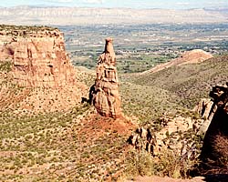 |
I really don't think I've given Colorado National Monument a fair review. They're just a victim of circumstance. If you're coming from the West, you have just seen the San Rafael Swell or Arches and Canyonlands. If you're coming from the South, you've just been on the Million Dollar Highway. If from the East, the Rocky Mountains. At this point, Colorado National Monument... is just a nice scenic drive. |
| Near Grand Junction, Colorado / 15 Images. Visited Sep 1997. | |
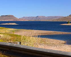
Some miscellaneous pictures that don't fit anywhere else. Denver International Airport, the Rockies from my hotel room in Broomfield, CO, and Dillon Reservoir along I-70...
Northern Colorado
I'm calling this section "Northern Colorado" because I couldn't think of any other relationship between Dinosaur and US-287 and the rest of the stuff on this page... :-)Coming off of I-80 South on Wyoming SR-789, you will eventually find yourself on Colorado SR-13 when you cross the border. One of the reasons you want to do this (okay, maybe the only reason), is it's one of the shortest ways to Dinosaur National Monument.
Colorado State Route 13 / US-40 (toward Dinosaur NM)
Dinosaur National Monument (Also in Utah)
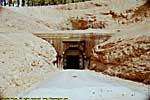
I'm sure at one time, Dinosaur National Monument wasn't in Colorado. It was in Utah. However, in 1938, the park was expanded to include the confluence of the Green and Yampa rivers, putting most of the park in Colorado.While the newer part of the park has nothing to do with dinosaurs, the Quarry part of the park is the real deal. They've actually enclosed an entire hillside of partially exposed fossils as an exhibit.
| Dinosaur National Monument | |
|---|---|
 |
Dinosaur National Monument is really two parks, the original Dinosaur Quarry, and the 1938 addition of the confluence of the Green and Yampa Rivers. The original Quarry is fascinating. If you ever wanted to see where Dinosaur fossil skeletons come from, this place will show you. There is also access to the Green River, showing some interesting bits of twisted and bent layers of rock... |
| Near Dinosaur, Colorado and Jensen, Utah / 53 Images Visited Sep 1998 | |
US-287 and Colorado-14 (Cache La Poudre River)
In 1997, the plan was to get off the Interstates and see America. That started in Colorado, where instead of taking I-25 South from Wyoming into Colorado, I drove I-80 to Laramie, and took US-287 South toward Ft. Collins and the Rocky Mountains.
My first side trip off of US-287 was Colorado-14, and was chosen only because it was the squiggliest road on the map. I still do that. Some things never change, I guess...
Central Colorado
US-550, The Million Dollar Highway
This section actually starts in Durango, Colorado, in where we stayed for the night and drove the Million Dollar Highway (US-550) the next morning. I'm including the road here, because it's technically a major spur off of US-50.
I drove it from Durango to Montrose, and it ranks up there as one of my top 10 roads.
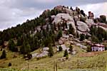
| US-550, Million Dollar Highway | |
|---|---|
|
The Million Dollar Highway is a spectacular mountain road which crosses the mining country of Western Colorado. I drove it from Durango to Montrose in Colorado, a magnificent drive I'd recommend to anyone. |
| Colorado / 55 Images. Visited Sep 2008. | |
At Montrose, we turned onto Eastbound US-50. (Westbound US-50 actually goes North to Grand Junction, before merging with I-70 to get through the San Rafael Swell in Utah.)
US-50 (Colorado, Montrose to Salida)
| US-50 (Colorado) | |
|---|---|
|
I drove US-50 (in Colorado) from Montrose to Salida, where I stayed for the night. Along the way is the Black Canyon of the Gunnison, which was much more stunning than I expected, then through the Curecanti National Recreation Area, and over the remarkable Monarch Pass in the San Isabel National Forest. |
| Colorado / 27 Images. Visited Sep 2008. | |
I don't think I was expecting much from Black Canyon of the Gunnison National Park, so I didn't plan a lot of time there.
Oops. This is at least a half-day, probably a full day park, just to get a feel for the place.
| Black Canyon of the Gunnison National Park | |
|---|---|
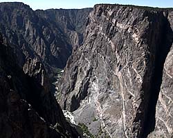 |
Black Canyon of the Gunnison National Park was a surprise, a narrow, deep river canyon with two thousand foot drop-offs just beyond the railing. There is also a steep drive down to the Gunnison River, where you can see the East Portal of the Gunnison Tunnel that was dug through the mountain to supply the city of Montrose with water. |
| Near Montrose, CO / 44 Images. Visited Sep 2008. | |
| Curecanti National Recreation Area | |
|---|---|
 |
I only passed through Curecanti NRA as a consequence of driving US-50 through Colorado. Since there are only seven images, they're on the US-50 (Colorado) page. |
| Near Gunnison, Colorado / 7 Images. Visited Sep 2008. | |
US-24 (Colorado, Buena Vista to Colorado Springs)
From Salida, we went North to US-24 to finish the trip to Colorado Springs.
Florissant Fossil Beds National Monument is about 30 miles outside of Colorado Springs, right off of US-24. I stopped there in 1997.
| Florissant Fossil Beds National Monument | |
|---|---|
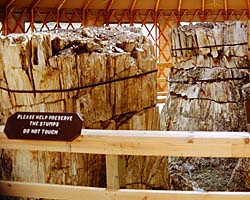 |
Florissant Fossil Beds National Monument was
once a subtropical lake, supporting an abundance of plant and wildlife.
Then the volcanoes started erupting, burying everything over hundreds of
thousands of years, petrifying trees and fossilizing plants and animals.
I stopped in while I was touring the Colorado Springs area. Unfortunately, I was shooting film, so only have a few images. |
| Near Florissant, Colorado / 9 Images. Visited Sep 1997. | |
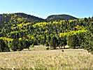
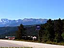
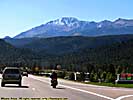
I was in Colorado Springs in 1997 for a couple of days checking out the local sights, but every time I wanted to go up Pikes Peak, the peak was covered by clouds. But I finally got up there in 2008, on an almost cloudless, sunny day.
| Pikes Peak Highway | |
|---|---|
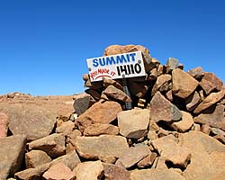
|
Pikes Peak Highway is a single purpose highway, specifically built as a tourist attraction. And it's a pretty good one, climbing to 14,100 feet via a few dozen switchbacks, with pull offs to enjoy the incredible views. You can also get to the top via a cog railroad, but what's the fun in that? I thought the air was thin at almost 12,000 feet in Rocky Mountain National Park, but the (lack of) air at 14,000 was actually noticeable. |
| Colorado / 58 Images. Visited Sep 2008. | |
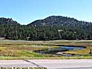
| Garden of the Gods, Colorado Springs City Park, Colorado | |
|---|---|
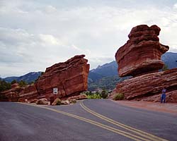 |
Garden of the Gods is a city park in Colorado Springs. This first surprised me, but after some thought, most cities have city parks. Just not ones with sandstone fins that jut out perpendicular to the ground with Pikes Peak as the background. Where I live, I get squirrels and some trees. |
| Colorado Springs, CO / 19 Images. Visited Sep 1997. | |
This is mostly the area around Cripple Creek when I used Colorado Springs as a base for a couple of days...
Colorado Springs / Cripple Creek Area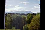
Southern Colorado
US-160 (Colorado, I-25 to Four Corners)
In 1997, the plan was to get off the Interstates, and see America. So on the way to the Grand Canyon, we'd take a U.S. Highway across the continental divide and through the desert to the National Park.
That road was US-160, which we took from I-25 all the way to US-89 in Arizona. Along the way (in Colorado) is Wolf Creek Pass (the Continental Divide on US-160), Great Sand Dunes National Monument, Mesa Verde National Park, and Four Corners.
US-160 in Arizona is on the Navajo Indian Reservation page.
| US-160 (Colorado, Wolf Creek Pass) | |
|---|---|
|
I drove US-160 from I-25 to the Four Corners. It's a nice drive, with several major attractions along the way, such as Great Sand Dunes and Mesa Verde National Parks, and a place you can stand on four states at one time. This page only has images from Colorado. |
| Colorado / 29 Images. Visited Sep 1997. | |
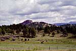
| Great Sand Dunes National Monument (Now a National Park) | |
|---|---|
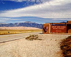 |
Great Sand Dunes National Monument is now a National Park, but it was a National Monument when I was there, so it's still referred to here as a Monument. It's also supposed to be haunted, but I can't attest to that. These dunes exist because the sand blown into this pocket of the Sangre De Cristo Mountains can't make it over the peaks, and drop out into the dune field. |
| Near Alamosa, Colorado / 18 Images. Visited Sep 1997. | |
| Mesa Verde National Park | |
|---|---|
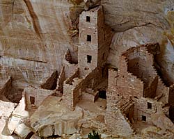 |
Mesa Verde National Park is different from most National Parks, in that the subject of the place is human history of a (mostly) vanished civilization. The ruins of the cities of the Anasazi are remarkable, and impressive, considering they were built a thousand years ago. Also here are pit dwelling of an even earlier civilization of some 1500 to 2000 years ago. |
| Near Cortez, Colorado / 92 Images. Visited Sep 1997. | |
| Four Corners Monument, Navajo Tribal Park | |
|---|---|
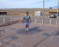 |
Four Corners Monument is the only place in the U.S. where four States meet, perhaps the ultimate place for a stupid tourist photo in the Southwest. I should know, I've been there twice! If I ever go back, I'm taking my GPS to see if it's really in the right spot. :-) In addition to the monument (there is an entrance fee), there are stalls around run by (rented by?) the locals selling locally produced merchandise. Oh, try the fry bread. Mmmmmm... |
| Utah, Arizona, New Mexico, Colorado / 28 Images. Visited Sep 1997, Sep 2008. | |
|
|
Connecticut
No pics of Connecticut.
|
|
Delaware
No pics of Delaware.
- 04/30/2016 - Initial deployment
- April 2017 - Upgrade to v3.4.
- September 2022 - Upgrade to v5.0.
| Help! | About This Site | Contact Me |