
Places I've Been... By State
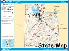
Utah is the only state on this page, and is the only State to be split into two parts.
Utah - Page 2
| Page 1 | Introduction | Moab Area | State Routes 12 & 24 |
|---|
| Page 2 | The US-89 corridor | Navajo Tribal Parks | Miscellaneous Places |
|---|
|
|
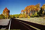
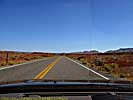
Though I call it the US-89 corridor,
Utah - US-89 (in Utah)
|
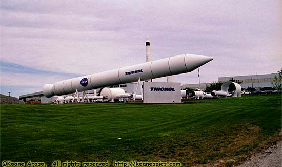
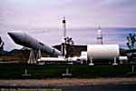
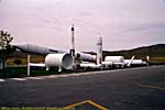
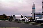
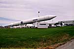
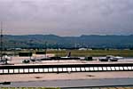
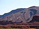
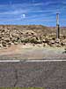
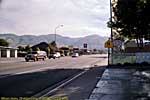
| Thiokol hardware display... |
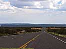
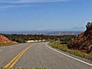
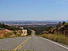
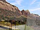
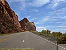
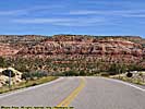
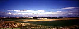
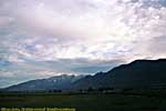
US-89 is a remarkable road which stretches from Montana to Arizona, and either touches, passes through, or comes within a few miles of over a half-dozen major Western Parks, from Glacier to the Grand Canyon. It enters Utah from the North on the Western shore of Bear Lake, about 150 miles after leaving Grand Teton National Park.
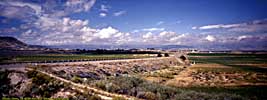
Golden Spike National Historical Site
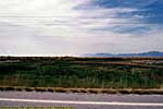
US-89 travels to the Southwest after entering Utah, to closely parallel I-15 in the squeeze between the mountains and the Great Salt Lake. Close to Brigham City, it passes within about 30 miles of Golden Spike National Historical Site. It's about as close as you can get to the site, since the Eastern half of the Great Salt Lake gets in the way.
Golden Spike is where the Transcontinental Railroad was completed. It may have been driven by greed, power, corruption and massive land grants, but it fundamentally transformed the United States only a half decade after the Civil War. The War may have reunited the North and the South, but the Transcontinental Railroad united the East and the West, completing a link that connected the Atlantic to the Pacific ocean.
| Golden Spike National Historic Site | |
|---|---|
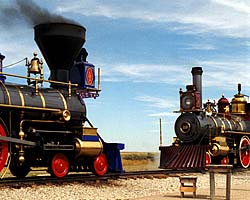 |
Golden Spike National Historic Site is where that final spike (made of gold, hence the name) was driven, completing the Transcontinental Railroad. That single event tied a geographically divided nation together, transforming a treacherous six month trip by wagon or ship to a five day, sightseeing adventure. They have seasonally operated replicas of the Central Pacific Jupiter and the Union Pacific 119, the locomotives present when the final spike was driven. It's a must for any train buff... |
| Near Promontory, Utah / 19 Images. Visited Sep 1998. | |
You have to take Utah-83 to get to Golden Spike, and Thiokol is right outside the park.
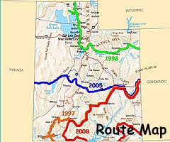
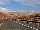
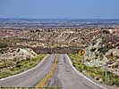
I was back on US-89 in 1997 for all of four miles 200 miles to the South, a short leg from Utah-143 to Utah-12. (I was coming from Cedar Breaks, and heading to Bryce Canyon.) In 2008, I drove US-89 South from Utah-12, and essentially took it South all the way to the Grand Canyon in Arizona... But US-89 in Arizona is another page...
Zion is a mere 60 miles from Utah-12 (10 miles from US-89), but I visited that park in 1997, and it has since become a victim of its own success. While Zion is a decent sized park, the area along the Virgin River is not. Rather than fight the crowds, we bypassed Zion and moved on to Coral Pink and Glen Canyon.
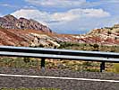
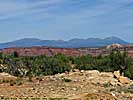
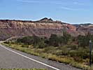
Coral Pink Sand Dunes is a Utah State Park just a few miles from where US-89 turns East toward Glen Canyon. Yes, the sand there really is pink, eroded from the local sandstone to a very fine powder. If you visit the park and walk into the sand field, you'll also have pink shoes and laces, pink socks, and pink floor mats in your car.
| Cedar Breaks National Monument | |
|---|---|
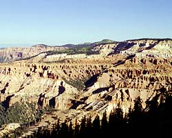 |
Cedar Breaks National Monument has a problem. It's a beautiful place, almost a mini-Bryce Canyon. But that's its problem. It's located about 60 miles North of Zion National Park, and 60 miles West of Bryce Canyon National Park. If you drove here (and you probably will if you visit), it is dwarfed by the majesty of either (or both) of the other parks. So if you visit Cedar Breaks, try to see it first. :-) |
| Near Cedar City, Utah / 16 Images. Visited Sep 1997. | |
| Zion National Park | |
|---|---|
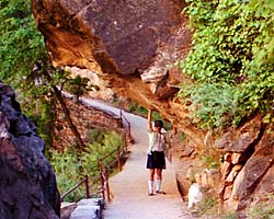 |
Zion National Park is another victim of its own success. It's a decent sized park, but its premier attraction, Zion Canyon, is narrow and confined. During certain times of the year (which might be all year now), you can only get in via a shuttle bus. That said, it is a beautiful park. And don't forget there's another entrance to the park, the Kolob Canyons. |
| Near Virgin, Utah / 81 Images. Visited Sep 1997. | |
| Coral Pink Sand Dunes State Park, Utah | |
|---|---|
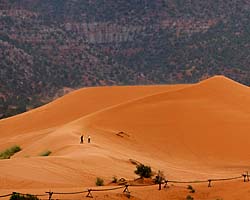 |
Coral Pink Sand Dunes State Park isn't that far off US-89 between Zion and Glen Canyon. Should you choose to stop there, you'll find a very, very fine, pink sand, eroded from the neighboring cliffs and shaped by the wind into large dunes. Should you choose to walk into the dune field, you'll find your shoelaces pink, your socks pink, with sand between your toes, and will track inside your car and follow you around for days... |
| Near Kanab, Utah / 13 Images. Visited Sep 2008. | |
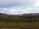
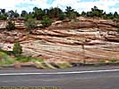
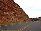
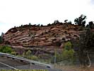
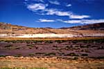
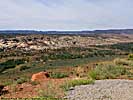
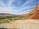
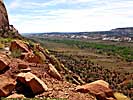
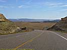
US-89 goes right through Glen Canyon National Recreation Area, but it has to jog 75 miles East to do it. If you think this was the intent, it was not. US-89 crosses the Colorado at the Glen Canyon Bridge, and US-89a crosses at Navajo Bridge, about 15 miles apart as the crow files, but is 40 miles by road.
It's one of the only places to cross the Colorado in the area, true back to the 1800's, when John Lee operated a river ferry, appropriately name Lee's Ferry. (The ferry operated until the first Navajo Bridge opened in 1929.) Downstream, there isn't another crossing of the Colorado until you get to Las Vegas. Upstream, the next crossing is some 75 miles away as the crow flies, but only if the water levels are high enough for a car ferry to operate. Otherwise, the next crossing upstream by bridge would be some 100 miles away.
But in any event, US-89 crosses over into Arizona before it gets to Glen Canyon, but over 90% of Glen Canyon National Recreation Area and Lake Powell reside in Utah...
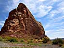
| Glen Canyon National Recreation Area | |
|---|---|
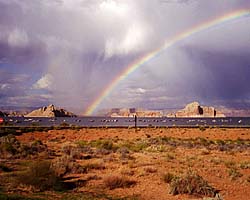 |
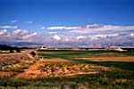
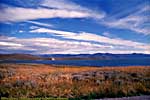
The Glen Canyon National Recreation Area encompasses and products the Colorado River (and many of its tributaries) from Canyonlands to Grand Canyon National Park. It is mostly a creation of the Glen Canyon Dam, which creates a reservoir behind it (Lake Powell) a hundred miles long. Included on this page is the Navajo Bridge at Marble Canyon and the Lees Ferry Unit of the park, river level access a dozen miles below the dam. |
| Arizona, Utah / 102 Images. Visited Sep 1997, Sep 2008. | |
| Lake Powell, Glen Canyon NRA | |
|---|---|
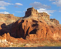 |
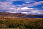
Lake Powell is created from the Colorado River (and its tributaries) by the Glen Canyon Dam. It's approximately 140 river miles (100 linear miles) long, and provides water, power and entertainment to millions in the Southwest. Using it as a water route is also the only convenient way to get to Rainbow Bridge National Monument. These images are of the 50 river miles from Wahweep to Rainbow Bridge National Monument. |
| Arizona, Utah / 48 Images. Visited Sep 2008. | |
| Rainbow Bridge National Monument | |
|---|---|
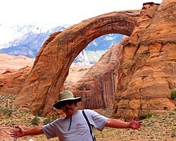 |
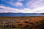
Rainbow Bridge National Monument is the largest (known) Natural Bridge in the world, at 290 feet high and 275 feet wide. It is accessible by boat from Lake Powell, or you can get a permit from the Navajo, and do an arduous 14 mile hike across a sandstone desert. |
| Near River Mile 49, Lake Powell, Utah / 47 Images. Visited Sep 2008. | |
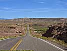
| US-89 | |
|---|---|
|
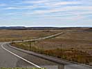
US-89 is a remarkable road that follows some of the most scenic areas of the West from Canada to Arizona, and along the way passes through (or comes within a few miles of) over a half dozen major Western Parks. Glacier to Yellowstone to Grand Teton, Bryce, Zion, Glen Canyon and Grand Canyon. I've actually frequented this road quite a bit, but in a disjointed, non-continuous fashion. |
| Visited Various | |
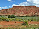
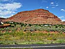
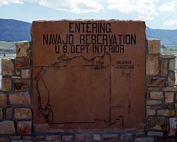
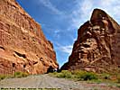
Utah - Navajo Indian Reservation and Tribal Parks
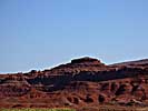
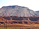
While admittedly much of the Navajo Indian Reservation is desert scrub, they do have some instantly recognizable landscapes and vistas, made famous by John Ford and a few hundred other movies and television programs.
Also unique to the Reservation is the only place in the United States where you can stand on four states at one time, ultimately the most trivial accomplishment you can put on your travel CV. I can proudly say I've done it twice.
There are a couple of other parks other than Monument Valley and Four Corners, such as the Little Colorado River Gorge in Arizona.
Navajo Tribal Parks
| Navajo Indian Reservation | |
|---|---|
 |
The images I have of the Navajo Indian Reservation (other than the Tribal Parks I've visited) are mostly along US-89 and US-89A, from Marble Canyon/Navajo Bridge and Page, Arizona through Antelope Pass to Grand Canyon. There are also images along US-160 from Four Corners to US-89. |
| Arizona, Utah / 61 Images. Visited Sep 1997, Sep 2008. | |
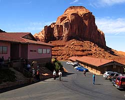
| Monument Valley, Navajo Tribal Park | |
|---|---|
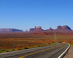 |
Monument Valley is definitely worth a stop. It's landscapes are some of the most memorable in the world, immortalized by everyone from John Ford to Robert Zemekis. Goulding's Lodge is also on this page, as are images from one of the four-hour tours through the restricted parts of the park. |
| Near Kayenta, Utah / 160 Images. Visited Sep 2008. | |
| Gouldings Lodge | |
|---|---|
 |
Gouldings Lodge has history. You'll find it featured in a lot of "Making of" John Ford/John Wayne movies. The rooms you can rent today aren't as old as the movies, and are quite modern in fact. They all face the sandstone monuments, so every room has a premier view, among the best I've had. This link will take you to the Monument Valley page. |
| Near Kayenta, Utah / 25 Images. Visited Sep 2008. | |
| Four Corners Monument, Navajo Tribal Park | |
|---|---|
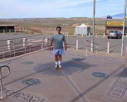 |
Four Corners Monument is the only place in the U.S. where four States meet, perhaps the ultimate place for a stupid tourist photo in the Southwest. I should know, I've been there twice! If I ever go back, I'm taking my GPS to see if it's really in the right spot. :-) In addition to the monument (there is an entrance fee), there are stalls around run by (rented by?) the locals selling locally produced merchandise. Oh, try the fry bread. Mmmmmm... |
| Utah, Arizona, New Mexico, Colorado / 28 Images. Visited Sep 1997, Sep 2008. | |
Utah - Miscellaneous Places
They might be miscellaneous, but that only means they're they're in the middle of nowhere. That doesn't mean they're not worth stopping at, it just means you have to want to get there, since they're off the typical tourist routes...
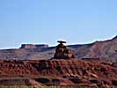
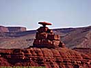
Just North of Monument Valley on US-163 is a small town called Mexican Hat, because there's a rock formation there that looks like a... Mexican Hat. Kinda.
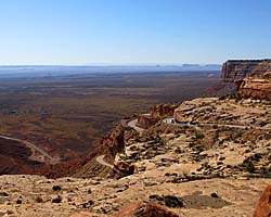
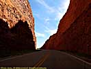
Also in the desolation between Monument Valley and Moab, is a surprisingly interesting road that climbs one of the stairs in the Grand Staircase. It's called the Moki Dugway, and climbs over 1000 feet up the side of a cliff face. It's actually the shortest way to Natural Bridges National Monument from Monument Valley.
| Utah State Route 261, The Moki Dugway | |
|---|---|
|
When I planning my 2008 trip, I was going to leave Monument Valley and go North to Natural Bridges National Monument via Utah-261. On every map the road took this tiny little squiggle, like a knot in a string. I actually had a detour ready in case the road was too... shoddy. It turned out to be a fantastic road. I did some research on it when I got back, and it turns out it actually had a name and some history... |
| Utah / 29 Images. Visited Sep 2008. | |
| Natural Bridges National Monument | |
|---|---|
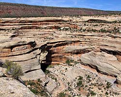 |
Natural Bridges National Monument is actually an impressive place, but it's another park that you have to want to go to, since it's not on the way to anything else. (That's not exactly true, but it's close enough.) The monument preserves three natural stone bridges, which still exist mostly because there's little rain or other severe erosive forces here. |
| In the middle of nowhere, Southeastern Utah / 46 Images. Visited Sep 2008. | |
Leaving Natural Bridges to the East...
State Routes 95 & 262, SE Utah
Dinosaur National Monument is in both Utah and Colorado, just South of Wyoming. The dinosaur part of the park is in Utah, where the Park Service enclosed an entire hillside of fossils in a building...
| Dinosaur National Monument | |
|---|---|
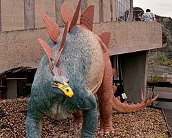 |
Dinosaur National Monument is really two parks, the original Dinosaur Quarry, and the 1938 addition of the confluence of the Green and Yampa Rivers. The original Quarry is fascinating. If you ever wanted to see where Dinosaur fossil skeletons come from, this place will show you. There is also access to the Green River, showing some interesting bits of twisted and bent layers of rock... |
| Near Dinosaur, Colorado and Jensen, Utah / 53 Images Visited Sep 1998 | |
| Jump to: | Utah State Page 1 |
|---|
- 04/30/2016 - Initial deployment
- April 2017 - Upgrade to v3.4.
- September 2022 - Upgrade to v5.0.
| Help! | About This Site | Contact Me |