
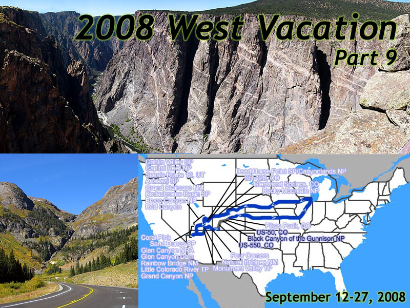
2008 West Vacation, Part 9
September 12 to 27
September 12 to 27
Day 13
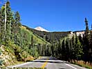
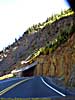
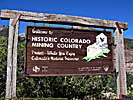
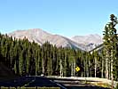
US-550 - September 24
 |
| My 2008 West Vacation. 16 days, 4596.3 miles. Day 13, Durango, CO to Salida, CO |
Drove almost the entire length of Durango looking for a Shell. One doesn't seem to exist. Filled up at the Exxon, pump gives me a receipt error, and the clueless lady inside the store can't give me one either. (She finally comes up with a receipt, and it's the wrong one.)
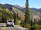
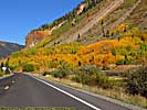
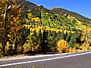
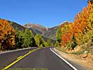
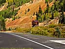
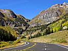
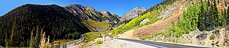
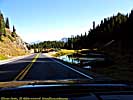
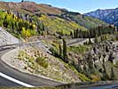
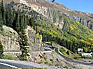
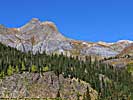
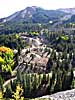
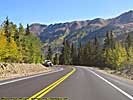
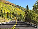
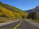
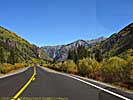
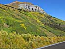
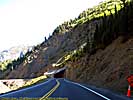
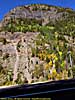
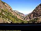
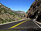
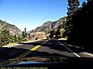
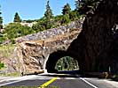
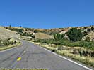
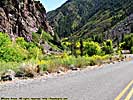
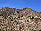
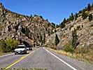
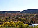
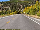
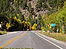
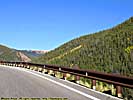
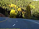
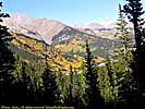
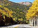
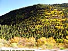
US-550 (also known as the Million Dollar Highway) is one of those beautiful mountain roads and probably one of my top 10 drives. As you get into the peaks, they have some of the tightest switchbacks I've seen on a paved road. As we get into Silverton, there's some color change in the trees.
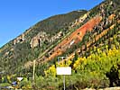
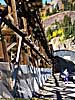
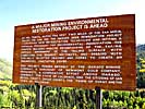
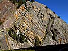
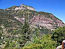
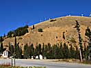
We get to the old Idarado Mine site, a gold/silver/copper/lead/zinc mine, which operated on and off from the 1910 to 1978, and in 1992 became a 20 million dollar superfund site. There are reportedly 80 miles of tunnels beneath the mountains. The other entrance to the mine is 8 miles away in Pandora on the other side of the mountains.
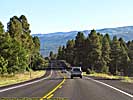
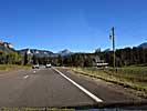
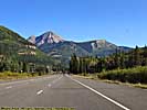
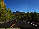
US-550, Part 2
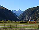
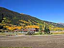
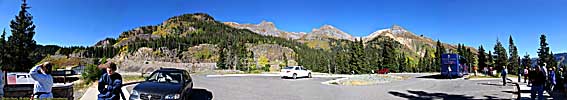
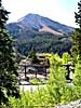
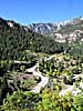
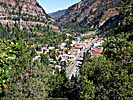
Ouray, is a very cool small town nestled between a couple of mountain peaks. I should have allocated a little more time in the small towns like Silverton and Ouray. Some day...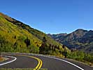
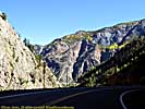
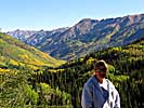
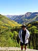
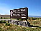
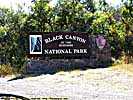
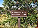
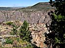
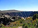
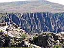
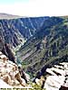
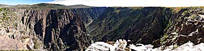
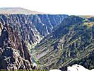
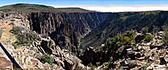
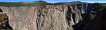
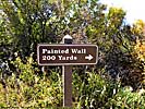
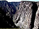
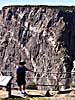
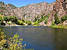
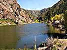
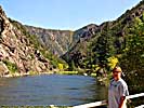
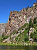
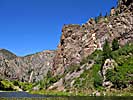
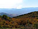
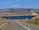
Black Canyon of the Gunnison National Park - September 24
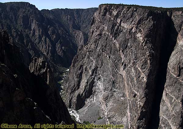 |
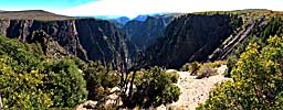
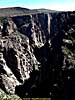
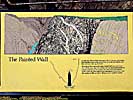
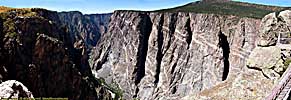
| May not look like it, but this canyon is almost a half-mile deep... Painted Wall, Black Canyon of the Gunnison National Park, CO |
Black Canyon of the Gunnison National Park, Part 1
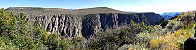
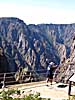
Black Canyon of the Gunnison National Park, Part 2
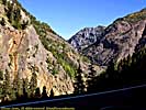
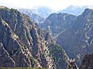
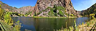
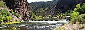
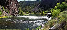
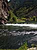
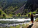
We go down the East Portal Road to the river, and my experience with the tight switchbacks on US-550 is dwarfed by the switchbacks going down to the Gunnison River. At times, I shift down to first, the torque converter whining at the engine revs to 4000rpm to slow me down. There's a moron in a Tahoe behind me tailgating, so I pull off and let him pass.We get to the bottom by the river, and said moron's brakes are smokin'. Good job! He should learn how to drive his vehicle. He'll probably blame GM for crappy brakes, when the driver's at fault. They never catch fire, though I was ready with the video camera in case his vehicle went up in smoke...
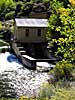
We can get to the diversion dam, but not all the way to the main dam, because there's a snowplow blocking our way. The diversion dam feeds a water tunnel that goes from here to Montrose, under a mountain, and supplies water to the town. Built back in the early 1900's. Amazing.
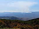
The ride back up seems shorter, and a small fire we saw off in the distance has grown considerably. It's probably 20 miles away, and we have to get down the road.
Black Canyon of the Gunnison National Park, Part 2
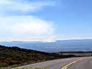
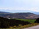
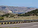
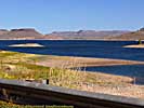
US-50 - September 24
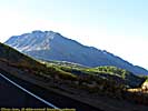
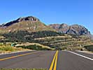
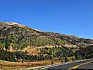
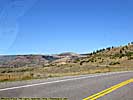
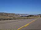
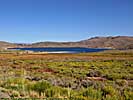
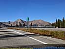
US-50 follows the Gunnison and the Blue Mesa reservoir for miles. Amazed at how big the reservoir is, and it's low too.After a while, the road starts to climb, and we get to Monarch Pass, 11,300 ft, the continental divide. What goes up, must go down, and the climb we made, turns into 6% grades going down.
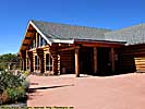
We end the day in Salida, CO. Standard Comfort Inn, not bad, not good. The good part is, we used my Choice points, so the room was free.
Hotel 7 of 10, shower 8 of 10, but not enough flow.
Dinner at Amicas. Wood fired Oven Pizza, microbrews. Pizza was excellent. Jo had the Chocolate Peanut butter mousse torte, I had the Chocolate Cannoli. Sugar shock. But good...
End of day 13 miles: 3272.5. Hotel: Comfort Inn, Salida, CO.
End 2008 Southwest Vacation - Part 9.
| Jump to: | Part 1 | Part 2 | Part 3 | Part 4 | Part 5 | Part 6 | Part 7 | Part 8 | Part 9 | Part 10 |
|---|
- 02/25/2009 - Initial Deployment
- 08/15/2013 - Update to v3.11
- 08/31/2014 - Update to v3.2
- September 2022 - Upgrade to v5.0.
| Help! | About This Site | Contact Me |