
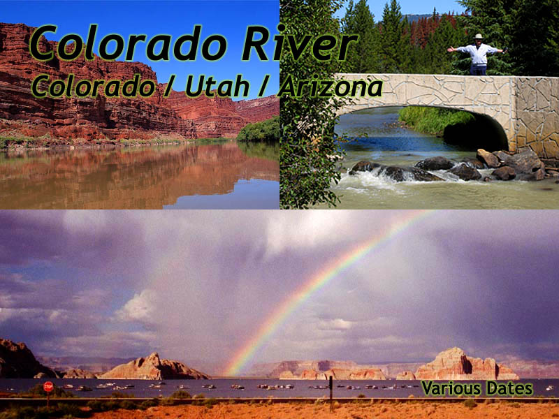
The Colorado River
| Introduction | Colorado | Utah | Arizona |
|
| Click to go directly to the slideshow |
But beyond that, the forces of nature that have influenced the river, have also created and preserved some of the most stunning landscapes on Earth.
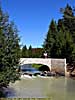
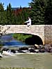
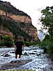
The Colorado's source is in the Colorado Rockies, within the boundaries of Rocky Mountain National Park. Just past Milner Pass (the Continental Divide) at Farview Curve, you can see the Kawuneeche Valley, where the River is only a dozen feet across during the fall, but you can see the large flood plains from the spring snow melts.
Once you descend into the valley, US-34 follows the River South as it exits the park. As the river turns West out of the Rocky Mountain Granite, it enters the Colorado Plateau, where it starts to cut deep channels into the relatively soft sandstone.
Colorado
| Rocky Mountain National Park | |
|---|---|
|
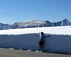
Rocky Mountain National Park is pretty much the very definition of the phrase "Purple Mountain Majesty". The views in this park are mind-boggling as you try to wrap you head around the scale of the scenery you're looking at. And more than that, it's the birthplace of the Colorado River, and two of the most scenic roads you'll ever want to drive. Let me also say that I've encountered snow twice in this park, in September. |
| Near Estes, CO / 177 Images. Visited Sep 1997(1), Sep 1997(2), Jul 2005, Sep 2008. | |
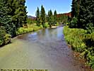
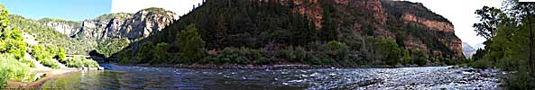
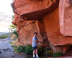
Colorado River, Rocky Mountain National Park
So what exactly are we seeing here? Why does the Southwest hold so many magnificent landscapes? If we do the Cliff Note version of the Reader's Digest Condensed book of geologic history, it starts 70 million years ago.
At that time, the entire area here was at the bottom of a vast, inland sea, hundreds of miles wide, that split North America in two from the arctic to the Gulf of Mexico.
Then the Pacific tectonic Plate ran up against, and was forced under the North American Plate. As the Pacific Plate was forced down, it like wise forced the North American plate upward, draining the inland sea, roughly producing the land mass we can recognize as North America. However, the Pacific plate kept pushing, and areas once at the bottom of that inland sea are now 8,000 feet above sea level in parts of Colorado and Utah.
As more and more stuff from the Pacific Plate got slammed into the North American plate on the West Cost, it created the Sierra Nevada Mountains as well as the numerous geologic earthquake faults California is known for.
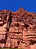
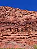
Those Sierra's and other inland mountain chains also create a massive rain shadow in the form of the Great Basin Desert, which extends from the Western border of Nevada to the Eastern border of Utah. During the uplift of the Colorado Plateau, massive catastrophic floods occurred, carving deep canyons and twisting the earth to form vertical layers of sandstone that were once flat.
Other catastrophic floods and geologic events like earthquakes and volcanoes would create huge river canyons where they would buzz-saw (geologically speaking) through the soft sandstone as the Earth literally rose and split apart like a bent block of cheese. As the North American plate continued to be pushed upward, the rivers of the Southwest became trapped in their channels, victims of their own success. Massive floods will still occur, but won't change nor influence some of the remarkable structures hundreds or thousands of feet above the river, once the river's domain, but now out of reach of the water.
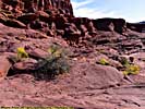
Natural Erosion from rain, wind and frost occur, and naturally shape the granite and different types of sandstone, whether layers of ancient sea-bed or petrified sand dunes, creating parks like Bryce Canyon with its magnificent hoodoos. Those horizontal layers of sandstone twisted and now vertical form fins and erode or the sand Monument Valley , now vertical, eroded down to become "fins", and eventually massive spires or arches.
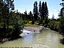
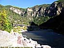
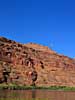
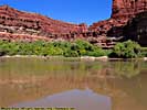
Colorado River, Near Colorado Springs
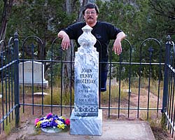
| Linwood Cemetery, Glenwood Springs, Colorado | |
|---|---|
|
If you're in Glenwood Springs and you want to pay your respects to one of the quasi-legendary gunfighters of the Wild West, prepare to walk up a few switchbacks. But hey, a visit to Doc Holliday's resting place in the Linwood Cemetery was pretty cool. This link will take you to the Colorado State Page. |
| Glenwood Springs, Colorado / 7 Images. Visited Sep 2008. | |
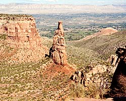
| Colorado National Monument | |
|---|---|
|
I really don't think I've given Colorado National Monument a fair review. They're just a victim of circumstance. If you're coming from the West, you have just seen the San Rafael Swell or Arches and Canyonlands. If you're coming from the South, you've just been on the Million Dollar Highway. If from the East, the Rocky Mountains. At this point, Colorado National Monument... is just a nice scenic drive. |
| Near Grand Junction, Colorado / 15 Images. Visited Sep 1997. | |
Utah
|
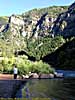
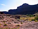
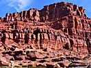
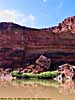
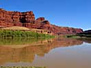
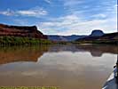
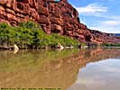
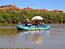
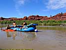
| We took a jet boat ride from Moab to Canyonlands |
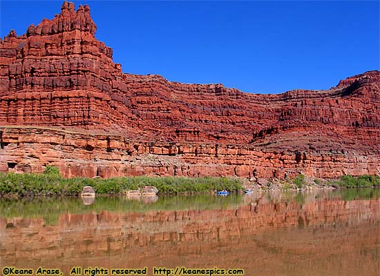
| Utah State Route 128 | |
|---|---|
|
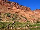
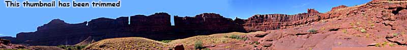
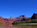
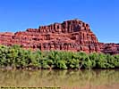
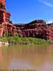
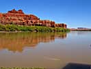
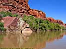
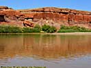
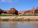
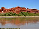
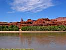
Utah-128 follows the Colorado River's meanders upstream (from Moab) for over 30 miles before turning toward (and joining) I-70. It is one of those roads which seemingly define some of the iconic views of the West, where the Colorado River lazily flows through the Red Rock desert with its sculpted mesas and pinnacles. There are also a couple of images of Cisco, an uranium mining town on US-6 near I-70. |
| Near Moab, Utah, Utah / 28 Images. Visited Sep 1997, Sep 2008. | |
| Moab, Utah | |
|---|---|
|
Moab is mostly a tourist town. It's a very handy base-camp for day-trips into Arches, Canyonlands, Dead Horse Point, trips on the Colorado, red-rock jeep tours, and is the start (or end) point for two outstanding Colorado River Roads, Utah-128 and Utah-279. It's also an excellent place to wander around after dinner, winding down from the day's activities. This link will take you to the Utah State Page. |
| Moab, Utah / 8 Images. Visited Sep 1997, Sep 2005, Sep 2008. | |
| Arches National Park | |
|---|---|
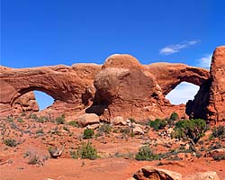 |
Arches National Park is a unique park, a sandstone desert with a unique geology that allows the formation of stone arches. Arches National Park has the greatest density of stone arches in the world. Although it's only a few dozen river miles upriver from Canyonlands, the two parks are completely different in character and content. |
| Near Moab, Utah / 58 Images. Visited Sep 1997, Sep 2005 | |
| Dead Horse Point State Park, Utah | |
|---|---|
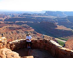
|
Dead Horse Point State Park is right next door to Canyonlands National Park, about a half-mile as the crow flies, or about 11 miles by road. That's just the way things are out here. From the top, you get a magnificent view of the Colorado River Valley and the goosenecks just before entering Canyonlands. Unfortunately, the main view is to the South, so the sun will always be in front of you. |
| Near Moab, Utah / 27 Images. Visited Sep 2005, Sep 2008. | |
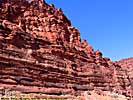
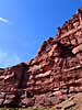
| Canyonlands National Park | |
|---|---|
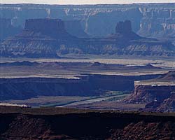
|
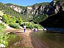
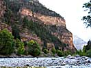
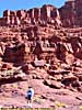
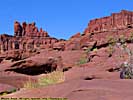
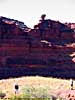
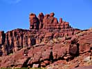
Canyonlands National Park is proto-Grand Canyon, and in my opinion even more impressive in many ways. It is the confluence of the Green and Colorado Rivers, a major contributor making the Colorado the powerhouse river of the Southwest. Once the Colorado enters Canyonlands, it doesn't leave Federal land until the river reaches the California. I've only been to the Island In The Sky District, since it was the most accessible. |
| Near Moab, UT / 49 Images. Visited Sep 1997, Sep 2008. | |
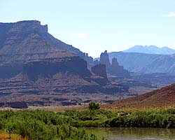
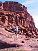
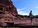
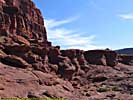
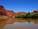
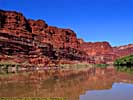
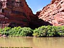
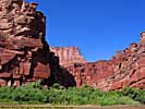
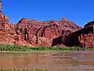
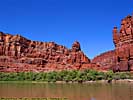
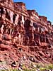
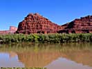
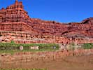
Colorado River Jet Boat Tour, Moab to Canyonlands


| Glen Canyon National Recreation Area | |
|---|---|
|
The Glen Canyon National Recreation Area encompasses and products the Colorado River (and many of its tributaries) from Canyonlands to Grand Canyon National Park. It is mostly a creation of the Glen Canyon Dam, which creates a reservoir behind it (Lake Powell) a hundred miles long. Included on this page is the Navajo Bridge at Marble Canyon and the Lees Ferry Unit of the park, river level access a dozen miles below the dam. |
| Arizona, Utah / 102 Images. Visited Sep 1997, Sep 2008. | |
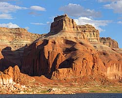
| Lake Powell, Glen Canyon NRA | |
|---|---|
|
Lake Powell is created from the Colorado River (and its tributaries) by the Glen Canyon Dam. It's approximately 140 river miles (100 linear miles) long, and provides water, power and entertainment to millions in the Southwest. Using it as a water route is also the only convenient way to get to Rainbow Bridge National Monument. These images are of the 50 river miles from Wahweep to Rainbow Bridge National Monument. |
| Arizona, Utah / 48 Images. Visited Sep 2008. | |
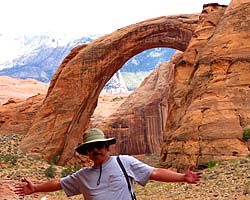
| Rainbow Bridge National Monument | |
|---|---|
|
Rainbow Bridge National Monument is the largest (known) Natural Bridge in the world, at 290 feet high and 275 feet wide. It is accessible by boat from Lake Powell, or you can get a permit from the Navajo, and do an arduous 14 mile hike across a sandstone desert. |
| Near River Mile 49, Lake Powell, Utah / 47 Images. Visited Sep 2008. | |
Arizona
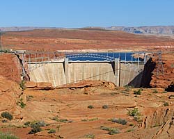
| Glen Canyon Dam, Glen Canyon NRA | |
|---|---|
|
Glen Canyon Dam is a 600 foot high thumbnail that holds back the Colorado River creating the massive reservoir named Lake Powell. I took the Dam tour, and it was a dam... It was an impressive tour which takes you all the way down to the generator room via two sets of elevators. No stairs, but there is some walking involved. |
| Near Page, Arizona / 56 Images. Visited Sep 2008. | |
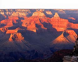
| Grand Canyon National Park | |
|---|---|
|
Grand Canyon National Park is the premier National Park in America, one of the seven natural wonders of the world, and many consider the park bucket-list-worthy. In addition to the South Rim, there is a North Rim, which is 10 miles as the crow flies, but over 200 miles by car. I won't mention the crowds. If there was ever a need to plan ahead for a trip, Grand Canyon is it. |
| Near Tusayan, Arizona / 163 Images. Visited Sep 1997, Sep 2008. | |
| Return to: | Colorado State Page | Utah State Page | Rivers and National Recreation Areas |
|---|
- 04/30/2016 - Initial deployment
- April 2017 - Upgrade to v3.4.
- August 2022 - Upgrade to v5.0.
| Help! | About This Site | Contact Me |