
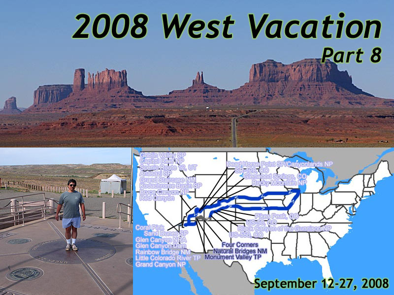
2008 West Vacation, Part 8
September 12 to 27
September 12 to 27
Day 12
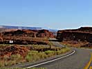
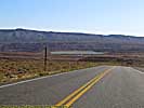
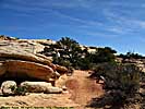
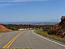
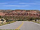
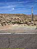
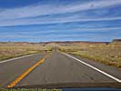
US-163 - September 23
 |
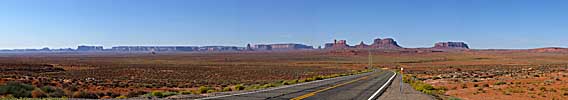
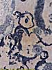
| My 2008 West Vacation. 16 days, 4596.3 miles. Day 12, Monument Valley, UT to Durango, CO |
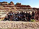
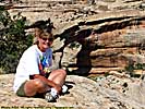
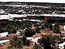
Get up sorta late, and there sounds like there's a party outside. Turns out there are dozens of people that are going to take the MV tour, and the place to wait for the trucks is just outside our door.
We check out and get gas even though we have 3/4 of a tank. Don't know what conditions are going to be like. We're getting off the main roads today. There's a quick food place in the gas station, and we get two breakfast burritos. One burrito has wrong ingredients (mine), but they only charge us for one, so I guess it works out in the end.
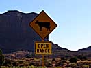
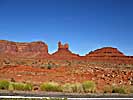
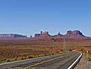
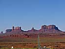
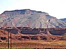
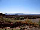
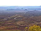
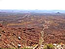
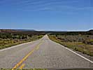
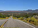
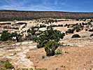
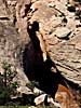
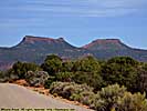
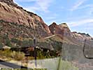
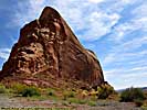
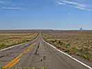
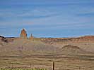
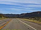
We arrived at Monument Valley from the South on US-163, and leave to the North on US-163, when I looked in my rear view mirror and hit the brakes onto a pull off to get yet another gorgeous vista of Monument Valley. From there, it's not too far to the San Juan River, where you leave the Navajo Indian reservation and enter Mexican Hat, who's claim to fame, is a rock formation that looks...kinda...like a Mexican Hat. I start humming one of those classical Mexican guitar tunes, and I get warned if I make that song stick in her head, she'll do me harm.
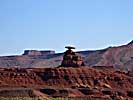
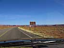
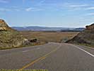
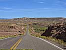
Utah-261 and the Moki Dugway - September 23
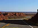
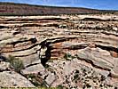
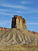
 |
| Monument Valley, from US-163. Monument Valley Tribal Park, Utah. |
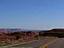
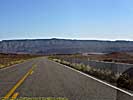
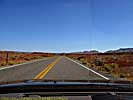
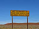
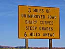
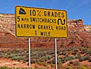
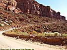
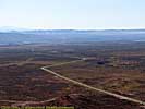
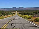
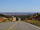
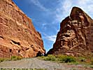
The main concern here is a little squiggly line on the map just past Valley of the Gods, and as soon as we turn, we get signs that warn us, 10% grades, unpaved, no trailers... Don't worry, it'll be fun!
We get to Valley of the Gods, and find it's a 17 mile unpaved road. We drive a mile or two of the washboard it is, and elect not to take it. After seeing what the 14 mile unpaved road yesterday in MV, I'd rather not subject my car to that.
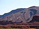
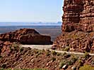
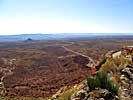
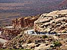
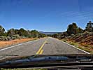
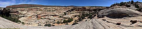
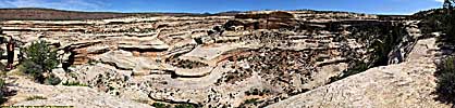
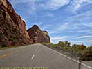
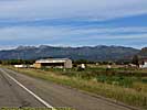
We get to the squiggly line, and it's a road, and it goes up, then disappears someplace on the side of the rock wall. The rock wall is the southern escarpment of the Cedar Mesa, which is 5300 feet above sea level at the base, and rises 1100 feet, about the same height as a 110 story skyscraper. (The Hancock in Chicago, or the Chrysler building in New York...) While we look at it and try to decide if we want to do the road or detour around, a group of bikers (as in some Harley-Davidson bikers from Belgium, believe it or not) with a support van to go along goes by, so we're brave enough to follow.
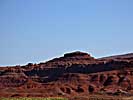
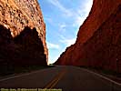
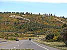
And our fears were foundless. The road's okay if you only go 20 miles per hour, and you probably don't want to more than 20 anyway. It would make my top 10 road list if it wasn't for the fact it's only 3 miles long.
Later research finds it even has a name. The Moki Dugway was built in 1958 for trucks hauling uranium ore to a processing facility in Mexican Hat. However, there's evidence of carved hand and foot holes, as well as paths that lead up the cliffs created by the ancient civilizations that lived in the area.
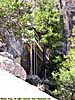
What a road. It goes up the side of the rock and switchbacks until you get to the top. Views are incredible. Halfway up, there's a pull-off, and the bikers stop to take some pictures and so do we. They're our road testers after all. They ask me to take their group picture. Only if I can take one too.
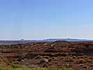
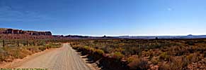
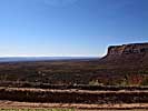
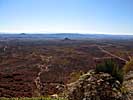
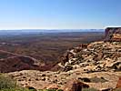
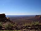
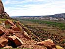
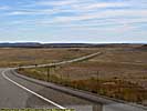
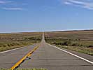
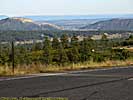
After taking some video, we continue to the top, and on to Natural Bridges National Monument. Once we're to the top of Cedar Mesa, the land is flat with a lot more vegetation than the valley floor. It's sort of surreal that we just climbed the side of a cliff from a sandstone desert that has rock formations sticking out of the ground everywhere you look, to a flat green plain...
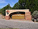
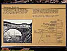
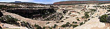
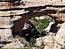
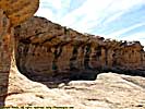
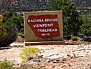
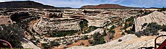
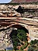
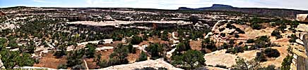
Natural Bridges National Monument, Part 1 - September 23
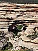
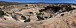
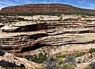
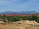
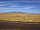
Travel the next 40 or so miles through virtually empty road, get to Natural Bridges with the Bikers not far behind. Get a map, and take the park loop. There are really only 3 accessible bridges from the scenic loop, but there's some incredible goosenecks and other rock formations. Extremely desolate here doesn't describe this place. Desolate, arid, hot and sunny might.Okay, let's get it over with. A Bridge spans (or spanned) flowing water, as in a river or stream runs through it in its natural course. An Arch may have been formed by flowing water, but wasn't formed by water flowing through it.
Natural Bridges National Monument, Part 1
Natural Bridges National Monument, Part 2
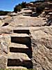
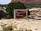
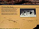
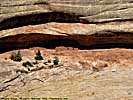
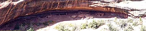
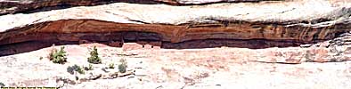
We actually walked out to the Horsecollar Ruin, another 1000 year old Anasazi site. We're about 80 or 90 miles from Mesa Verde, but back then that was almost an insurmountable distance.We went and took a look at the other two (easily accessible) bridges, then left for the Four Corners area.
Natural Bridges National Monument, Part 2
Utah-95/Utah-262/US-160
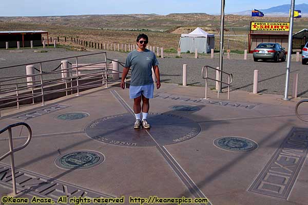 |
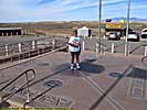
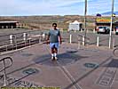
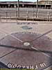
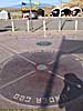
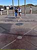
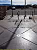
| The ultimate tourist picture. I feel so cheap... Four Corners Monument, UT,AZ,CO,NM |
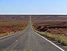
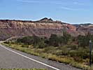
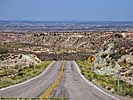
We leave Natural Bridges National Monument, taking Utah-95 East. About halfway to US-191, we cross the Comb Ridge, a long North-South fold in the earth's crust. Rather than switchbacks, there's a long linear road that turns into a man-made opening through the ridge.
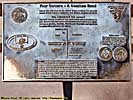
We turn South on US-191, away from Blanding, where we would have stayed last night if something hadn't opened up at Goulding's. From there, it's a turn onto Utah-262, one of the roads that lead to Hovenweep, but we had decided earlier not to go there, and end back up on US-160, 5 miles from Four Corners. It wasn't in the plans to go back to the monument, but the hell with it. It was only five miles away! We'd retake some pictures we took in 1997.
Four Corners Monument / Durango, CO - September 23
We donate a couple more bucks to the Navajo Indian Tribal Park's coffers, and after debasing myself with some ultimate tourist pictures, decide to get some fry-bread (my newly favorite Navajo delicacy) and go to one of the stands that surround the monument. The woman who runs the joint was asleep in her chair, so we decide not to wake her and go to another place across the way. Get a sugar/cinnamon fry-bread. Better than funnel cakes. Honest.Speed down US-160, and get to the former US-666, now US-491. Sheesh. No sense of humor. (The road was supposed to be US-660, but an errant mark on the ballot/bill forced it to be named US-666. You can google it for the full story.)
Pass Mesa Verde, and I want to stop in and get a picture of the entrance sign, but decide it's getting late as it is, and I reluctantly pass it by. I wish we had gotten more entrance sign pictures in my early vacations.
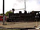
We get to Durango. It's packed, and I don't know why. No vacancies at any name brand hotels. We get stopped by the Durango-Silverton Narrow Gauge, and they blow the whistle as they cross the road and nearly take one of my eardrums out. We end up on the north side of the city at a place called Alpine Inn. At least there's a BBQ joint two doors down, a decision point for this hotel.
The BBQ joint is called Serious Texas BBQ, which was pretty good, except for the flies, the lack of decor, and the lack of BBQ sauces to try. Yes, smoky-goodness should be judged without sauce, but it's fun to try the local sauces. The brisket and the pork sandwiches were excellent. Got a Steiner Bock with dinner. Pretty good, but not memorable.
Alpine Inn wasn't that bad, a fridge and microwave in the room. It was one of those places that still had keys, as opposed to a key card. The fake Peony bush in the corner was tacky, but it was a standard two bed room. Carpet was a little dirty, but the shower was okay. No coffee maker though, and they seem to have run out of hot water in the morning. Room, 4 of 10. Shower, 7 of 10, when we had hot water. This place needs some serious updates.
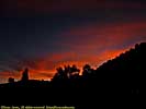
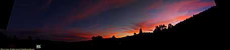
Nice sunset though.
End of day 12 miles: 2993.4. Hotel: Alpine Inn, Durango, CO.
End 2008 Southwest Vacation - Part 8.| Jump to: | Part 1 | Part 2 | Part 3 | Part 4 | Part 5 | Part 6 | Part 7 | Part 8 | Part 9 | Part 10 |
|---|
- 02/25/2009 - Initial Deployment
- 08/15/2013 - Update to v3.11
- 08/31/2014 - Update to v3.2
- September 2022 - Upgrade to v5.0.
| Help! | About This Site | Contact Me |