
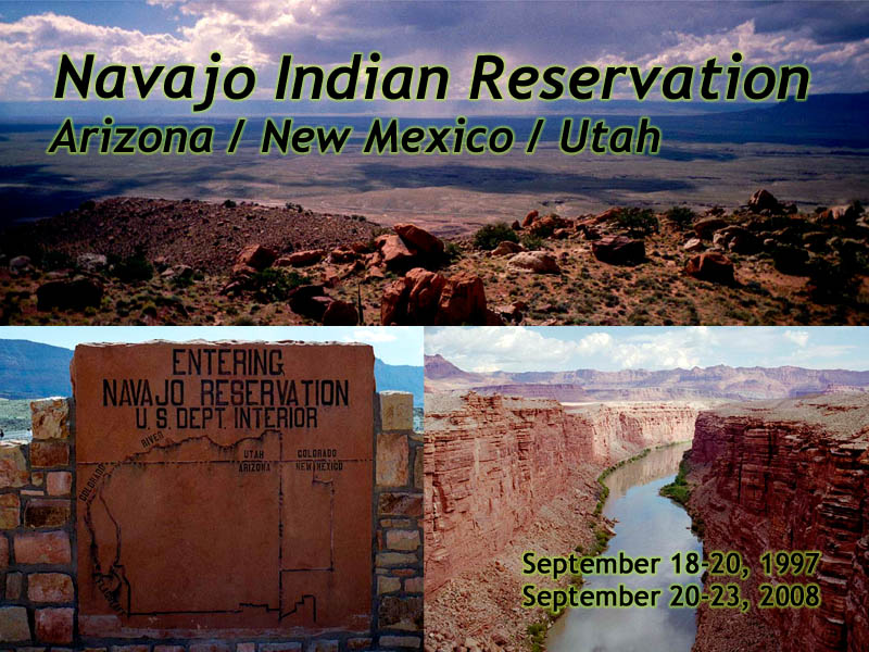
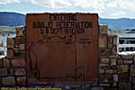
Navajo Indian Reservation
| Introduction | Marble Canyon / Navajo Bridge | Grand Canyon to Antelope Pass | Antelope Pass |
| Page to Antelope Pass | Antelope Pass to Marble Canyon | US-160 (Four Corners to Cameron) | Related Links |
|
| Click to go directly to the slideshow |
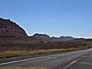
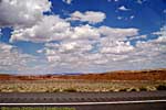
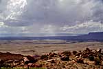
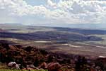
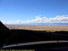
I've only been in the Northern half, down US-89, US-160, and through Kayenta to get to Monument Valley, probably the most famous area of the reservation. Every time was on the way to or from the Grand Canyon.
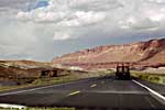
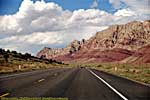
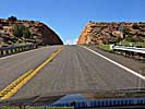
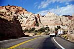
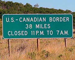
From the North, US-89 goes right through the Glen Canyon NRA, and you'll encounter an entrance fee should you pass through it. If you have no desire to see Lake Powell, there's a bypass (US-89A, though it might be Alt-89 on some maps) which bypasses Glen Canyon by travelling South of the Vermilion Cliffs National Monument and crosses the Colorado River at Marble Canyon. It rejoins US-89 in the Reservation at a place called "Bitter Springs". (I have noticed that many "towns" on the maps of sparsely populated areas in the West are nothing more than a junction of two roads, with perhaps a gas station or other small business there.)
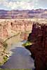
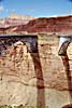
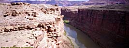
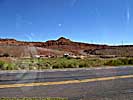
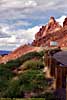
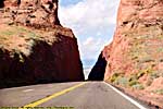
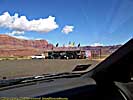
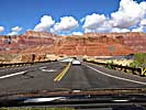
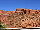
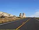
Marble Canyon
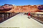
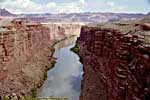
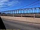
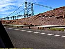
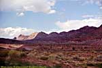
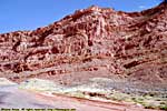
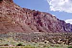
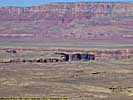
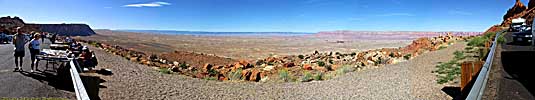
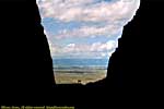
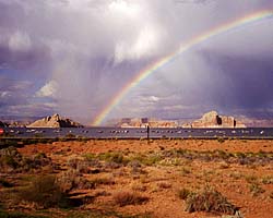
US-89a exists only for a short time in the Navajo Indian Reservation, but it makes its introduction at Marble Canyon, where the new Navajo Bridge allows automotive traffic, and the old Navajo Bridge is open to foot traffic only. You get a spectacular view of the Colorado River down this narrow (relatively speaking) canyon, 500 feet above the water.The now, pedestrian-bridge is what essentially put the ferry service just North of here out of business. You can still see where the ferry service operated in the nearby Lees Ferry Unit of the Glen Canyon National Recreation Area just West on US-89a.
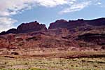
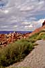
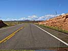
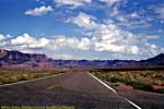
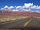
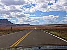
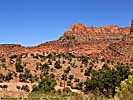
US-89, Grand Canyon to Antelope Pass
US89 Grand Canyon to Antelope Pass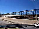
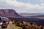
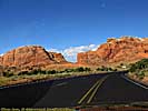
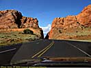
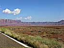
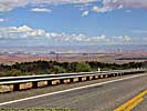
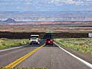
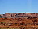
US-89 Antelope Pass to Marble Canyon
US160 (Four Corners to Cameron)
Related Links
| US-89 | |
|---|---|
|
US-89 is a remarkable road that follows some of the most scenic areas of the West from Canada to Arizona, and along the way passes through (or comes within a few miles of) over a half dozen major Western Parks. Glacier to Yellowstone to Grand Teton, Bryce, Zion, Glen Canyon and Grand Canyon. I've actually frequented this road quite a bit, but in a disjointed, non-continuous fashion. |
| Visited Various | |
| Glen Canyon National Recreation Area | |
|---|---|
|
The Glen Canyon National Recreation Area encompasses and products the Colorado River (and many of its tributaries) from Canyonlands to Grand Canyon National Park. It is mostly a creation of the Glen Canyon Dam, which creates a reservoir behind it (Lake Powell) a hundred miles long. Included on this page is the Navajo Bridge and the Lees Ferry Unit of the park, river level access a dozen miles below the dam. |
| Arizona, Utah / 47 Images. Visited Sep 1997, Sep 2008. | |
| Four Corners Monument, Navajo Tribal Park | |
|---|---|
|
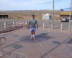
Four Corners Monument is the only place in the U.S. where four States meet, perhaps the ultimate place for a stupid tourist photo in the Southwest. I should know, I've been there twice! If I ever go back, I'm taking my GPS to see if it's really in the right spot. :-) In addition to the monument (there is an entrance fee), there are stalls around run by (rented by?) the locals selling locally produced merchandise. Oh, try the fry bread. Mmmmmm... |
| Utah, Arizona, New Mexico, Colorado / 28 Images. Visited Sep 1997, Sep 2008. | |
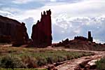
| Little Colorado River Gorge, Navajo Tribal Park | |
|---|---|
|
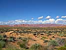
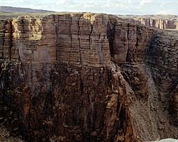
If you're heading to Grand Canyon from US-89, the Little Colorado River Gorge is a side-stop along the way. You can step up right next to the gorge, and if the sheer cliff face doesn't bother you... Then you're a better man than I. |
| Near Cameron, Arizona / 16 Images. Visited Sep 1997, Sep 2008. | |
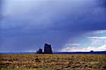
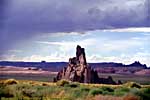
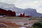
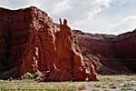
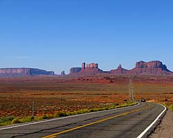
| Monument Valley, Navajo Tribal Park | |
|---|---|
|
Monument Valley is definitely worth a stop. It's landscapes are some of the most memorable in the world, immortalized by everyone from John Ford to Robert Zemekis. Goulding's Lodge is also on this page, as are images from one of the four-hour tours through the restricted parts of the park. |
| Near Kayenta, Utah / 160 Images. Visited Sep 2008. | |
Navajo Indian Reservation Trip Reports: Sep 1997, Sep 2008.
| Return to: | State Index | Arizona State Page | Utah State Page | Navajo Tribal Parks |
|---|
- 04/30/2016 - Initial deployment
- April 2017 - Upgrade to v3.4.
- August 2022 - Upgrade to v5.0.
| Help! | About This Site | Contact Me |