
2008 West Vacation, Part 1
September 12 to 27
September 12 to 27
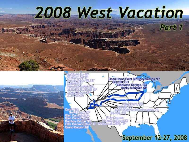 |
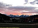
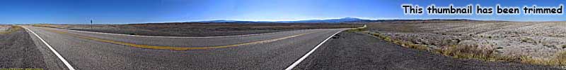
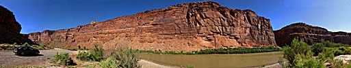
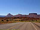
| My 2008 West Vacation. 16 days, 4596.3 miles. Days 1-4, Home to Dead Horse Point State Park |
Who: Me, Keane.
Jo, fellow traveler.
Where: Colorado, Southern Utah, Northern Arizona
When: September 12 through September 27, 2008
Background
May 2008After a relatively short trip in 2007, I wanted to take a longer road trip. But where to go? I'd been eyeing my 1997 trip, the trip that cemented my love for long road trips out West. By this time I had already duplicated my 1996 trip, much of my 1998 trip, and even my 2001 trip. There were parts of my 1997 trip I had touched on, but I had never been back to Southern Utah and Northern Arizona.
Three years after that 1997 trip, both video and my photo darkroom went digital, but it wasn't until 2002 that memory cards replaced film. 2007 brought the Canon G7, the first camera I though truly surpassed what my Nikon F3 could do. However, the G7's limitation of jpeg only and a non-swivel preview screen caused it to have one of the shortest lifespans of any camera I owned.
On this trip, I was packing the G7 successor, a brand new Canon G9, the first digital camera I owned that I thought truly surpassed my film cameras, without the limitations of the G7. An almost instant ready-to-shoot time, no shutter lag, superb 4000x3000 pixel images, and you could check your results immediately for instant gratification and verification. I was still using my Sony Hi-Def camcorder that I took on my 2006 Vacation. (A Sony HC-3 1080i MiniDV Camcorder.)
I figured all of the video and photos I had from 1997 could be dramatically improved upon. The West's vistas are sweeping panoramas, and now I had the knowledge and tools to photograph and present them as the panoramics they are in real life.
It might also be time to visit the Southwest before it became a victim of its own success. Imagine at one time, the only way to get information about visiting an area, was from books, magazines, and the US Mail by writing to a chamber of commerce for information about hotels and local destinations. A road trip like this would have been an impossible task. It's most likely why you went someplace, you found a base camp and stayed put for days at a time.
Then came cable television and the vast lack of programming to fill dozens of station's time slots. No longer were the Parks and Wildlife the territory of Disney and PBS. Channels that catered to travel and nature filled their time with shows that took you to the Grand Canyon, Zion, Arches, Grand Teton, Yellowstone, Glacier and they were shown over and over and over and over... And the tourists came.
Then came the popularity and easy access to the Internet, where you can just bring up a search engine and enter the name of any destination and get information on hotels, restaurants, points of interest and just about any sordid detail about the place in seconds. Add in travel forums and review sites, and not only were rarely known sites now advertised, and it caused even more tourists to come.
These are staggeringly beautiful places. But many times, while enormous in size, is limited to where humans can actually go. The perfect example is Zion. It's a pretty good size park, with at least three entrances. But the main draw, the walk along the Virgin River, is very narrow with 1000 foot cliffs on both sides. It doesn't hold a lot of people, and fewer cars. So now, during the more crowded seasons, you must park in a remote lot and take a bus in. It won't be long before you'll need reservations to get into the park itself. It won't be long before parts of Grand Canyon are like this.
So we'd go back to the Grand Staircase, we'd just have to decide what we'd do, and where we'd go. I didn't want to duplicate my 1997 trip, but there had to be some overlap. After all, one of the reasons to go back was to retake some pictures and take video, not to mention there weren't that many roads to alter the route.
There were plenty of places that were discarded from the '97 trip, mostly due to lack of information about the place, but eleven years had brought a revolution of changes. The internet brought a wealth of knowledge that even a seasoned, repeat traveler couldn't know just 20 years before. Pictures, reviews, road conditions, entrance fees, hours of operation, all available with a few keystrokes.
A trip was coming together.
Going to see the Grand Staircase
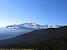
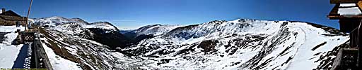
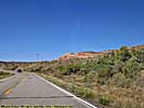
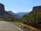
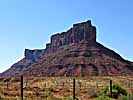
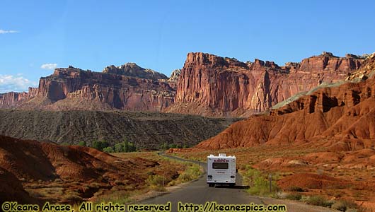 |
| Part of the Grand Staircase, Capitol Reef National Park |
The tourist side of the Southwest calls it the Grand Circle. You can enter the circle at any point, and see some of the most magnificent sites in the world doing part or all of the circle. Though the circle is pretty loosely defined (though it always goes through Colorado, Utah, Arizona and New Mexico), the geology and history of the area pretty much does deliver on most any promise you'd be given on what you'd see.
You can see red rock deserts, some of the tallest mountains in the country, human settlements a thousand or two years old, canyons that span centuries, rock sculptures that exist nowhere else in the world, all in a week or two. Or a year or two. It depends on how much time you have.
This is where some of the most well known areas and parks are. The Grand Canyon. Bryce Canyon. Zion. Arches. Canyonlands. Glen Canyon. Monument Valley. Capitol Reef. Four Corners. And the lesser known but no less impressive Kodachrome Basin. Goblin Valley. Mesa Verde. Chaco Canyon. Scenic Route 12. Natural Bridges. Black Canyon. Utah-128.
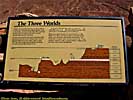
It's known as the Grand Circle, but it's better described as the Grand Staircase. It's known as the Grand Staircase because when the Colorado uplift occurred, the topmost layer of the Earth's crust wasn't flexible enough to bend, so there are literally giant stairs that start in Colorado, and step down toward Arizona and New Mexico. All along the way you can see where repeating catastrophes rendering the Earth's surface occurred, sometimes leaving behind the most amazing and beautiful sites in the world.
It is an amazing area. But much of it is in remote areas, only obtainable via two-lane blacktop, and sometimes, not even that. Almost all of it is within the boundaries of the Mojave and Great Basin Deserts, so it's arid and hot, especially in the summer. Much of it isn't very populated, either. I found more traffic in almost all of the places that were scary-deserted in 1997, but you should still pack with survival in mind, plenty of water and food that will last a day or two.
Planning
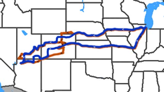 |
| My 2008 West route is in blue (with white arrows indicating direction of travel), the 1997 route is in orange (with black arrows). |
If you actually get right down to it, the first half of my trip (if you don't count that little Chicago to Colorado part) would be to follow the Colorado River almost from its source, to the Grand Canyon, a distance of some 660 miles.
My destination this trip was Glen Canyon National Recreation Area, because it got the short end in 1997, and was just an overnight stop. We were going to visit the dam and take the 50 water-mile (and that's only one way) boat trip up Lake Powell to Rainbow Bridge National Monument.
It quickly became apparent we'd be taking just about the same route as in 1997. Maybe not the exact same route, but there are only so many ways you can get through the area, while still visiting the parks you want to see. But that was okay, since I did promise myself I'd spend some time exploring Southern Utah if I was ever back in the area.
So for my 2008 trip I planned a route that went through Central Colorado, then down to the Grand Canyon, and wound its way back up through Southern Utah to I-70, and back home. About two weeks.
Having learned my lesson not to take my vacation during the tourist season means it would take place after Labor Day, but before it really got cold in the mountains and started snowing. The only time I could make this work, would be the third and fourth weeks of September.
But I couldn't make the dates work. Most of the hotels were booked solid. So in a flash of inspired brilliance I reversed the route. (It also happened to be a menu choice in my mapping program. Heh.) The number of available reservations went up. In 1997, I pretty much went clockwise around the Grand Circle, this time, I'd be going counter-clockwise, through Utah, then Arizona, then back through Colorado.
Assuming it would be easy to get reservations up to and including Glenwood Springs, my hard reservations would start in Moab, Utah. The first round looked like this:
Sept. 15: Best Western Canyonlands Inn in Moab, UT. Preferred choice.
Sept. 16: Best Western (Capitol Reef) in Torrey, UT. Preferred choice.
Sept. 17: Circle D in Escalante, UT. If you look, there isn't a lot of choices in Escalante. Preferred choice. Actually, one of the only choices.
Sept. 18: Best Western Rubys Inn (Bryce Canyon) in Rubys Inn, UT. This reservation was made because there weren't any rooms available at the park lodge. Otherwise the nearest lodging is a fair distance away.
Sept. 19 & 20: Lake Powell Resort, Wahweap, AZ. Preferred choice, and out midpoint destination. Hint: When I booked the room, I could do it from two different sites, both associated with Lake Powell. But I could get the room through one site, but not the other. So if you're booking at the Resort and can't find a room, try another result from the search.
Sept. 21: Best Western Grand Canyon Squire Inn, Tusayan, AZ. We stayed in the Quality Inn in '97 and this had to be a better choice. This reservation was made because there were no openings in Grand Canyon Village in the Park.
Sept. 22: Comfort Inn, Blanding, UT. This reservation was made because our first choice, Goulding's Lodge, wasn't available. Blanding is only 40 miles up the road from Monument Valley. Only 40 miles. It was the closest hotel that I could get a reservation.
After Monument Valley, I assumed we'd be out of tourist territory and could easily find a room. Wrong by one night, but in truth we didn't know where we'd really be at the end of that day. There were a lot of questionable roads, and how far we'd get depended on the conditions we'd encounter.
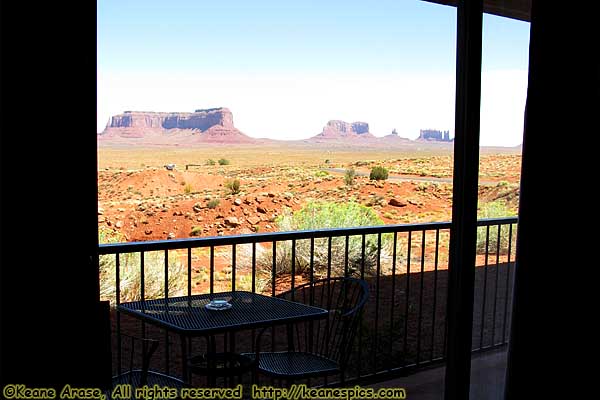 |
| Hands down, Best Hotel View ever. Goulding's Lodge, Utah. |
July 13
A room becomes available at Gouldings Lodge in Monument Valley and I booked it, which solves our choice of Monument Valley tour company. Since Gouldings runs their own tours, I also book an extended Jeep tour of Monument Valley that's run by the Navaho, so we're allowed in the private areas of the Reservation. Our room in Blanding is cancelled.
August 20
One of the new rooms becomes available at Maswik Lodge in Grand Canyon Village. Booked. Ultimately, though, I wanted a rim hotel, so I kept checking, and would upgrade if one became available.
Reading the reviews for Maswik (and Torrey and Ruby's Inn for that matter), there are diametrically opposed reviews. There are those that liked/loved the rooms, and there are those that really hated the rooms. It turns out there are two types of rooms available, with one set either new or remodeled, and the others old and definitely un-modern.
I guess it's the expansion of all these places due to the increase in tourism. The newer rooms might be more expensive, but they were worth the extra cost.
My room at Maswik was nothing more than what you'd get at a Comfort Inn, but the new/higher cost room at Torrey was a two room affair, with the back room opening onto a deck with a marvelous view of the reef. And did I mention I had a whirlpool tub in my Ruby's Inn room?
Up to the day before we arrived, a rim hotel never became available, nor did anything open up at the Bryce Canyon Lodge. (I checked several times a day for the next month, and even at the hotels we stayed at on the way out West.) Actually, I think the trip was better for it, and the grapes weren't sour, either.
We'd leave Friday afternoon, September 12, and be back Saturday September 27. We had a plan.
Day 1
Day 1 was to get us as far away from Chicago as possible, and get a good start on the vacation. Since our first stop was going to be Rocky Mountain National Park, and it takes a day and a half to get there, Day 1 was going to be that half-day.Make our way to I-88, and take it from the start in Chicago's Western suburbs to the end, where it joins up with I-80 at the West end of Illinois. We won't get off of I-80 until we hit Colorado.
And it rained all afternoon. From just about the minute we left, until about an hour before we quit for the day. We got to Des Moines much earlier than expected, and decided to travel a little further before we stopped for the night. That was a mistake, since I still keep forgetting how empty the West is. We had to drive all the way to the Missouri River before we spotted a Best Western from the interstate in Council Bluffs, across the river from Nebraska. Oh well, we wanted to make miles today, anyway.
It was that evening in Council Bluffs that I also experienced the worst food ever from an Arby's. My relationship with that fast-food chain has never recovered from that meal.
This couldn't be a bad trip, could it? Too late now, you're 500 miles from home...
End of day 1 miles: 474.8. Hotel: Best Western, Council Bluffs, Iowa.
Day 2
Start the day, check out, and begin the journey across Nebraska. Nebraska for the most part, is flat and boring, but they make up for it with a 75mph speed limit. We go through Grand Island, Kearney and North Platte, all major stops on the railroad out West.
Some Nebraska rest area on I-80 - September 13
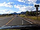
We pass through Ogallala, and are soon on I-76, which tells me I'm entering Colorado. I intend to get off on US-34, but US-34 follows I-76 (though US-34 was here first) and there are numerous times I can do that. We finally see a sign telling us tourists who are going to Estes Park to stay on I-76 until you're told otherwise, and we get off at the exit that says "Exit here to Estes Park". I guess it worked. We stop at the rest area at that exit, and I know I've been to this rest area before. What does that mean?
I call ahead to make reservations in Estes Park, since we're now convinced that's where we'll stay that night. The Comfort Inn is full, but the Rodeway has a room. Whatever, so long as it has a bed.
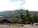
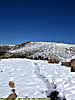
The road to Estes Park isn't as bad as I thought it would be, it's newly repaved and fast. A half-hour later, you can see the Rockies far off in the distance. There seems to be snow on the peaks.
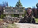
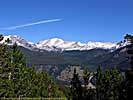
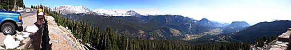
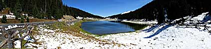
Rocky Mountain National Park, Day 1 - September 13
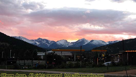 |
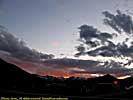
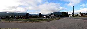
| Even a sunset over a Shell Station is gorgeous in Estes Park. Heh. |
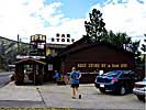
Stop in at The Dam Store, just outside of Big Thompson Canyon. I've stopped here every time I've been down US-34, three times now. This is my fourth visit to Rocky Mountain National Park. I was here twice in 1997, two weeks apart, on my way to the Southwest and on the way back. I was also here in 2005 for a class.
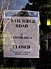
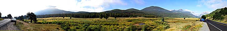
The rest of the day was supposed to be spent going up Old Fall River Road, then come back via Trail Ridge Road and sleep overnight in Estes Park. We get to the Entrance and buy a National Parks annual pass. We'll more than break even with the number of parks we're visiting.
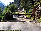
There is an ominous sign that says Old Fall River Road is closed, and Trail Ridge road is closed at Rainbow Curve, all due to snow and dangerous driving conditions. I guess scheduling the trip in the last two weeks of September to avoid the white stuff didn't work. We decide to just stay on the main grounds of the park, without going up into the mountains.
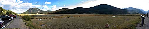
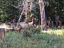
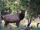
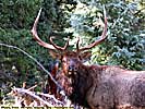
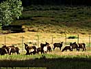
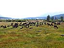
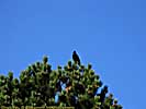
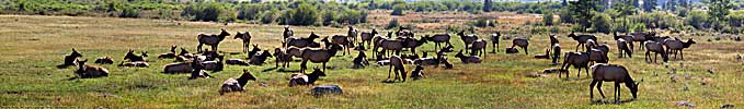
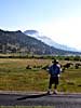
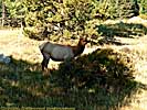
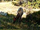
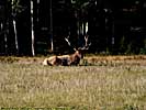
The elk are out. Lots of elk. Lots of tourists watching the elk, too. The Elk here are hairier than the Elk in Yellowstone, and I don't remember seen large herds here in past trips. The weather is beautiful, though. It's usually cloudy when I'm here.
It'll be dark soon, so we decide to go to the hotel. Choice Reservations people tell me it's off of US-36. Can't find it. Call reservation hotline again, they still tell me it's off US-36. Get the telephone number of the hotel, and call the hotel. It's off of US-34. We saw it on the way in. *NOW* I know where it is.
We backtrack a little and get dinner at Smokin Dave's BBQ & Taphouse. There's a 45 minute wait for a table, 15 minutes for carry-out. We decide to carry out. I get the three meat (brisket, pulled pork and ribs.) Jo get's the one meat, pulled pork. I can't resist the pecan pie. Takes 30 minutes anyway. Should have just gotten a table. Food in hand, we go to the hotel and check-in. It might be a basic economy hotel, but the room is pretty nice.
I wanted a dark beverage with dinner, and there just happened to be a liquor store right across the street. At the appropriately named "Liquor Mart", I bought an English Oatmeal Stout for dinner, and they had Arrogant Bastard Ale, which I hadn't seen since my trip in 2005. So the first couple of souvenirs I bought to take home were a couple of bottles of ale.
Dinner was excellent. Ribs were meaty, brisket tender, pork very tasty. Couldn't finish the pie. Couldn't finish the brisket and pork either, so we decide to take it with us and packaged it up in plastic ziploc bags on ice in the second cooler.
Rocky Mountain National Park, Day 1
End of day 2 miles: 1072.2. Hotel: Rodeway Inn, Estes Park, Colorado.
Day 3
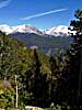
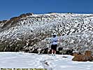
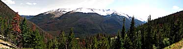
Rocky Mountain National Park, Day 2 - September 14
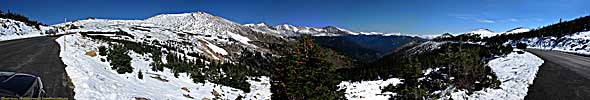
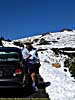
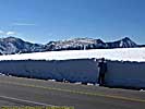
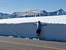
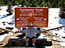
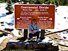
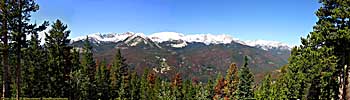
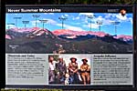
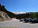
We're up, check out and get back on US-34 to the Fall River Visitors Center. Old Fall River Road is closed and has no chance of reopening. Trail Ridge Road is still closed, but will hopefully reopen at noon. The Ranger looks at me like I'm from Mars not knowing it snowed, but hey! I'm a tourist! Or more likely, I'm the bazzilionth tourist who's asked the question. If Trail Ridge Road doesn't open, we'll have to backtrack to Denver to get around (quite a detour), or take the maddingly slow US highways that now go through the Denver suburbs.There are still lots of Elk around, which the tourists find fascinating. I am jaded since Yellowstone has already yielded Elk up close and personal...
Get up to Rainbow Curve, and the Ranger there says the road will be open in 15 minutes. We wait. It's more like 30-45, but the road opens. Snow is prevalent. At one lookout, a doe and her fawns go walking by, ignoring us tourists, but probably ready to dash up a hillside where us clumsy humans can't go...
Rocky Mountain National Park, Day 2 Part 1
Rocky Mountain National Park, Day 2 Part 2
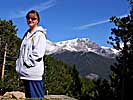
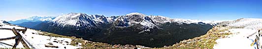
Jo wants to walk out to a viewpoint. Hey! I'm wearin' shorts here. I know how it goes, once afternoon comes and we lose 6000 feet, I'll be comfortably dressed, but at 12,000 feet with that perpetual wind that comes over the Rockies, it's flippin' cold.The five foot drifts near Lava Cliffs makes for good photos, but jeez it's cold even without the wind. And I've never seen Fall River Pass so...white. I even sit my butt down on melting snow at Milner Pass so one cheek is on the Mississippi watershed, and the other on the Colorado Watershed. What a tourist. I feel so cheap...
Rocky Mountain National Park, Day 2 Part 2
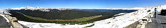
Rocky Mountain National Park, Day 2 Part 3
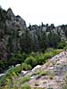
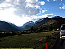
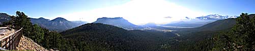
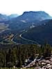
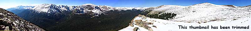
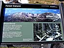
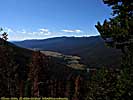
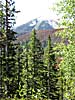
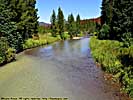
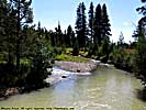
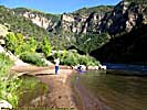
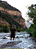
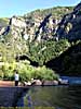
Take off down the Grand Lake side, headed toward I-70. We're only on it for a few miles before it becomes apparent that it never snowed here. Apparently, only from about 11 thousand feet and up. Looking around, there are huge brown patches of dead trees from a beetle infestation. NPS/NFS better do something, or there won't be a live tree left on the Western Slopes.There's a few little picnic areas that stop by the Colorado River. We're only a few miles from the source, and the river is just a 10 foot wide stream. We'll essentially follow the Colorado to the Grand Canyon in one fashion or another. After all, most of the sights we'll see were created by the Colorado River in eons past...
It's about 2pm when we leave the park, and right outside is a little burger joint who boasts big burgers, so we decide to stop in for food. It is excellent and are soon (and soon is a relative thing out here) back on I-70 heating West.
We pass though the Eisenhower Tunnel Complex, and I'm still amazed at the work they did here putting a four lane Interstate though a mile-and-a-half of mountain. It's a true engineering feat. Still, one day I still want to take US-6 over Loveland Pass, the main road through the mountains before I-70 was completed.
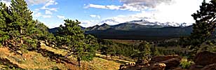
It's from here we start to step down the Grand Staircase, giant steps of geologic time created by massive and often repeated geologic catastrophes. We descend from the high Rockies to a more reasonable height, but out here reasonable is a relative thing.
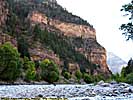
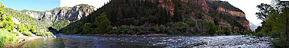
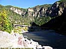
We soon pass through the narrow gorges along the Colorado River, where the I-70's Eastbound and Westbound lanes separate and become their own roadways, weaving around and through the mountains, each designed to be used for two way traffic should something befall the roadway. Like snow. There is access to the Colorado River in several places, so we stop at one before we head into Glenwood Springs. The small stream we saw before is gathering other sources of water, and the river's getting bigger, and the river still has to fall another 8000 feet before it reaches the Gulf of California.
Rocky Mountain National Park, Day 2 Part 3
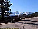
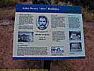
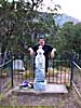
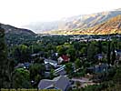
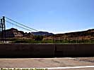
Glenwood Springs (Doc Holliday's grave) - September 14
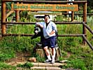
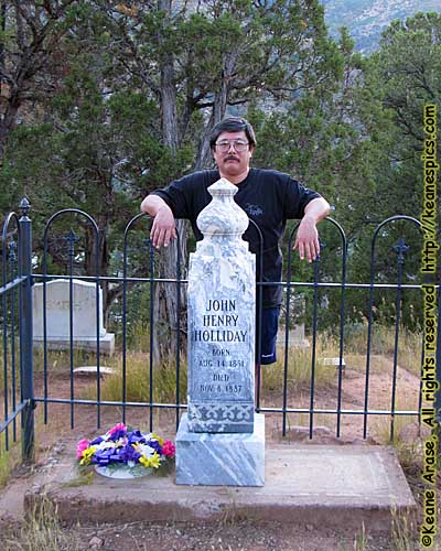 |
| Hangin' out with Doc, Glenwood Springs, Colorado |
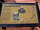
We stop for the night in Glenwood Springs, Colorado. We could have gone on, but we're not sure about the lodging in the next semi-major city Rifle, and then Grand Junction is 100 miles away. We have no reservation here, so we have to hunt for a hotel. We turn right on a main road, only to find the Comfort Inn we stayed at in 1997 is now a no-name hotel. Backtracking, Jo sees a sign that points to Doc (John Henry) Holliday's gravesite. I had often said that I'd like to find his gravesite, and pay my respects to one of my favorite notorious killers, made famous by a fast gun and elevated to hero status along with Wyatt Earp, Wild Bill Hickok, Bat Masterson, Billy the Kid and other men who would otherwise be a footnote in history if it wasn't for the print media, and later Hollywood and television.
I mean, I actually went to Tombstone, Arizona, so it's not like this is a weird thing for me to do. But that's another Road Trip.
Had we turned left instead of right, we would have found hotel row. We find and check into the Best Western. Since the large burgers we ate at lunch are still being digested, we aren't that hungry, so we decide to go visit Doc first.
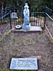
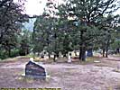
We actually find the trail (which starts in a residential neighborhood), and eventually find out that the Linwood Cemetery is like 200 feet above Glenwood Springs on one of the canyon walls. 200 feet at 6000 feet above sea-level. Way more than we bargained for. :-) On top of that, once you get there, they feed you the line that they don't know exactly where he's buried. The records were lost or stolen or destroyed they say. I suspect they know exactly where Doc is, and don't want to have people digging him up. It's pretty peaceful (and deserted) up there. The place is actually actively used, some of the headstones were relatively recent.
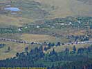
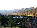
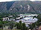
On the way back down, we get some picture of Glenwood Springs from above, which shows how the city is nestled in-between the mountains in a valley.
We found a brewpub right off the Colorado River for dinner, which had an excellent dark ale and draft root beer, but so-so fish and chips.
Nice hotel, the shower gets a 9, but 4 points off for having soft water. So a 5 overall.
End of day 3 miles: 1313. Hotel: Antler Inn (Best Western) in Glenwood Springs, Colorado.
Day 4
We're again Westbound on I-70, and we stop in Grand Junction, at the exit where we stayed in 2005. There was actually a store there I wanted to see, but the entire exit had been re-developed and the store closed. Well, we wanted food and gas anyway.
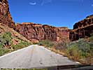
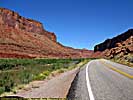
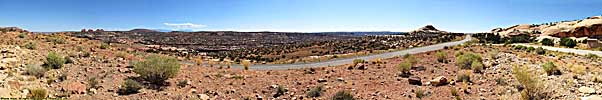
Cisco, Utah & Utah-128 - September 15
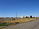
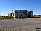
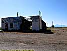
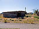
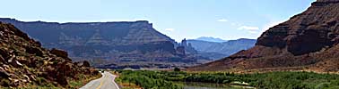
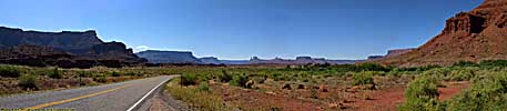
Got off I-70 at the Cisco exit, and took US-6 to UT-128. They call it US-6, but it's not really US-6, but there you are. (Later maps will call it Business US-6, but it doesn't pass by any organized town, much less a business district.) We pass Cisco, now almost a ghost town, but was once a thriving community that supported Uranium mining. Boom towns come and go, it's just the evidence of them takes longer to disappear out here in the desert.Utah State Route 128 arrives sooner than expected, and for once we're on the road Southwest toward Moab in the morning, (took it in the other direction, later in the day in 1997 and 2005), and the John Ford vistas are spectacular. Some of the road looks brand new, and I'm beginning to suspect some of the road isn't where the old road used to be. There were a lot of places I could see the road being washed out in the spring melt, so maybe the new road is out of the flood plain.
Once we arrived in Moab, I get the oil changed in the car. Third time at the same place. Used to be a Jiffy Lube, now it's a Quaker State. Who knew they'd have a repeat customer from 1400 miles away? Right across the street is the Moab Brewery, a brew pub/restaurant, which I'd recommended. But we're not eating there today.
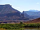
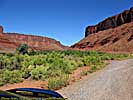
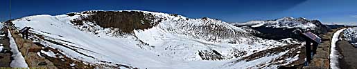
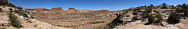
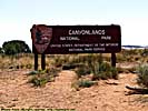
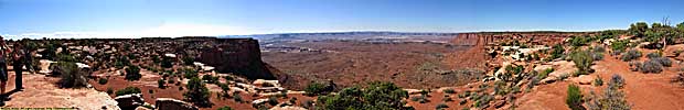
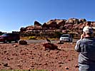
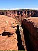
Canyonlands National Park - September 15
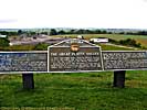
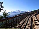
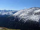
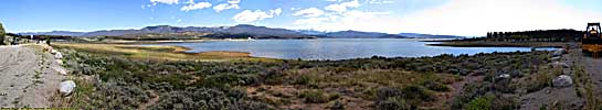
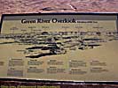
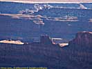
It's still only Noon, so we went up into Canyonlands National Park. Our Colorado River jet boat tour and visit to Arches in 2005 precluded a visit to Canyonlands, so it and Dead Horse Point State Park were the top priorities in Moab this trip.Canyonlands National Park is the confluence of the Colorado and Green Rivers, which naturally divide the park into 3 sections. Since there are paved roads in only one area of the park, that's where we were. We were also here in 1997.
The flow from the Green helps make the Colorado the powerhouse river of the Southwest, generating electricity and providing drinking water and crop irrigation that supports millions through the Southwest desert, where such populations have no right to otherwise exist. And ironically, Canyonlands is a desert.
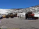
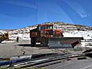
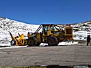
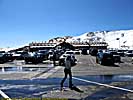
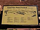
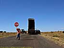
Stopped in the visitors center. We weren't told they were working on the roads. And I mean every darn road we were on. Nightmare going to Grandview Point. Worse going to Upheaval Dome. Parking at Upheaval crowded by oil and gravel trucks. Blah.
Had I known this, I might have gone to Dead Horse first. I did get some okay Green River side shots, but the construction delays put the Sun right in front of me at Dead Horse Point.
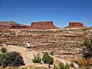
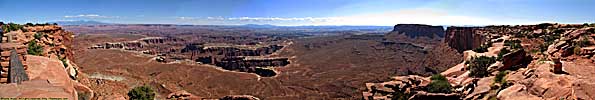
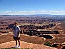
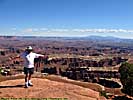
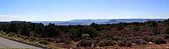
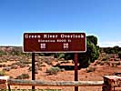
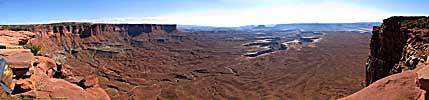
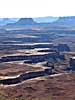
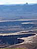
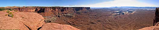
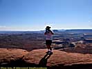
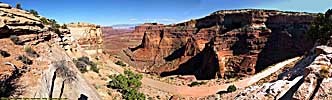
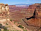
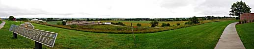
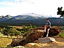
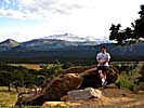
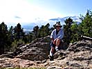
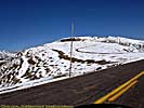
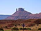
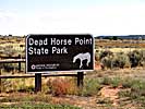
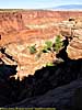
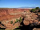
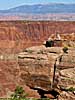
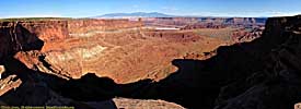
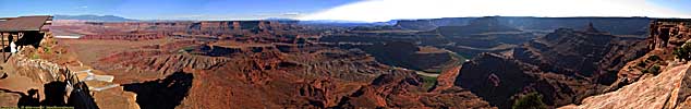
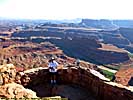
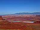
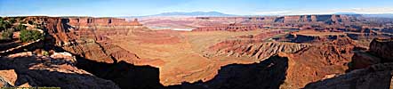
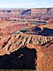
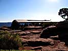
Dead Horse Point State Park - September 15
Dead Horse Point State Park was one of those things that was cut from my 1997 trip, for no other reason that I didn't have the time to go there, and lack of information of what I'd see.But the jet boat tour in 2005 changed that. We saw Dead Horse Point from the river. It was time to see the river from Dead Horse Point.
From Canyonlands, Dead Horse Point State Park is only a 5 or 10 mile drive. This area of land was used to corral horses, believe it or not. There are cliffs on all sides, and the only access to the entire area is a strip of land about 15 feet wide, easy to gate off. There are wide variations on how the place got its name, from forgetting the horses were there and dying of thirst, to the killing of a prostit... Well, never mind.
The afternoon/evening sun is in front of us and is terrible, noon probably would have been better. Isn't hindsight wonderful? Still, the views were spectacular.
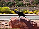
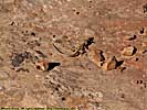
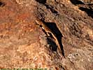
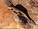
When we saw Dead Horse Point from the river, you quickly lose perspective due to the vast distances and lack of reference. You are mostly in a box, since the river usually has canyon walls on both sides, and the river constantly curves. But from the elevated position of Dead Horse Point, you have an instant perspective, the tiny ribbon of river itself. Off to the left are the Potash pools from the mining operation outside of Moab. The lizards, while not exactly friendly, pose for the camera...
The drive back to Moab seems long to me, maybe it's the harsh afternoon Sun, maybe you're just tired from hiking around a National Park.
We checked into the hotel, and we have a very decent room overlooking the pool. I check the local restaurant propaganda while Jo calls home. We get downstairs and looked at the hotel restaurant, but passed because there was a wait. Half-block down was Miguel's Baja Grill. Table for two, no waiting. Guacamole was *excellent*. Had the pork enchiladas, Jo had a half-order taco and they both were excellent. They served a spicy, grilled Jalapeno with dinner, which was spicy and make your eyeballs bleed *HOT*. Would eat there again, every night.
The Best Western Canyonlands is a nice place situated in the middle of Moab, with dozens of gift shops, eateries, bars and other little eclectic businesses within walking distance. Like many small towns that've grown for one reason or another, there are two Best Westerns about 1/4 mile from each other. The shower has good flow, water drains quickly and it's harder water. Nice view out the window overlooking the pool, and beyond that the main street. This is the third time I'm staying in Moab, and this is definitely the best place yet. 9 of 10.
End of day 4 miles: 1622. Hotel: Canyonlands Inn (Best Western) in Moab, Utah.
End 2008 Southwest Vacation - Part 1.
| Jump to: | Part 1 | Part 2 | Part 3 | Part 4 | Part 5 | Part 6 | Part 7 | Part 8 | Part 9 | Part 10 |
|---|
- 02/25/2009 - Initial Deployment
- 08/15/2013 - Update to v3.11
- 08/31/2014 - Update to v3.2
- September 2022 - Upgrade to v5.0.
| Help! | About This Site | Contact Me |