
Places I've Been... By State
|
|
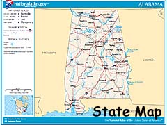
Alabama
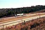
In 1998, I had driven the Natchez Trace Parkway from Natchez to Tupelo, Mississippi, before having to terminate the drive due to a irritating back problem. (I was in a crappy hotel bed for a week...) In 2000, I finished driving the Trace, starting from the Terminus at Pasquo, Tennessee (near Nashville) and finished at Tupelo. From there, I drove through Alabama to Florida, but didn't take any pictures.Oh well. I blame it on the bulk, expense and inconvenience of film at the time.
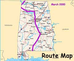
But the National Parkway does goes through Alabama for some 30 miles, albeit less than 10% of the Trace's length, so it's still included here...
| Natchez Trace Parkway | |
|---|---|
|
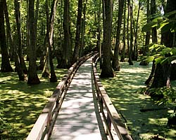
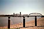
I've actually driven all 443 miles of the Natchez Trace Parkway, who's history goes back hundreds of years before the industrial revolution. Once one of the most important roads in young America, today it's preserved as a monument to its past history, with dozens of historic and scenic sites along its length. If you're travelling to a destination somewhere along the Trace, it'd be worth the extra half-day or so to drive a portion of it... |
| Mississippi, Alabama, Tennessee / 94 Images. Visited Jun 1998, Mar 2000, Nov 2011. | |
 |
Alaska
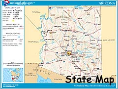
Ain't been there. Got nothin'. Sorry.Arizona
| Grand Canyon Area | Glen Canyon Area | Navajo Indian Reservation and Tribal Parks | Southern Arizona |
|
|
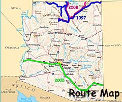
I've been to the state 3 times, twice to see that small gash on the Earth called the Grand Canyon. Relatively speaking, of course.
I'm splitting up the state into four groups. Grand Canyon, Glen Canyon and the Navajo Tribal Parks somewhat overlap in the same area of Northeast Arizona, but are distinct enough to separate them out.
Arizona - Grand Canyon Area
And so the first grouping of pages is about what is perhaps America's premier river canyon, Grand Canyon National Park and a close tributary, the Little Colorado River Gorge, which is a Navajo Tribal Park.
| Grand Canyon National Park | |
|---|---|
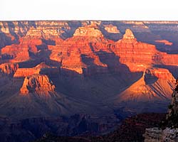 |
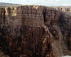
Grand Canyon National Park is the premier National Park in America, one of the seven natural wonders of the world, and many consider the park bucket-list-worthy. In addition to the South Rim, there is a North Rim, which is 10 miles as the crow flies, but over 200 miles by car. I won't mention the crowds. If there was ever a need to plan ahead for a trip, Grand Canyon is it. |
| Near Tusayan, Arizona / 163 Images. Visited Sep 1997, Sep 2008. | |
| Maswik Lodge | |
|---|---|
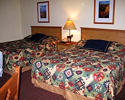 |
Maswik Lodge was the best reservation I could get in Grand Canyon Village, six months out from my trip. I checked every day for an opening at a rim hotel, but nope... There are some interior shots of the room (however see the page for a caveat), but no exterior pics, probably because the exterior was unremarkable. There were several buildings surrounding a parking lot, if I remember correctly. The link will take you to the Grand Canyon page. |
| Grand Canyon Village, Arizona / 9 Images. Visited Sep 2008, (interiors). | |
| Little Colorado River Gorge, Navajo Tribal Park | |
|---|---|
 |
If you're heading to Grand Canyon from US-89, the Little Colorado River Gorge is a side-stop along the way. You can step up right next to the gorge, and if the sheer cliff face doesn't bother you... Then you're a better man than I. |
| Near Cameron, Arizona / 16 Images. Visited Sep 1997, Sep 2008. | |
Arizona - Glen Canyon / Lake Powell Area
This next group is all about Glen Canyon National Recreation Area, just upriver from Grand Canyon, but only those parts in Arizona, since the park extends a hundred miles into Utah. See the Glen Canyon page.
| Glen Canyon National Recreation Area | |
|---|---|
 |
The Glen Canyon National Recreation Area encompasses and products the Colorado River (and many of its tributaries) from Canyonlands to Grand Canyon National Park. It is mostly a creation of the Glen Canyon Dam, which creates a reservoir behind it (Lake Powell) a hundred miles long. Included on this page is the Navajo Bridge at Marble Canyon and the Lees Ferry Unit of the park, river level access a dozen miles below the dam. |
| Arizona, Utah / 102 Images. Visited Sep 1997, Sep 2008. | |
| Glen Canyon Dam, Glen Canyon NRA | |
|---|---|
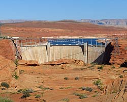 |
Glen Canyon Dam is a 600 foot high thumbnail that holds back the Colorado River creating the massive reservoir named Lake Powell. I took the Dam tour, and it was a pretty dam good... uh... It was an impressive tour which takes you all the way down to the generator room via two sets of elevators. No stairs, but there is some walking involved. |
| Near Page, Arizona / 56 Images. Visited Sep 2008. | |
| Lake Powell, Glen Canyon NRA | |
|---|---|
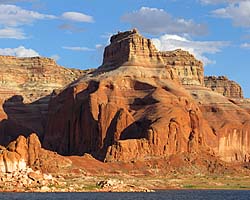 |
Lake Powell is created from the Colorado River (and its tributaries) by the Glen Canyon Dam. It's approximately 140 river miles (100 linear miles) long, and provides water, power and entertainment to millions in the Southwest. Using it as a water route is also the only convenient way to get to Rainbow Bridge National Monument. These images are of the 50 river miles from Wahweep to Rainbow Bridge National Monument. |
| Arizona, Utah / 48 Images. Visited Sep 2008. | |
Arizona - Navajo Indian Reservation and Tribal Parks
This group contains the Arizona pages for the Navajo Indian Reservation and tribal parks. It should be noted that the Little Colorado River Gorge (above, grouped with Grand Canyon), and Monument Valley in Utah are also Tribal Parks.
| Navajo Indian Reservation | |
|---|---|
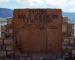 |
The images I have of the Navajo Indian Reservation (other than the Tribal Parks I've visited) are mostly along US-89 and US-89A, from Marble Canyon/Navajo Bridge and Page, Arizona through Antelope Pass to Grand Canyon. There are also images along US-160 from Four Corners to US-89. |
| Arizona, Utah / 61 Images. Visited Sep 1997, Sep 2008. | |
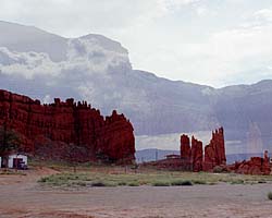
| US-160 / US-163 (Arizona) | |
|---|---|
|
US-160 though Arizona lies completely within the Navajo Indian Reservation, from Four Corners to US-89 near the Grand Canyon. Monument Valley is a stone's throw from US-160, so you get to see quite a few sandstone rock formations that just jut out from the desert. (These images are on the Navajo Indian Reservation page.) |
| Arizona / 14 Images. Visited Sep 1997, Sep 2008. | |
| Four Corners Monument, Navajo Tribal Park | |
|---|---|
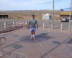 |
Four Corners Monument is the only place in the U.S. where four States meet, perhaps the ultimate place for a stupid tourist photo in the Southwest. I should know, I've been there twice! If I ever go back, I'm taking my GPS to see if it's really in the right spot. :-) In addition to the monument (there is an entrance fee), there are stalls around run by (rented by?) the locals selling locally produced merchandise. Oh, try the fry bread. Mmmmmm... |
| Utah, Arizona, New Mexico, Colorado / 28 Images. Visited Sep 1997, Sep 2008. | |
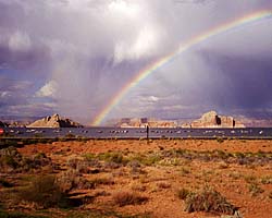
| US-89 | |
|---|---|
|
US-89 is a remarkable road that follows some of the most scenic areas of the West from Canada to Arizona, and along the way passes through (or comes within a few miles of) over a half dozen major Western Parks. Glacier to Yellowstone to Grand Teton, Bryce, Zion, Glen Canyon and Grand Canyon. I've actually frequented this road quite a bit, but in a disjointed, non-continuous fashion. |
| Visited Various | |
|
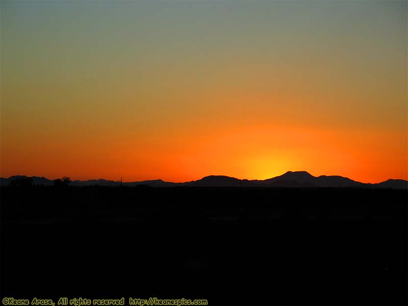
| Sunset along I-10... |
Southern Arizona
In 2005, I was on my way out to Disneyland for its 50th anniversary. On the way was Tombstone, one of those iconic old, wild-western towns that are more of a tourist destination than actually authentic these days, but that wasn't going to stop me.
So long as you're there, Saguaro National Park is only about 30 miles to the North. Both give an iconic view of the West, but in completely different ways...
| Saguaro National Park | |
|---|---|
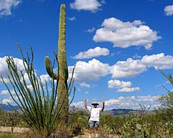 |
Saguaro National Park provides the iconic view of the Desert Southwest, featuring dozens of different types of cacti, including the towering, Saguaro Cactus. The park is split into two units, (East and West), with Tucson in-between. It's also only an hour's drive from Tombstone, which attempts to preserve another iconic view of the West. |
| Near Tucson, Arizona / 23 Images. Visited Sep 2005. | |
| Tombstone, Arizona | |
|---|---|
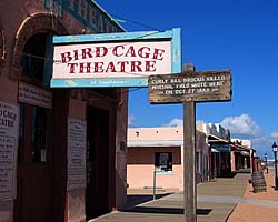 |
Tombstone has some real cred as a Wild West town, and they've tried to keep some of that reputation alive. I didn't bother with the OK Corral reenactment, but I did visit the courthouse and the Birdcage Theater... |
| Tombstone, Arizona / 37 Images. Visited Sep 2005. | |
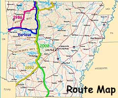
Arkansas
|
|
|
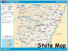
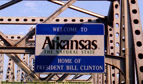
| Arkansas welcome sign |
Since then, I've been through there a number of times, anytime I was heading toward the Southwest and could make the route go though the Ozarks...
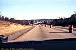
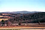
This group of links are of Arkansas Scenic Route 7, one of my top roads to drives. Hot Springs and Buffalo National River are on Route 7...
| Arkansas Scenic 7 | |
|---|---|
|
Arkansas Scenic 7 might be the first road I actively went out of my way to drive, while looking for an interesting way to get to Fort Smith, Arkansas. Since that time, I've driven it every time I had to go through that part of the country. Unfortunately, as repairs are made with federal funds, the road is being brought up to federal highway standards, which generally ruins the character of the drive. |
| Arkansas / 49 Images. Visited Feb 1986, Jun 1992, Jun 1998, Sep 2002, Sep 2005. | |
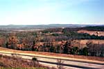
| Buffalo National River | |
|---|---|
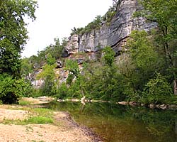 |
Buffalo National River is located in Northwest Arkansas, and protects about 140 river miles (55 linear miles) of the Buffalo River as it flows through the Ozarks. I'm not quite sure why the Buffalo gets National River status, but a National River it is. They've been developing more sites along the river since I first visited in 1992, and it is a scenic place. I've only been to two sites, both along AR-7, Ozark and Pruitt Landing. |
| Northwest Arkansas / 31 Images. Visited Jun 1998, Sep 2002, Sep 2005. | |
| Hot Springs National Park | |
|---|---|
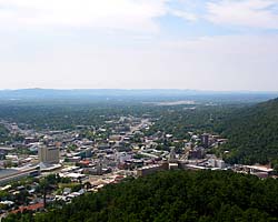 |
Hot Springs National Park was the 18th National Park designated in 1921, during a health craze in the US. It was actually declared a reservation in 1832, making it the oldest park in what would become the National Park System. It's a huge fresh water aquifer that spits out 850,000 gallons of water per day. It's I swear I had pictures of the bath houses somewhere, but I'm not sure where they are... |
| Hot Springs, Arkansas / 16 Images. Visited Jun 1998, Sep 2002. | |
I was in Fort Smith for several weeks, one or two weeks at a time. I think it was here that I decided I was working on a customer site too long if the bartender at the hotel set me up with just a nod... :-)
- 04/30/2016 - Initial deployment
- April 2017 - Upgrade to v3.4.
- September 2022 - Upgrade to v5.0.
| Help! | About This Site | Contact Me |