
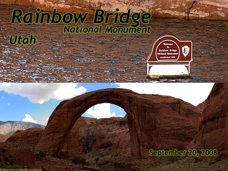
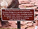
Rainbow Bridge National Monument
|
| Click to go directly to the slideshow |
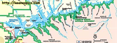
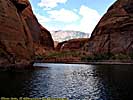
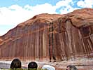
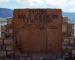
It is almost on the shore of Lake Powell (it straddles a tributary), and is contained within the Glen Canyon National Recreation Area, right next to the Navajo Indian Reservation. It is about 50 river miles from the two automobile accessible marinas, so catching a boat to the Monument is a 100 river mile round trip. You can also get to over land with special permission from the Navajo Nation, but it is a very long trek over uneven terrain without any available resources.
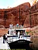
Round trip transit time by tour boat from the Wahweep Marina (in Arizona), was approximately 4 to 5 hours, and you spend about an hour at the monument, so it really is a half-day affair. (If you do something like this, bring your own water and have a hat that ties down to your head if you plan on sightseeing from the upper deck. Also be prepared for a lot of sun.)
|
| This map was downloaded from the NPS site. |
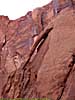
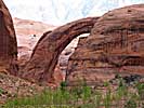
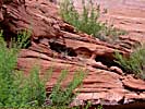
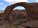
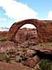
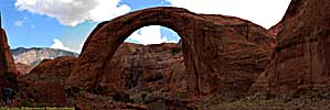
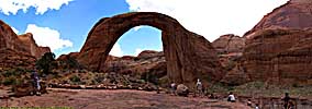
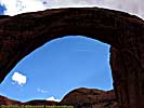
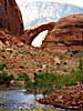
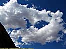
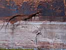
Now, Rainbow Bridge is a stone arch, but it's technically called a "Bridge", because it spans and was formed by the water running through it, as opposed to those in Arches National Park, where sandstone fins were naturally eroded into an arch. Yes, this will be on the quiz next week.
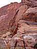
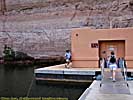
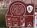
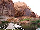
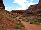
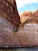
The National Park Service provides a floating pier for several boats, which can be extended depending on the water level on Lake Powell. The lower the lake, the farther the walk, over a mile during a drought.
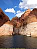
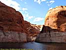
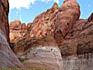
Lake Powell to Rainbow Bridge National Monument Dock
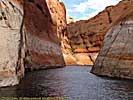
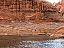

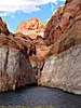
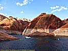
Rainbow Bridge National Monument Dock to Lake Powell
Related Links
| Colorado River | |
|---|---|
|
The Colorado River starts as a small stream in Rocky Mountain National Park, and gathers hundreds of other streams and rivers along the way to become the lifeline of the Southwest, providing water, electricity and recreation to millions in the five states the river flows through or touches. I've actually followed the river in one form or another, from Rocky Mountain National Park to Grand Canyon. I've also done more river miles on the Colorado than any other river... |
| Colorado, Utah and Arizona / 55 Images. Visited Sep 2005, Sep 2008. | |
| Glen Canyon National Recreation Area | |
|---|---|
|
The Glen Canyon National Recreation Area encompasses and products the Colorado River (and many of its tributaries) from Canyonlands to Grand Canyon National Park. It is mostly a creation of the Glen Canyon Dam, which creates a reservoir behind it (Lake Powell) a hundred miles long. Included on this page is the Navajo Bridge at Marble Canyon and the Lees Ferry Unit of the park, river level access a dozen miles below the dam. |
| Arizona, Utah / 102 Images. Visited Sep 1997, Sep 2008. | |
| Lake Powell, Glen Canyon NRA | |
|---|---|
|
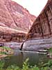
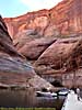
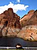
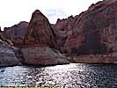
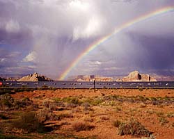
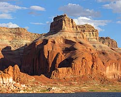
Lake Powell is created from the Colorado River (and its tributaries) by the Glen Canyon Dam. It's approximately 140 river miles (100 linear miles) long, and provides water, power and entertainment to millions in the Southwest. Using it as a water route is also the only convenient way to get to Rainbow Bridge National Monument. These images are of the 50 river miles from Wahweep to Rainbow Bridge National Monument. |
| Arizona, Utah / 48 Images. Visited Sep 2008. | |
| Navajo Indian Reservation | |
|---|---|
|
The images I have of the Navajo Indian Reservation (other than the Tribal Parks I've visited) are mostly along US-89 and US-89A, from Marble Canyon/Navajo Bridge and Page, Arizona through Antelope Pass to Grand Canyon. There are also images along US-160 from Four Corners to US-89. |
| Arizona, Utah / 61 Images. Visited Sep 1997, Sep 2008. | |
Rainbow Bridge Trip Report: Sep 2008
| Return to: | State Index | Utah State Page | National Monuments |
|---|
- 04/30/2016 - Initial deployment
- April 2017 - Upgrade to v3.4.
- August 2022 - Upgrade to v5.0.
| Help! | About This Site | Contact Me |