
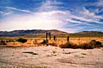
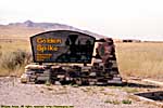
Golden Spike National Historic Site, Utah
|
| Click to go directly to the slideshow |
What he saw was mountain after mountain after mountain. Mountains that dwarfed the mountains of the East. And they were late, and snow was on the peaks. Patrick Gass wrote in his journal, "They were the most terrible mountains I ever beheld."
At that point, the hope of a Northwest Passage, a shortcut between Asia and Europe, died.
After Lewis and Clark's report, and the trail blazing of the early mountain men and pioneers, it took 6 months to cross the West by oxen drawn wagon, hardly a time saver over the 3 to 6 months it took sailing around Cape Horn. (Not to mention almost zero cargo capacity.) Early pioneers to the Northwest and the gold rush stampede proved just how hazardous and difficult the journey could be. America was a country from the Atlantic to the Pacific, but it took a good portion of a year to cross it.
|
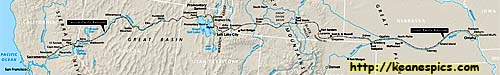
| Transcontinental Railroad Map. Click on the map for a larger view. |
Like a lot of ideas, the technology had to be invented before the idea could even be feasible. A relatively efficient steam engine, cheap steel (with better mining and refining tech), and even the railroad itself, all had to be invented or improved before the endeavor could be possible.
Though the dream of crossing the country by rail was an early idea after railroads were established in the East, no company could shoulder the cost of such an endeavor. It was politics and states rights that separated the North from the South, but it was vast distances, deserts and mountains that separated the East from the West.
While Abraham Lincoln worked on that North / South problem, he was also considering the East / West problem as well. Work on the Transcontinental Railroad actually started during his administration, by three companies with money, loans and huge land grants from the government.
The Western Pacific Railroad was to lay track from the San Francisco Bay area to Sacramento, California. The Central Pacific was to start from Sacramento, and build toward the rising sun, having to surmount the Sierra Nevada mountains and the Great Basin Desert. (They would eventually absorb the Western Pacific.) The third company was the Union Pacific, who was to start from Council Bluffs, Iowa, the East side of the Missouri River, and to go West and chase the setting sun across the Great Plains and the Rocky Mountains. Work began as early as 1863 in the West by the Central Pacific, but the Union Pacific didn't start until 1865, since the Civil War used so many resources, from men to iron to money.
It wasn't clear exactly where in the West they would meet. Since each company would earn not only dollars per mile of track laid, but land grants as well, it was a competition for each company to lay the most track. The meeting of the tracks would be determined as they grading crews got close to one another. The grading crews did meet in Utah, then passed each other, so close that work on one railroad's planned route would interfere with the other.
Congress finally stepped in and declared that the meeting of the railroads would be at Promontory Summit in Utah, north of the Great Salt Lake. Only four years after the North and the South were reunited, the East and the West were finally tied together by a pair of steel rails. At 12:47PM on May 10, 1869 we became, for the first time, a truly continental nation, removing the barriers which prevented migration and movement of raw and finished goods across the country.
|
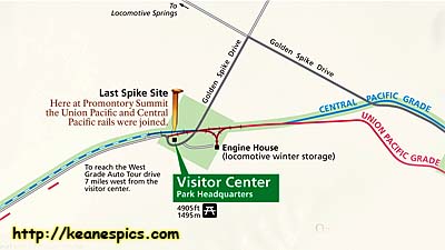
| Cropped map of Golden Spike. Click on the map for a larger view. |
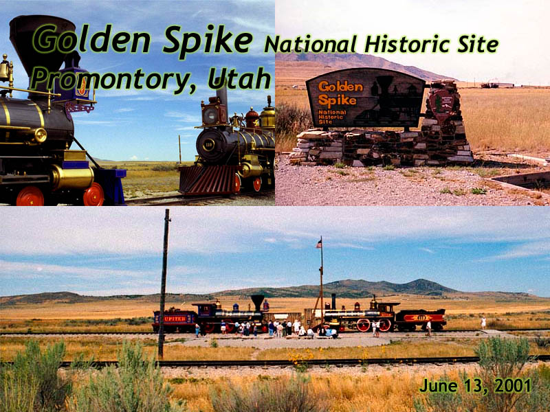
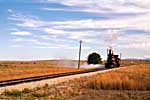
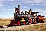
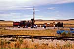
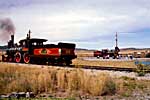
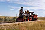
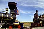
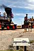
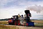
There are two operating steam trains here, (almost) exact replicas of the Central Pacific Jupiter and the Union Pacific 119, the locomotives present when the final spike was driven. They operate during the summer season, and belch smoke, steam and sparks. It's a very cool place if you're into trains. (And apparently, the site has expanded since I was there, taking advantage of the unused grades.)
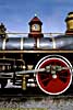
A story I was told when I was there was the trains could be accurately replicated, except for one detail. They had no idea what colors to paint it, since all the photos were black and white, and documentation such as newspaper articles didn't describe the color scheme. So they consulted with a company that had their own working narrow gauge railroad, The Disney Company.
Golden Spike National Historic Site
Related Links
Golden Spike is some 30 miles from US-89, but US-89 couldn't get any closer without having to cross the Great Salt Lake. So it's included as a US-89 park, even though it's a bit of a stretch...
| US-89 | |
|---|---|
|
US-89 is a remarkable road that follows some of the most scenic areas of the West from Canada to Arizona, and along the way passes through (or comes within a few miles of) over a half dozen major Western Parks. Glacier to Yellowstone to Grand Teton, Bryce, Zion, Glen Canyon and Grand Canyon. I've actually frequented this road quite a bit, but in a disjointed, non-continuous fashion. |
| Visited Various | |
Trip Report: Sep 1998.
| Return to: | State Index | Utah State Page | Historical Sites |
|---|
- 04/30/2016 - Initial deployment
- April 2017 - Upgrade to v3.4.
- August 2022 - Upgrade to v5.0.
| Help! | About This Site | Contact Me |