
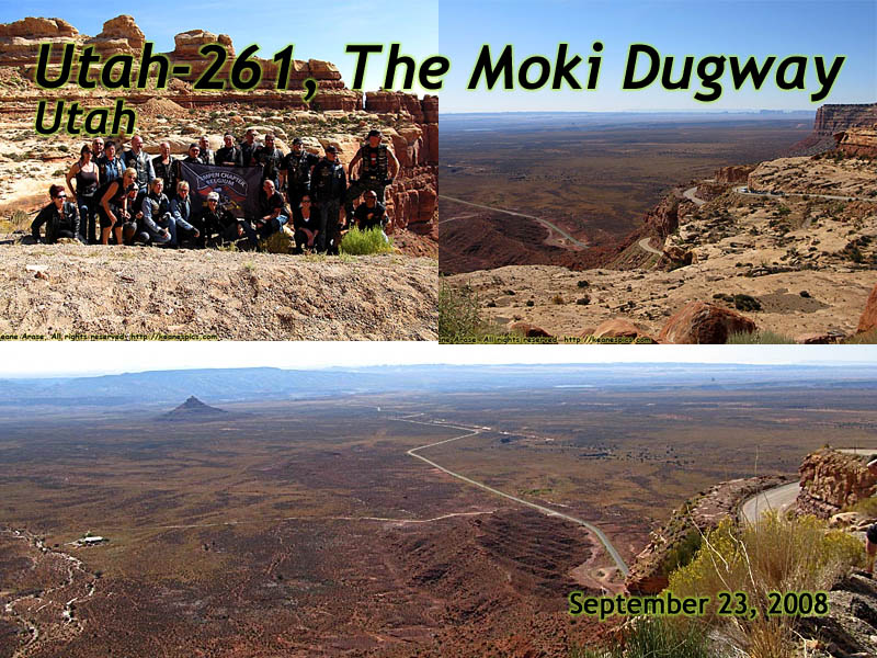
Moki Dugway
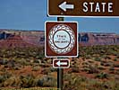
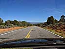
Utah-261 (near Mexican Hat)
| Introduction | Trail of the Ancients | The Moki Dugway | UT-261 | Related Links |
|
| Click to go directly to the slideshow |
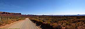
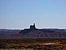
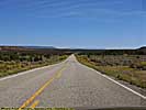
If you look at any map, the obvious shortest route between Mexican Hat (the first city (well, the first named location) North of the Navajo Indian Reservation) and Natural Bridges, is Utah-261. However, look at that same map again, and you'll see this little "knot" in the middle of nowhere. Hmmm... I like my roads squiggly, but this seemed a bit severe. So, if the road was impassable, I'd have to route myself through Utah-95 though Blanding, which would make it both my entrance and exit route.
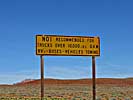
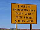
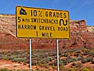
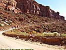
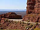
As we turned onto Utah-261, we get a warning signs that say, "10% grades, unimproved, no trailers, 5 MPH switchbacks, narrow gravel road..." Don't worry, it'll be fun!
|
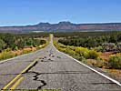
| The Moki Dugway |
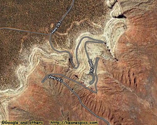
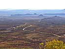
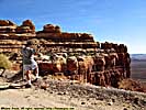
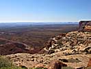
Later research would find that this section of road has a name, The Moki Dugway. It was built in 1958 for trucks hauling uranium ore to a processing facility in Mexican Hat. However, there's evidence of carved hand and foot holes, as well as paths that lead up the cliffs created by the ancient civilizations that lived in the area. These cliffs might be a natural barrier for some, but not us humans!
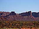
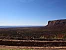
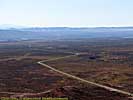
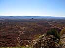
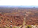
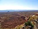
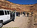
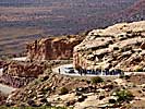
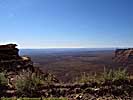
The road climbs the southern escarpment of the Cedar Mesa, which is 5300 feet above sea level at the base, and rises 1100 feet in less than 3 miles. While we look at it and try to decide if we want to do the road or detour around, a group of bikers (as in some Harley-Davidson bikers from Belgium, believe it or not) with a support van to go along goes by, so we're brave enough to follow.
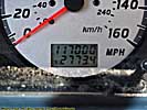
And our fears were foundless. The road's okay if you only go 20 miles per hour, and you probably don't want to more than 20 anyway. It would make my top 10 road list if it wasn't for the fact it's only 3 miles long.
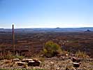
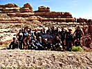
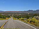
What a road. It goes up the side of the rock and switchbacks until you get to the top. Views are incredible. Halfway up, there's a pull-off, and the bikers stop to take some pictures and so do we. They're our road testers after all. They ask me to take their group picture. Only if I can take one too.
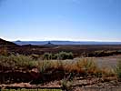
After taking some video, we continue to the top, and on to Natural Bridges National Monument. Once we're to the top of Cedar Mesa, the land is flat with a lot more vegetation than the valley floor. It's sort of surreal that we just climbed the side of a cliff from a sandstone desert that has rock formations sticking out of the ground everywhere you look, to a flat green plain...
Trail of the Ancients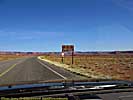
Related Links
| Natural Bridges National Monument | |
|---|---|
|
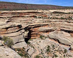
Natural Bridges National Monument is actually an impressive place,
but it's another park that you have to want to go to, since it's not on the
way to anything else. (That's not exactly true, but it's close enough.)
The monument preserves three natural stone bridges, which still exist mostly because there's little rain or other severe erosive forces here. |
| In the middle of nowhere, Southeastern Utah / 46 Images. Visited Sep 2008. | |
Moki Dugway Trip Report: Sep 2008.
| Return to: | State Index | Utah State Page | Roads |
|---|
- 04/30/2016 - Initial deployment
- April 2017 - Upgrade to v3.4.
- Sepember 2022 - Upgrade to v5.0.
| Help! | About This Site | Contact Me |