
Arches National Park
| Introduction | Entrance to Balanced Rock | Windows Section | Fiery Furnace to Skyline Arch, Delicate Arch | Related Links |
|
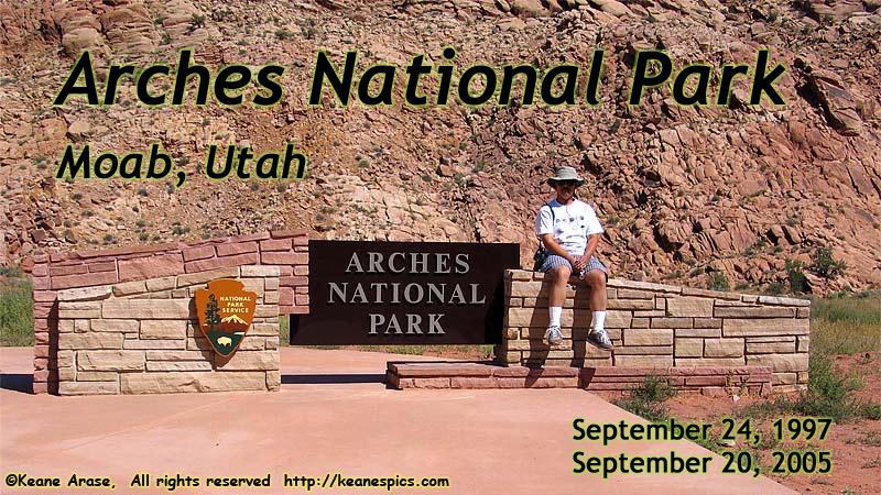
| Arches National Park Entry Sign. Click to go directly to the slideshow... |
|
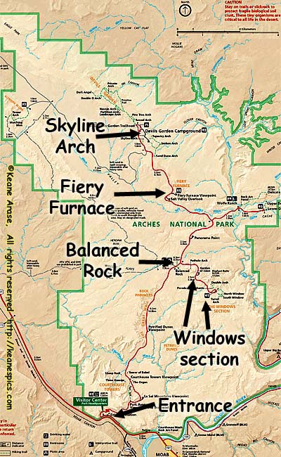
| Map of Arches National Park. (Click for a larger map.) |
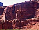
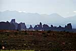
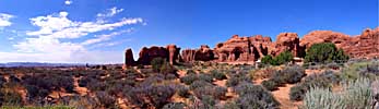
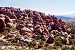
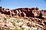
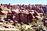
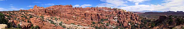
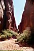
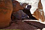
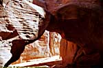
The area in Arches, was bent 90 degrees, and what was horizontal layers of sandstone, were now vertical. After eroding a few million years, the stronger (or perhaps luckier) sandstone remained, and were now "fins", vertical layers of sandstone reaching a hundred feet into the air. Further erosion caused holes to form in the fins, creating arches. (And these are "arches", not bridges. Stone bridges are created by water. Arches are created by erosion.)
I've been to two or three places that would qualify as an alien landscape. Even when you're there, the place seems surreal.
The first is Craters of the Moon National Monument. There aren't any craters there, but vast lava flows and cinder cones, so most everything is dark brown or black.
The second is about 75 miles west of Arches, at a Utah State Park named Goblin Valley. (Relatively) small sandstone rock formations litter the valley floor. It's sort of like a rock garden, where the rocks could be a few feet in length.
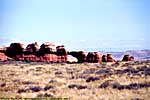
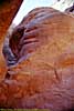
The third, of course, is Arches, where entire landscapes seem to be other-worldly, from arches to impossibly balanced rocks, to almost instantly recognizable natural rock formations. These aren't the small formations of Goblin Valley, but sandstone structures rising a hundred feet into the air.
There are more than 1600 cataloged arches within the parks boundaries, the greatest density of stone arches anywhere in the world. This is one of the premier National Parks in America, and definitely resides in one of my must see parks. With attractions such as Canyonlands National Park, Dead Horse State Park and Utah-128 right in the vicinity, it makes Moab a natural base camp if you're visiting the park.
I was at Arches National Park twice, in September 1997 and September 2005. The first time, all the photo gear was analog. The second time it was all digital, and went into the park with the express purpose of imaging the park with more modern equipment and photo-stitching techniques.
I'm going to split the park by road segments.
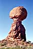
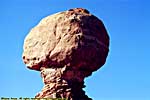
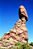
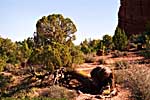
Entrance to Balanced Rock
There's a (relatively) new visitor's center, as well as a new entrance, which was moved down the road from the old one. The old entrance used to be right around a blind corner, where overflow traffic trying to get into the park would block US-191, the main road south from I-70. It's pretty apparent why the entrance was moved to a relatively straight stretch of road with more waiting area before the entrance booths.
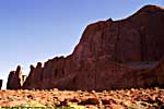
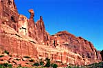
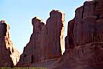
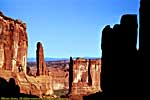
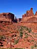
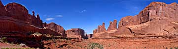
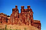
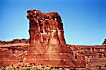
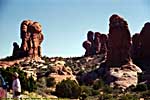
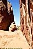
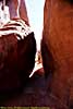
There are various recognizable rock formations along the park road, which is probably why the park road goes this way. Park Avenue showcases a "valley" of sorts between two standing fins of sandstone.
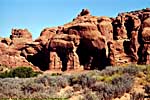
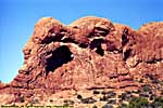
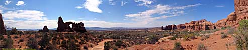
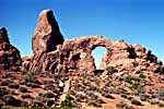
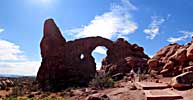
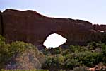
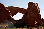
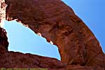
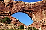
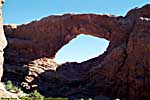
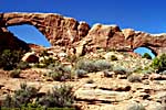
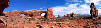
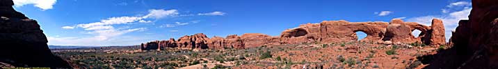
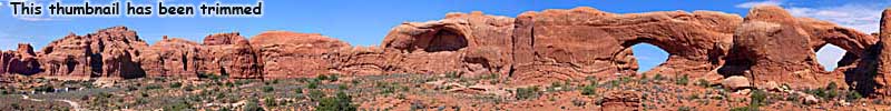
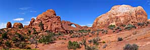
Windows Section
The windows area of the park has an high concentration of famous arches, The Parade of Elephants, Double Arch, North and South Windows (The Spectacles) and Turret Arch.As you can tell from the picture below, Jo was still suffering from sticking her nose into that flower in Great Basin...

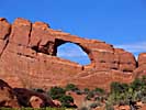
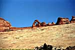
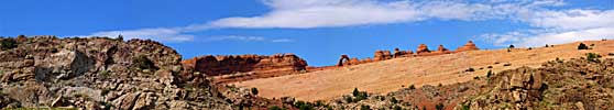
Fiery Furnace to Skyline Arch, Delicate Arch
From the Windows area, we visited Fiery Furnace, Skyline Arch, and the most iconic arch, one of Utah's icons, Delicate Arch. No I didn't walk to it. I probably would have if I had included the time to do it, but the hours always seem to be better spent elsewhere.
Fiery Furnace to Skyline Arch, Delicate Arch


Related Links
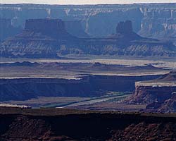
Canyonlands is just downriver from Arches, around 30 minutes by road. On the way to Canyonlands is Dead Horse Point State Park, which has a magnificent view of the Colorado and the gooseneck before the river enters Canyonlands. Utah-128 follows the meanders of the Colorado River, right across the river from Arches. It's the alternative way to get to I-70 from Moab.
| Canyonlands National Park | |
|---|---|
|
Canyonlands National Park is proto-Grand Canyon, and in my opinion even more impressive in many ways. It is the confluence of the Green and Colorado Rivers, a major contributor making the Colorado the powerhouse river of the Southwest. Once the Colorado enters Canyonlands, it doesn't leave Federal land until the river reaches the California. I've only been to the Island In The Sky District, since it was the most accessible. |
| Near Moab, UT / 49 Images. Visited Sep 1997, Sep 2008. | |
| Dead Horse Point State Park, Utah | |
|---|---|
|
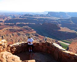
Dead Horse Point State Park is right next door to Canyonlands National Park, about a half-mile as the crow flies, or about 11 miles by road. That's just the way things are out here. From the top, you get a magnificent view of the Colorado River Valley and the goosenecks just before entering Canyonlands. Unfortunately, the main view is to the South, so the sun will always be in front of you. |
| Near Moab, Utah / 27 Images. Visited Sep 2005, Sep 2008. | |
| Colorado River | |
|---|---|
|
The Colorado River starts as a small stream in Rocky Mountain National Park, and gathers hundreds of other streams and rivers along the way to become the lifeline of the Southwest, providing water, electricity and recreation to millions in the five states the river flows through or touches. I've actually followed the river in one form or another, from Rocky Mountain National Park to Grand Canyon. I've also done more river miles on the Colorado than any other river... |
| Colorado, Utah and Arizona / 55 Images. Visited Sep 2005, Sep 2008. | |
Arches Trip Reports: Sep 1997, Sep 2005.
| Return to: | State Index | Utah State Page | Moab, Utah | National Parks |
|---|
- 04/30/2016 - Initial deployment
- April 2017 - Upgrade to v3.4.
- July 2022 - Upgrade to v5.0.
| Help! | About This Site | Contact Me |