
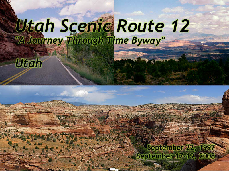
Utah Scenic Route 12
"A Journey Through Time Byway"
|
| Click to go directly to the slideshow |
Introduction
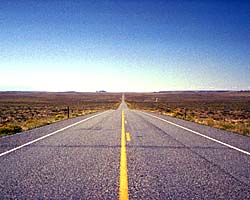
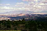
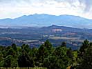
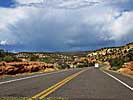
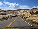
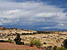
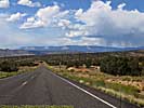
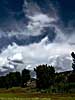
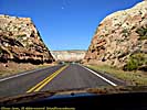
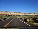
Utah Scenic Route 12 also has another name, "A Journey Through Time Byway". (Who comes up with these names?) In truth, that name belongs to US-89, which actually traverses almost all of the Grand Staircase from Panguitch, Utah to Grand Canyon in Arizona. Utah-12 does show off some magnificent scenery, From the Waterpocket Fold, an almost wasteland from a geologic upthrust 60 million years ago, through some petrified sand dunes from when the Western United States was a lifeless desert a couple hundred million years ago, to the Pink Cliffs and their odd erosion of Bryce and Red Canyons.Driving this road gets my highest recommendation. It has both the road and the scenery to make it a worthwhile drive, with Capitol Reef on one end, and Bryce Canyon on the other. It's only 120 miles long, starting at US-89 and ending at US-24. You can actually drive it in a few hours, but you'd be cheating yourself out of some of the most memorable sights in Utah.
|
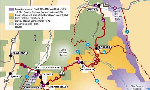
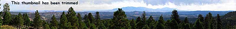
| Cropped map of Utah-12 and its attractions. Click on the map for a larger view. |
Utah-12 started life as Utah-11 in 1914, from (what is now) US-89 to Tropic, a town on the other side of Bryce Canyon National park. The road was finally completed to Torrey (Utah-24) in 1986, via construction and other state route re-assignments. You can find it's (legislative) history in a doc on the Utah Department of Transportation website.
I would also recommend getting information of all the attractions along this road at the Scenic Byway 12 website, but again, check road and weather conditions when you're there.
The first time I drove it on an overcast, crummy day in September 1997. I started from US-89 and only gave myself a day to drive it, but that day also included Cedar Breaks, Bryce Canyon and half of Capitol Reef. I know that was kinda dumb and rushed, but what else do you eliminate? Grand Canyon? Zion? Arches and/or Canyonlands?
I would fix that in 2008, which was essentially a redo of 1997, but in the opposite direction and a decade of road trip planning. I spent two-and-a-half days on the road, from Utah-24 to US-89, spending the nights in Escalante and Ruby's Inn. I was also shooting digital instead of film, so there are probably 10 times the number of images in that direction.
So in that spirit, we'll start Utah-12 from the Eastern (well, Northern) end at US-24 near Torrey, and end at US-89. Since Utah says Mile 0 is US-89, the mileage markers will go down instead of up. A minor inconvenience, lol...
| Mile Marker (Mileage from US-24) |
Attraction |
|---|---|
| 124 (0) | Utah-24Capital Reef NP |
| 87 (37) | Anasazi Indian Village SP (UT) |
| 73 (51) | Boynton Overlook |
| 70 (54) | Head of the Rocks Overlook |
| 60 (64) | Escalante, Utah |
| 25 (99) | Cannonville / Kodachrome Basin SP (Utah) |
| 13 (111) | Bryce Canyon City (Ruby's Inn) Bryce Canyon NP |
| 3 (121) | Red Canyon |
| 0 (124) | US-89 |
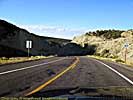
Utah-12, Capitol Reef (UT-24, MM124) to
Anasazi State Park Museum (MM87)
Technically, Capital Reef National Park isn't on Utah-12, it's on Utah-24, but the road parallels the Waterpocket Fold for around 25 miles before the road starts to curve to the West.| Utah State Route 24 | |
|---|---|
|
Utah State Route 24 was the southern detour around the
San Rafael Swell for 35 years before I-70 opened through the wilderness.
Today, it's still the way to get to Goblin Valley State Park, Capitol Reef National Park and the Waterpocket Fold. It is also one of the endpoints of Utah-12, a road everyone should drive at least once... |
| Utah / 35 Images. Visited Sep 1997, Sep 2008. | |
| Capital Reef National Park | |
|---|---|
|
Capital Reef National Park protects the Waterpocket Fold,
the edge of a geologic up thrust long since eroded away over the last 60 million
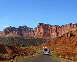
years. Give or take a few million. The first time I was at the park, the Scenic Drive was washed out due to some flash flooding, so the sights along Utah-24 were the only ones accessible. When I was there in 2008, I had some magnificent weather, a much better planned trip, and spent the entire afternoon in this park. |
| Near Torrey, UT / 95 Images. Visited Sep 1997, Sep 2008. | |
Capitol Reef to Anasazi State Park Museum

Anasazi State Park Museum (MM87) to
Escalante, Utah (MM60)
As I mention in Anasazi State Park, it's almost 40 miles from Torrey, and a logical stop to get out and stretch your legs and take a break.| Anasazi State Park, Utah | |
|---|---|
|
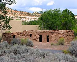
Anasazi State Park Museum (UT) is Utah's park dedicated to
the Anasazi, who disappeared as a culture some thousand years ago. Too be honest, the ruins
are much like those at the other major Anasazi sites, but most of those have been co-opted by the
federal government. It is, however, a nice place to get out and stretch your legs, use the bathroom, get something out of the cooler... |
| Boulder, Utah / 15 Images. Visited Sep 2008. | |
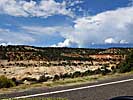
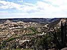
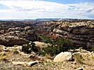
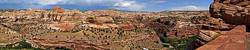
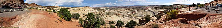
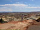
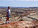
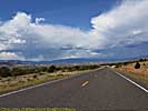
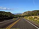
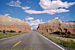
The most scenic part of Utah-12 might be between Boulder and Escalante, a 27 mile stretch of road that cuts through the petrified sand dunes.
Anasazi State Park Museum to Escalante, Utah
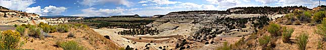
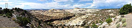
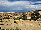
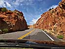
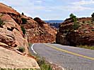
Head of the Rocks Overlook (MM70)
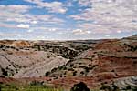
Escalante, Utah (MM60)
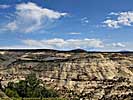
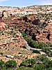
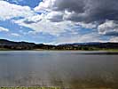
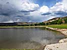
If you're on a road trip with a loaded car, I can't recommend Grand Staircase-Escalante National Monument other than Utah-12, mostly because most of the roads are wash-board gravel roads, which will punish your already loaded suspension. (Multiply the problem if you have a sports suspension and low-profile tires.)If you have a high-clearance vehicle (or a rental) have at it! Just be aware that even a modest amount of rain may make some of these roads impassible. Check at the Visitor's Center in Escalante for road and weather conditions.
| Grand Staircase-Escalante National Monument | |
|---|---|
|
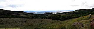
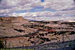
Grand Staircase-Escalante National Monument
is actually larger than the state of Delaware, but has a population close
to the number of visitors in the park. The GSENM page starts with an overview of what the Grand Staircase actually is, a geologic wonderland stretching from the Aquaritus Plateau at Bryce Canyon to the bottom of the Grand Canyon. This 8,000 foot drop in elevation in almost discreet steps holds some of the most breathtaking scenery in America. |
| Near Escalante, Utah / 33 Images Visited Sept 1997, Sep 2008. | |
On the other hand, we had the best meal of the trip in a small restaurant name Georgies, a house-now-restaurant that has only four tables because that's what fits in the former living room. If she's still there, stop in for lunch or dinner. Scratch made Mexican. It was excellent.
There's nothing wrong with staying here overnight (we did), but if I was clairvoyant, I would have stayed two days in Bryce Canyon City, rather than a night in Escalante and a night in Bryce Canyon. It's only 45 miles down the road, and it'd be a nice to eliminate unpacking and packing the car for a night. Should it be late and force you to bypass say, Kodachrome Basin, it isn't that far to backtrack the next morning (15 miles). This also has the advantage of arriving at Bryce Canyon City after the hotel check-in time, a minor problem I had at Ruby's Inn.
But do eat here. The food was far superior to what's available in Bryce Canyon.


Escalante, Utah (MM60) to
Kodachrome Basin State Park (MM25)
Escalante, Utah To Kodachrome Basin State Park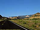
Kodachrome Basin State Park (MM25) to
Red Canyon (MM3)
| Kodachrome Basin State Park, Utah | |
|---|---|
|
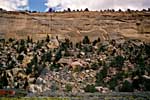
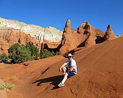
Kodachrome Basin is another one of those
amazingly scenic Utah State Parks, just a short detour off of Utah-12.
The basin was actually named by National Geographic after the new (in 1949) fine grained transparency film from Kodak. When Utah created the state park, the company gave them permission to retain the name. Fast forward almost 70 years, and not only is film an almost dead medium, but there isn't a processing plant left that can actually develop a roll of Kodachrome. |
| Near Cannonville, Utah / 39 Images. Visited Sep 2008. | |
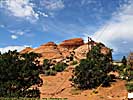
Of course, the crown of Utah-12, is Bryce Canyon National Park, a series of amphitheaters showcasing sandstone Hoodoo's...
| Bryce Canyon National Park | |
|---|---|
|
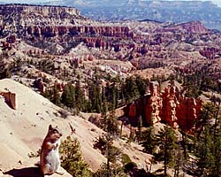
Bryce Canyon is just magnificent. The park isn't really
a canyon, but a series of amphitheaters of sandstone formations, carved by erosions
into pillars that look more like sculptures.
It's on my list of must visit parks. Unfortunately, it's also on many other people's list of must visit parks, too. Located a dozen miles from US-89 on Utah-12, it sits on top of the Grand Staircase that descends to the South. |
| At Utah-12 and Utah-63 / 156 Images. Visited Sep 1997, Sep 2008. | |
| Ruby's Inn | |
|---|---|
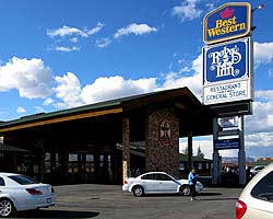
|
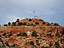
Ruby's Inn is named after Ruby Syrett, who promoted
the area in 1910, years before Bryce Canyon became a park. As a matter of fact, the Syrett
family still owns the land right outside the park, as well as the two hotels,
both gas stations, the restaurants, all the gift shops and grocery store.
Only the original Best Western existed when I was there, and I stayed in a brand new room with a whirlpool tub right next to the pool atrium. It was rough, but someone had to do it... |
| Near Bryce Canyon National Park, Utah / 25 Images. Visited Sep 2008. | |
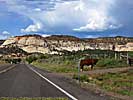
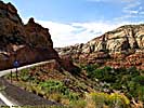
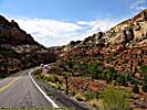
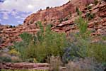
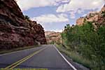
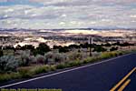
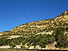
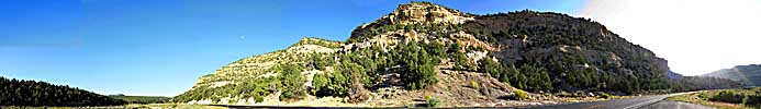
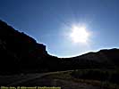
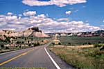
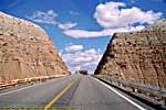
Red Canyon is only 3 miles from US-89, the start (or end) of the road.
| Red Canyon | |
|---|---|
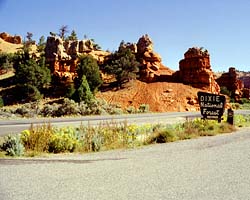
|
Red Canyon is pretty much at the Western
end of Utah-12 (mile marker 3), and is a USFS site. I understand there's
even a visitors center there now.
I've only seen the parts from Utah-12, but there are images from Jo's horseback ride through the canyons. |
| Near Utah-12 and US-89, Utah / 33 Images. Visited Sep 1997, Sep 2008. | |
| US-89 | |
|---|---|
|
US-89 is a remarkable road that follows some of the
most scenic areas of the West from Canada to Arizona, and along the way passes
through (or comes within a few miles of) over a half dozen major Western Parks.
Glacier to Yellowstone to Grand Teton, Bryce, Zion, Glen Canyon and Grand Canyon.
I've actually frequented this road quite a bit, but in a disjointed, non-continuous fashion. |
| Visited Various | |
Finally, even though the road is a lot more travelled today than it was when I find did the road in 1997, make sure you have supplies just in case, like water and snacks that can serve as food should you need it. However, if you get a chance to drive the road, I'd recommend it.
Scenic Utah 12 Trip Report: Sep 1997, Sep 2008.
| Return to: | State Index | Utah State Page | Roads |
|---|
- 04/30/2016 - Initial deployment
- April 2017 - Upgrade to v3.4.
- September 2022 - Upgrade to v5.0.
| Help! | About This Site | Contact Me |