
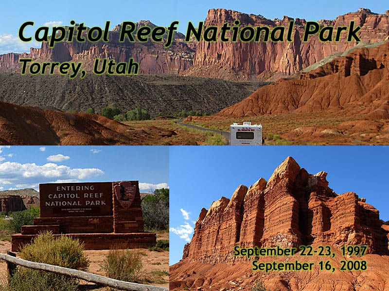
Capitol Reef National Park
|
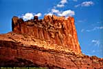
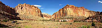
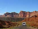
| Capitol Reef National Park. Click to go directly to the slideshow... |
In the late 1800's, the Mormons started homesteading farther South from The Great Salt Lake, and a group started a settlement at what is now The Fruita Historic District. The settlement, Fruita (then named Junction), never supported more than 10 families, but it was a very successful venture.
It was located where the Freemont River cut through the Capitol Reef, so named because of the white domes that resembled the Capitol Building; and any impassible barrier, whether on land, or at sea, was called a Reef.
In 1921, however, a booster effort out of Torrey, started promoting the area in Wayne County as The Wayne Wonderland. Concerned that much of the area was becoming exploited, the booster club started a campaign to create The Wayne Wonderland National Monument.
|
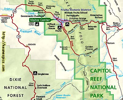
| Cropped map of Capitol Reef National Park. Click for a larger view. |
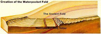
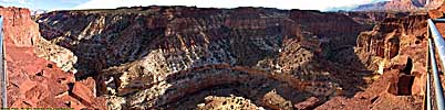
While the wall was probably a mystery to the pioneers who homesteaded here, today it's called the Waterpocket Fold, a hundred mile long up thrust that occurred 65 million years ago (by the same forces that created the Rockies), but has since eroded down. (See the cross section at the right.) The cut through the Reef was caused by the Freemont River, which was able to keep its channel and cut through the wall as the ground was pushed upward. It's named Waterpocket due to the eroded depressions in the rock that retain rainwater.
Capitol Reef National Park protects this Fold, so it's a long (60 miles North-South), but narrow (6 mile average, East-West) park. It is essentially surrounded by National Forests, BLM lands, Grand Staircase-Escalante National Monument, and touches Glen Canyon National Recreation Area at the Southern tip, where the Fold continues to Lake Powell.
|
| Cross section of the Waterpocket Fold. |
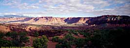
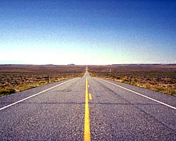
Utah-24, the main road that allows access to the park, follows the Freemont River from Hanksville, and follows the natural passage formed by the river through the Fold. Once through the Fold, Utah-24 follows the "Reef" until it exits the park close to Torrey.
The Scenic Drive of the park follows the Fold South for a few miles. It was washed out by some flash floods when I was there in 1997, and in 2008, it was apparent why the road would wash out. Definitely a drive to do, if you can.
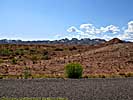
East Entrance / Notom Road
I actually drove a few miles of Notom Road, looking for Notom. Couldn't find it, and abandoned the search when the road went to gravel.

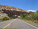
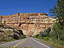
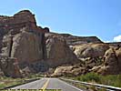
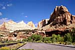
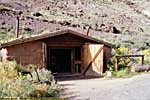
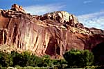
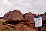
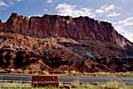
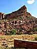
Entrance to Visitors Center
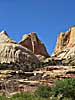
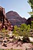
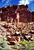
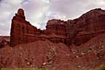
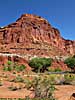
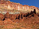
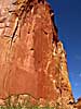
US-24 crosses through the Waterpocket Fold here, where the rocks are a jumbled mess of confusion. It's the white "domes" here that prompted the "Capitol" in Capitol Reef. Very cool place.
Utah-24, Entrance to Visitors Center
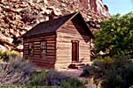
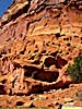
Fruita Historic District
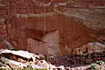
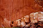
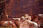
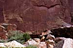
The Fruita Historic District is where the town of Fruita resided. The last resident actually moved away in the 1960's. While the place was part of the National Monument, the residents were grandfathered in, and the land was purchased when the owner decided to leave, not by eminent domain. It should be mentioned that there were never more than 10 property owners here, so it was pretty easy to manage.There are some petroglyphs here (which I still maintain is just ancient graffiti :-) ) from the Freemont Culture, some 1000 years ago. The one room schoolhouse has been maintained, the seemingly iconic structure that defined a pioneer town.
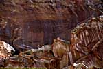
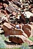
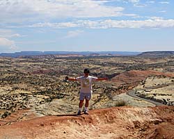
And a word about slickrock. I just "walked" up that rock in the picture for perspective, it's just too easy to think that some of those sandstone rocks are small. I'm a good 7 or 8 feet off the ground there. It was way easy getting up there. It was way not easy getting back down...
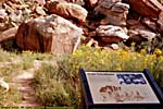
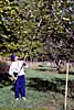
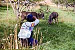
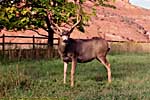
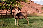
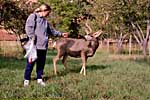
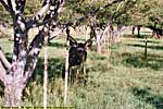
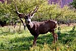
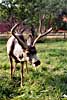
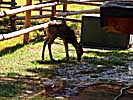
Not only has the Park Service maintained and rebuilt some of the buildings, but they also maintain the orchards that were established here by the pioneers, both fruit and nut trees. The orchards are open when their bounty is in season, and it's all you can eat, free, so long as it's consumed within the orchard. There's a nominal fee per pound if you take the fruit/nuts with you. (Apples were in season when I was there, and they were pretty good. The deer agreed. I know, we shouldn't have fed it. Bad tourists.)
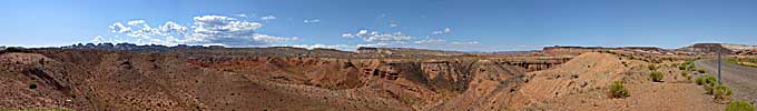
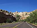
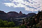
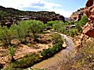
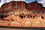
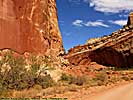
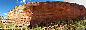
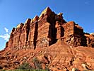
Visitors Center to Goosenecks Point
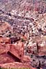
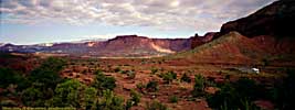
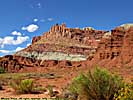
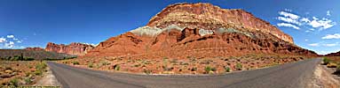
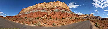
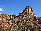
Utah-24 follows the Fold here, and you can clearly see the different layers of rock exposed by the up thrust.
Utah-24, Visitors Center to Goosenecks Overlook
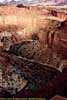
Goosenecks Overlook
There's a short drive to a short walk to an overlook of the goosenecks of Sulphur Creek. It's easy to lose the path if you're not paying attention and arrive at a point with no guard rail... But I digress.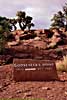
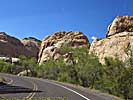
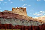
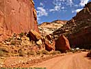
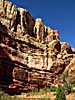
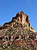
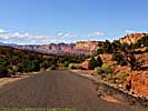
Goosenecks Overlook to Torrey
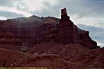
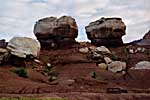
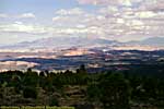
Other formations along Utah-24.
Utah-24, Goosenecks Overlook to Torrey
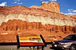
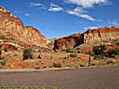
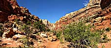
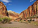
Scenic Drive, Visitors Center to Grand Wash
The visitor's Center is at the start of the Scenic Drive. We also stopped in at the Gifford's homestead, one of the families that lived in Fruita. (We bought a (six inch, I think) peach pie for consumption that night at the hotel.)(The Scenic Drive was closed when I was here in 1997 due to flash floods that took out the road...)
Scenic Drive, Visitors Center to Grand Wash

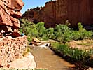
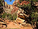
Grand Wash
We walked part of the Grand Wash.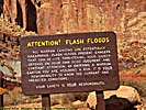
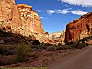
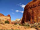
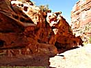
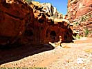
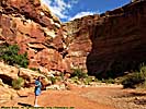
Grand Wash to Capitol Gorge
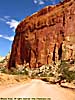
Scenic Drive, Grand Wash to End of Scenic Drive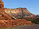
You can see the Waterpocket Fold from Utah-12, until the road starts curving to the West...
With Torrey a convenient place to stay overnight, a stop at Capitol Reef is a no-brainer if you're planning on driving Utah-12. Even if you only have a couple of hours, many of the sites are right on Utah-24, and easily accessible.
Related Links
| Utah State Route 24 | |
|---|---|
|
Utah State Route 24 was the southern detour around the San Rafael Swell for 35 years before I-70 opened through the wilderness. Today, it's still the way to get to Goblin Valley State Park, Capitol Reef National Park and the Waterpocket Fold. It is also one of the endpoints of Utah-12, a road everyone should drive at least once... |
| Utah / 35 Images. Visited Sep 1997, Sep 2008. | |
| Utah State Route 12 | |
|---|---|
|
Utah State Route 12 (also named as the "Journey Through Time Byway") is my favorite road in America. The 124 mile road starts at a unnamed junction with US-89 and ends in Torrey, Utah, pretty much connecting Bryce Canyon to Capitol Reef National Park. In-between are a couple of those spectacular Utah State Parks, a National Monument and some jaw-dropping landscapes just off the side of the road. |
| Utah / 67 Images. Visited Sep 1997, Sep 2008. | |
Trip Report: Sep 1997, Sep 2008.
| Return to: | State Index | Utah State Page | National Parks |
|---|
- 04/30/2016 - Initial deployment
- April 2017 - Upgrade to v3.4.
- August 2022 - Upgrade to v5.0.
| Help! | About This Site | Contact Me |