
Utah State Route 24
| Introduction | I-70 to Goblin Valley State Park | Goblin Valley SP to Capital Reef National Park |
| Torrey, Utah (Best Western) | Related Links |
|
| Click to go directly to the slideshow |
 Utah-24 was established in 1910, an off-shoot of Utah-11 (which
would become US-89), and connected several towns (mostly Mormon settlements),
such as Torrey, Fruita and Hanksville. In 1935, Utah-24 was extended from
Hanksville to Utah-8, which would eventually become I-70. It was one of
the only roads that crossed the Waterpocket Fold while detouring around
the San Rafael Swell. (See the I-70
portion of the Utah page for more information on I-70 and the Swell.)
Utah-24 was established in 1910, an off-shoot of Utah-11 (which
would become US-89), and connected several towns (mostly Mormon settlements),
such as Torrey, Fruita and Hanksville. In 1935, Utah-24 was extended from
Hanksville to Utah-8, which would eventually become I-70. It was one of
the only roads that crossed the Waterpocket Fold while detouring around
the San Rafael Swell. (See the I-70
portion of the Utah page for more information on I-70 and the Swell.)
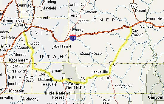
Today, the Eastern end of the road is Exit 149 on I-70, about 10 miles West of Green River. The Western end is near Sigurd, Utah, Exit 48 on I-70. (Utah-24 actually ends 10 miles past I-70 at US-50, probably its original destination before I-70 was built.)
I have only been on I-24 twice, from the Eastern end to Torrey, Utah, and have stayed overnight in Torrey both times. It's a natural place to stop, since it's right next to Capitol Reef and the start (or end) of Utah-12, my top pick of the best roads to drive in America.
Utah-24 - I-70 to Goblin Valley State Park
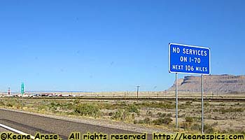 Just so you know, there might not be any services on I-70, but there
are services down Utah-12 & 24. They've been there a lot longer than I-70,
and it's usually easier to exist when there's a continuously flowing river
next to your town.
Just so you know, there might not be any services on I-70, but there
are services down Utah-12 & 24. They've been there a lot longer than I-70,
and it's usually easier to exist when there's a continuously flowing river
next to your town.
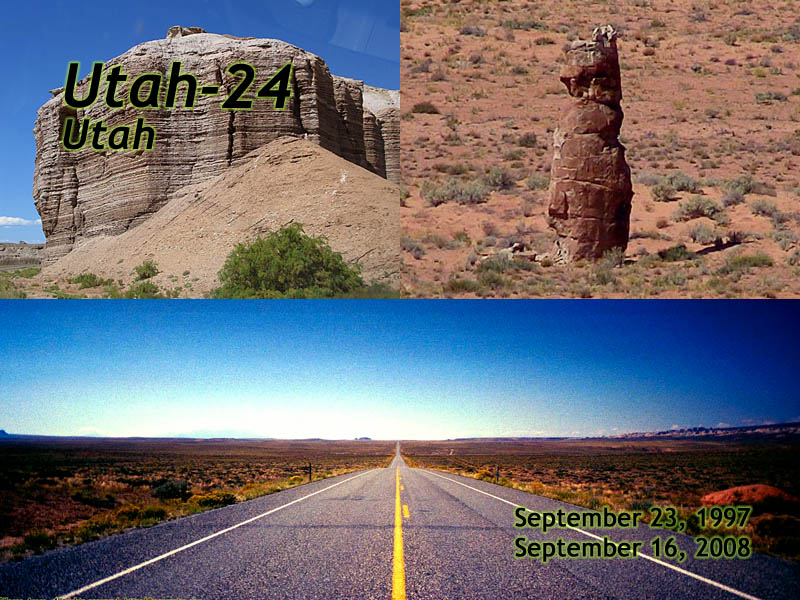
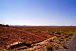
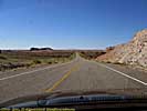
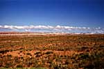
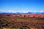
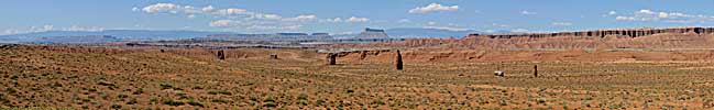
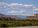
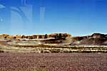
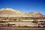
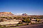
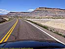
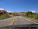
But that doesn't describe Utah-24 between I-70 and Hanksville. It's a flat area in the desert between the almost impassible San Rafael Swell, and the almost impassible wilderness West of the Colorado River. The road is almost arrow straight for 35 miles, and while it's obvious that at one time the end angled more toward Green River, it now angles toward I-70.
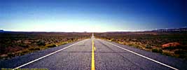
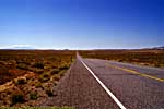
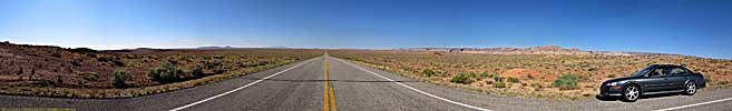
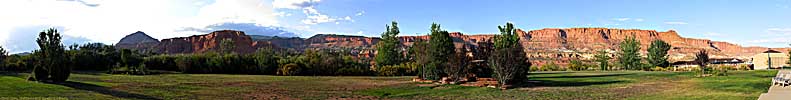
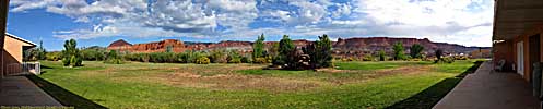
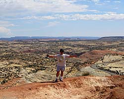
As a personal note, the third photo below (taken in 1997) got me $50 and a Top Ten Car and Driver hoodie sweatshirt as one of the top 10 straight roads. The wider panoramic below that is from 2008, and (I believe) the same spot, at the crest of a small rise in the road.
That might have been my 15 minutes of fame...
Utah-24, I-70 to Goblin Valley State Park
Utah-24 - Goblin Valley State Park
About halfway down this straight section of Utah-24, is a road that leads to Goblin Valley State Park, a recommended stop if you're going to or from Capitol Reef or Utah-12.| Goblin Valley State Park, Utah | |
|---|---|
|
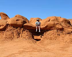
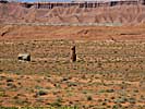
Goblin Valley State Park is a very unusual place that has thousands of relatively small stone monuments that the guy who discovered the place called "Goblins". I thought they looked more like mushrooms. Jo thought they look more like... poops. It's only a few miles off of US-24 from I-70, on the way to Capitol Reef and Torrey, the start of Utah-12. It's worth the stop. Just be aware you might be in the very definition of "Middle of nowhere". |
| Near Hanksville, Utah / 22 Images. Visited Sep 2008. | |
Utah-24 - Goblin Valley State Park to Capital Reef National Park
|
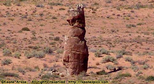
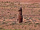
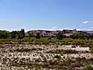
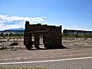
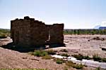
| Prairie Dog Rock. (You can't make this stuff up. Well, yeah you can, but I didn't.) |
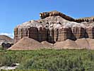
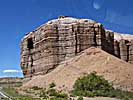
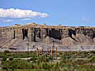
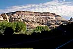
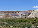
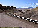
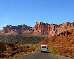
Once the road reaches Hanksville, it turns to the West and starts to follow the Freemont River Valley through the Waterpocket Fold. The Freemont was a big enough river to erode its way through the Fold as the land was thrust upward 60 million years ago, and is a natural passage through the geologic barrier. (See Capital Reef National Park for more information on the Waterpocket Fold.)
Of course, just because you're next to a flowing river doesn't mean you still aren't in a desert, it just means you'll have an easier time travelling through the terrain because the river eroded the landscape flat. But outside the river valley, the landscape is a magnificent confusion of rock that's been pushed, bent, cracked, and thrust out of the ground a hundred feet into the air.
Utah-24, Goblin Valley State Park to Capital Reef National Park
Utah-24 - Capital Reef National Park
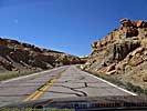
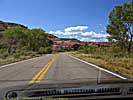
Utah-24 goes right through Capitol Reef National Park, and is actually a major part of the park and its sites (and sights). The road crosses through the Waterpocket Fold and then follows the "Reef" past the Visitors Center all the way to Torrey. Along the way is access to the river, several historical sites such as Fruita and its orchard and schoolhouse, access to slickrock and scenic sights such as the Goosenecks of Sulphur Creek. :-) It's a gorgeous drive.
| Capital Reef National Park | |
|---|---|
|
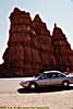
Capital Reef National Park protects the Waterpocket Fold, the edge of a geologic up thrust long since eroded away over the last 60 million years. Give or take a few million. The first time I was at the park, the Scenic Drive was washed out due to some flash flooding, so the sights along Utah-24 were the only ones accessible. When I was there in 2008, I had some magnificent weather, a much better planned trip, and spent the entire afternoon in this park. |
| Near Torrey, UT / 95 Images. Visited Sep 1997, Sep 2008. | |
Torrey, Utah (Best Western)
The Best Western in Torrey (at least in 2008), was one of those hotels that had two types of ratings on travel sites. The mediocre to bad reviews, and really good reviews. It once again boiled down to whether you booked a new room (suites) or an older room.I had booked a suite, and a very nice room it was. The door from the parking lot opened up into the bedroom, with the bathroom beyond that, then a living room with sink, fridge, microwave and a pretty darn good view out the back.
I liked the place, and you can't beat the location, right outside the park. The attached restaurant was okay, but I might try one of the other places in the area next time.
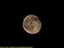
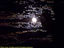
This area of the country is supposed to be one of the least light-polluted places in the US, so of course, I was there on a cloudy night with a full moon. Timing is everything...
Related Links
Of course, the whole reason I've travelled Utah-24 was to get to or from Utah-12. Utah-24 might be an awesome road, but Utah-12 tops my list of roads to drive...
| Utah State Route 12 | |
|---|---|
|
Utah State Route 12 (also named as the
"Journey Through Time Byway") is my favorite road in America.
|
| Utah / 67 Images. Visited Sep 1997, Sep 2008. | |
Utah 24 Trip Report: Sep 1997, Sep 2008.
| Return to: | State Index | Utah State Page | Roads |
|---|
- 04/30/2016 - Initial deployment
- April 2017 - Upgrade to v3.4.
- September 2022 - Upgrade to v5.0.
| Help! | About This Site | Contact Me |