
The Grand Staircase
& Grand Staircase-Escalante National Monument
| Introduction | The Grand Staircase | Grand Staircase - Escalante National Monument | Related Links |
|
| Click to go directly to the slideshow |
When I first came through this area in 1997, I had absolutely no clue on what I was seeing as I drove upwards in time from the Grand Canyon through Zion and Bryce Canyon, then up Utah-12 and 24. You saw the exhibits in the visitors centers and signs around the parks, but they form a disjointed picture because of the local-centric explanations. Most of the information would tie some formations in the park to other areas of Utah, but mostly missing was the background for it all.
So let's see if we can just hit the highlights...
|
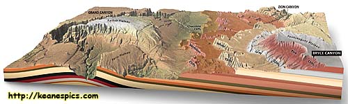
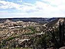
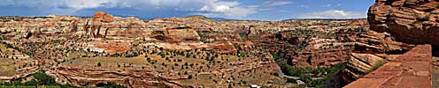
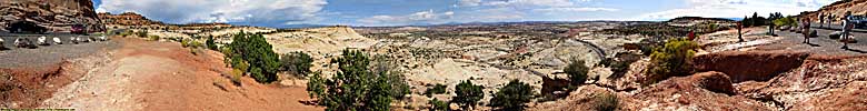
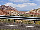
| Profile of the Grand Staircase in Utah/Arizona. Click for a larger view. |
- 200 to 300 million years ago, North America was part of the super-continent Pangaea. Because of its location within Pangaea, little moisture ever reached "North America" making it an almost lifeless desert. For millions of years, sand blew in and covered the area creating sand dunes, and as more layers were deposited, the older layers were compressed into sandstone.
- About 130 million years ago (after the breakup of Pangaea) an inland sea formed in the sub-tropical environment, covering most of middle America from what is now the Arctic Ocean to the Gulf of Mexico. Millions of generations of hard-shelled sea creatures lived, then died and formed the limestone of middle America. The shallow, sub-tropical sea shore was perfect for evolving the dinosaurs we know of today, which is why dinosaur fossils are found all over the central US, mostly in the deserts and badlands where little erosion takes place.
- The most important event happened 70 million years ago, when the Pacific (tectonic) Plate collided with the North American Plate and started pushing its way under at a rate of about 2 inches per year. As more of the Pacific Plate moved "Eastward" and under the North American Plate, it pushed (and is pushing) the North America Plate upward, creating some structures still visible today, like the Rocky Mountains, the Waterpocket Fold, and The Grand Staircase. As this uplift occurred, it drained the inland sea, which is why you can find marine fossils thousands of feet above sea level in places like Utah, and in the badlands of Western Nebraska.
While the granite was pretty tough stuff, the softer sandstone to the West was not. It eroded away after millions of years, forming some of the odd formations out West. One of these is the Grand Staircase, which is a large area of Southern Utah and Northern Arizona.
The Grand Staircase
|
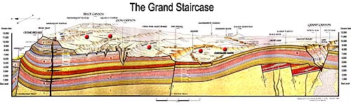
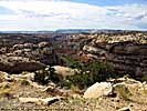
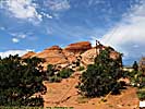
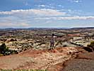
| Another profile of the Grand Staircase in Utah/Arizona. Click for a larger view. |
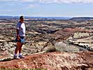
It's thought the North American plate in this region has been pushed up 5,000 to 10,000 feet, with the youngest and highest exposed rock around the Markagunt Plateau.
It's called a journey through time because in the (relatively) short drive, you travel over a layer of relatively young rock at the top of Bryce Canyon, around 140 million years old, to the bottom of the Grand Canyon, where the rock is somewhere around 1700 to 1800 million years old. That's over a billion and a half years of geologic history in some 300 to 400 linear miles.
Looking at it another way, the oldest rock in Bryce Canyon National Park is roughly the same as the youngest rock in Zion National Park. The oldest rock in Zion, is the same layer as the youngest rock in Grand Canyon. So just by visiting those three parks, you can see over 1.5 billion years of exposed, sedimentary rock.
You can also see from the cross section, the up thrust under the Grand Canyon area was the cause of the buzz saw effect of the Colorado against the rock. As the ground moved upward, the river cut its channel deeper, trapping it within the deep canyons we have today, from around Moab, Utah to the Gulf of California.
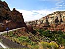
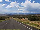
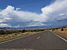
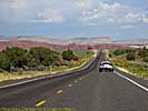
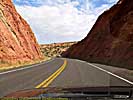
It is another geologic wonder transversed by US-89, though other roads that transverse the Staircase, like Utah-12 are just as spectacular.
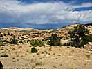
Grand Staircase - Escalante National Monument
|
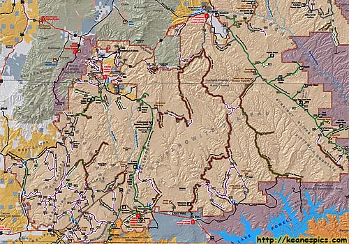
| Cropped map of a terrible map of Grand Staircase - Escalante National Monument from the BLM website. |
And while it is a desert, with zip codes with less than two people per square mile in it, it's still larger than the state of Delaware! (The Federal Goverment owns over 50% of Utah. National Parks, Monuments, Recreation Areas, BLM land, National Forests, etc, are all under the jurisdiction of the Feds.)
If you travel to the interior of the park, make sure you have emergency supplies just in case. Should you be off the beaten path (not that there are a lot of beaten paths in the first place), it could take days for you to be found, assuming the authorities know where to look. (Always file a plan with someone. Cell phone service does not exist in most of the park.) This is not a place to win Darwin Awards because you blindly followed a GPS.
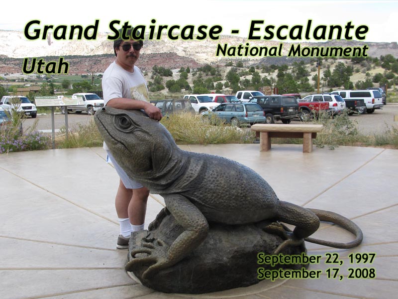
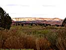
The first time I was through the park was in 1997, and I didn't even know it was a National Monument. (It was just over a year old at the time, and plans weren't even considered until sometime in 2000.) The second time through had the visitors centers built, but the park was virtually unimproved.
We were staying the night in Escalante in 2008, so we decided to try to get to one of the rock gardens in the park, one of the few places that doesn't require you to have a high-clearance, 4WD vehicle. It was 14 miles down a gravel road, which became a wash boarded hell seven miles in. Even if you think your car can handle that, remember your suspension will already be loaded with all your luggage, supplies and people, amplifying the bad road surface. I aborted the trip and had a delicious dinner in town.
Bottom line, if you don't have a high-clearance vehicle you're better off spending your time at Bryce Canyon, Capitol Reef or Kodachrome Basin. On the other hand, if Georgie's Cafe is still open in Escalante, stop in for lunch or dinner. So what if she only has four tables. The food was excellent.
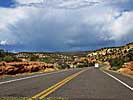
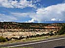
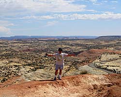
Since some of Utah-12 runs through the park, some images are duplicated here.
Grand Staircase - Escalante National Monument
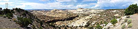
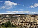
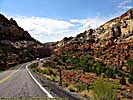
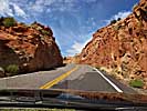
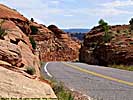
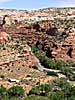
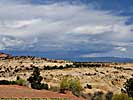
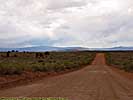
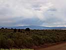
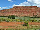
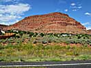
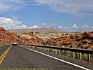
It's funny that I can't really recommend Grand Staircase-Escalante National Monument as a place to visit for the casual traveler, but I highly recommend seeing the established sights on the Grand Staircase itself. Cedar Breaks, Bryce Canyon, Zion, Glen Canyon and Grand Canyon are the big parks, but Kodachrome Basin and Coral Pink Sand Dunes State Park, Little Colorado River Gorge, and many of the public areas along US-89 and Utah-12 are also showcases of awesome scenery and geology.
Related Links
The Utah-12 page might have more images of Grand Staircase-Escalante than this page. It's hard to tell where you are on the road without GPS coordinates. US-89 (older than the Monument) transverses the Southern part of the Park by the base of the Vermillion Cliffs before entering Glen Canyon National Recreation Area.
| Utah State Route 12 | |
|---|---|
|
Utah State Route 12 (also named as the "Journey Through Time Byway") is my favorite road in America. The 124 mile road starts at a unnamed junction with US-89 and ends in Torrey, Utah, pretty much connecting Bryce Canyon to Capitol Reef National Park. In-between are a couple of those spectacular Utah State Parks, a National Monument and some jaw-dropping landscapes just off the side of the road. |
| Utah / 67 Images. Visited Sep 1997, Sep 2008. | |
| US-89 | |
|---|---|
|
US-89 is a remarkable road that follows some of the most scenic areas of the West from Canada to Arizona, and along the way passes through (or comes within a few miles of) over a half dozen major Western Parks. Glacier to Yellowstone to Grand Teton, Bryce, Zion, Glen Canyon and Grand Canyon. I've actually frequented this road quite a bit, but in a disjointed, non-continuous fashion. |
| Visited Various | |
Grand Escalanted Trip Report: Sep 2008.
| Return to: | State Index | Utah State Page | National Monuments |
|---|
- 04/30/2016 - Initial deployment
- April 2017 - Upgrade to v3.4.
- August 2022 - Upgrade to v5.0.
| Help! | About This Site | Contact Me |