
2008 West Vacation, Part 2
September 12 to 27
September 12 to 27
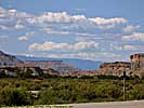
Day 5
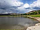
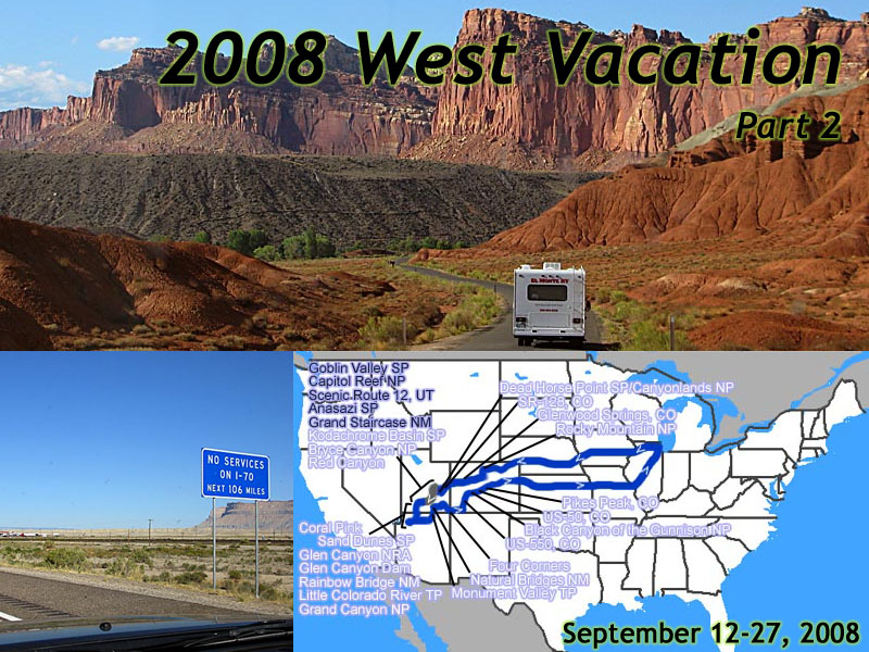 |
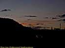
| My 2008 West Vacation. 16 days, 4596.3 miles. Days 5 & 6, Moab, UT to Torrey, UT. |
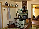
There's a full hot breakfast at The Canyonlands Best Western if you count okay scrambled eggs and thinly sliced bacon as a full breakfast, and it's close enough. I'd stay here again.
Stopped at Utah-128 on the way out and filled a couple of water bottles from the spring. If you watch some of the documentaries on some of the John Ford/John Wayne movies, they describe this spring. Maureen O'Hara said that it was supposed to restore you. Anyway, it flows 24 hours a day, and drains into the Colorado River, where it grows every mile by being fed by small springs like this.
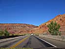
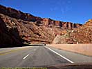
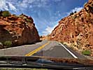
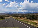
Take US-191 to I-70, and while it's another great Utah road, it's not as scenic as Utah-128. It is faster, since it doesn't follow the meanders of the river, and it's made to a US highway standard.
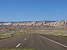
I-70 is no different, the vistas of the desert are awesome. It occurs to me that since I always exit/enter I-70 from here, and re-enter/exit I-70 around Cisco, there's a 25 miles stretch of I-70 I've never seen. Oh well.
We pass a series of signs that warn there's no services on I-70 for over a hundred miles. I'll bet the gas stations do a booming business at this exit. I also figure this is where all that money that goes into the maintenance of your car pays off...
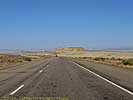
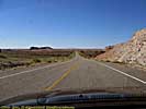
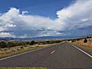
Get off on Utah-24, one desolate road in 1997, but a lot more traffic in 2008, much of it rent-an-RV types. At some point, my check engine light comes on. I hate it when that happens. Last fill up was in Moab. I wonder if I got bad gas, or my car just choked at being at high altitudes. Like me...
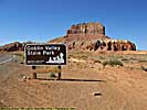
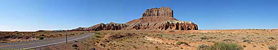
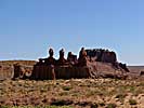
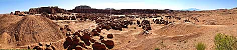
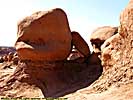
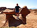
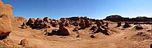
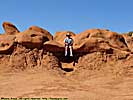
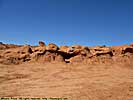
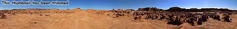
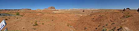
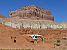
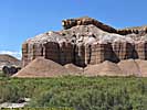
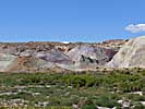
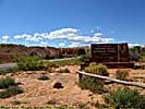
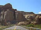
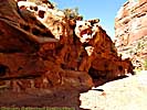
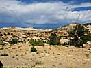
Goblin Valley State Park, UT - September 16
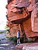
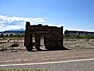
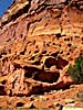
First stop of day was Goblin Valley State Park. There's a road that crosses US-24 about halfway between I-70 and Hanksville (which is on the map only because a few dozen people live there), that's the very definition of the middle of nowhere. If you turn West and follow some signs, you end up at a state park named Goblin Valley, which is more in the middle of nowhere than the crossroad where you turned.I had always read the roads to the park were unpaved, and I was unsure if I should go there, but the road is fully paved and some portions are excellent. Utah State Parks takes my $7, and we enter the park. (Hindsight sez I should have bought a Utah State Park Pass. We ended up going to five Utah State Parks,
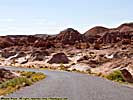
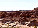
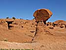
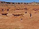
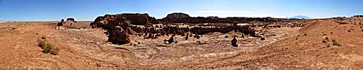
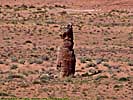
The valley itself holds some amazing stone structures. The person who discovered it, saw the stone structures as Goblins, and named the area. I think they look more like stone mushrooms, but mushroom valley doesn't have nearly the coolness of goblin valley. Jo, who doesn't like mushrooms, thinks they look like poop. Poop valley. That'd be a tourist draw.
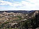
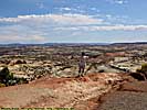
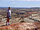
Once again, it very easy to lose perspective when viewing the images. There are people in the pictures...
If the place looks vaguely familiar, part of the film Galaxy Quest was filmed here. This is where the crew comes to get a Beryllium Sphere and meet the rock creature. If you never heard of the movie, join a lot of other people. I didn't see it until after I saw Goblin Valley, and the only reason I watched it was because they had a beryllium sphere in the visitor's center. :-)
(The movie is actually pretty darn good. It's not really a parody of Star Trek, but more of a Trek meets reality.)
I'd really like to camp here one moonless night. They say you're something like 10 miles from the nearest street light, maybe one of the last places that doesn't have light pollution. I'll bet the stars are amazing.
We walk among the stone formations for a while, then head out to Capitol Reef.
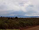
Utah 24 - September 16
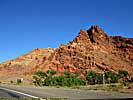
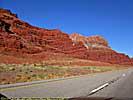
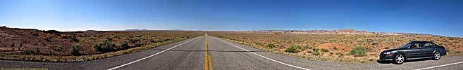
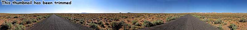
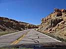
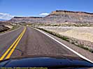
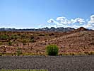
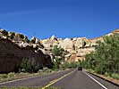
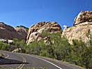
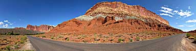
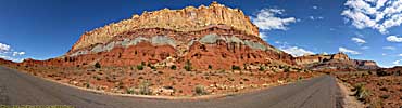
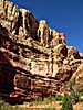
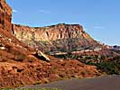
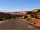
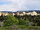
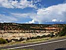
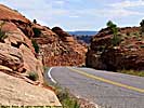
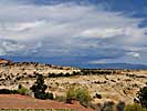
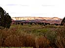
Once past the San Rafael desert, Utah 24 enters the Waterpocket Fold, and the road becomes as unreal as I remember it. Stone cliffs jut out from the ground, and rise a 1000 feet into the sky. We finally get to Capitol Reef National Park.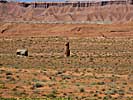
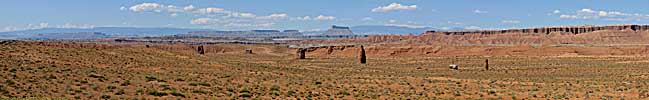
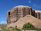
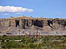
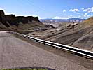
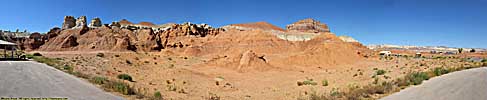
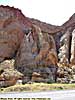
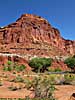
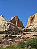
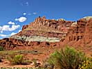
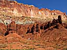
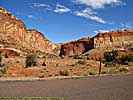
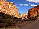
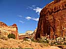
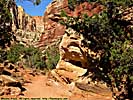
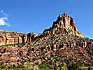
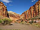
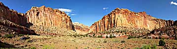
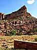
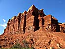
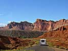
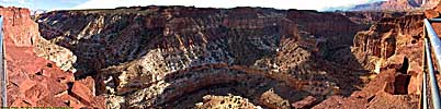
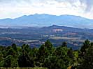
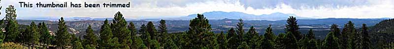
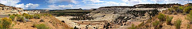
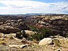
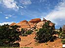
Capitol Reef National Park - September 16
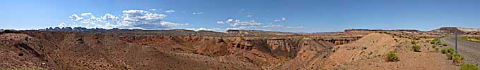
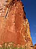
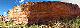
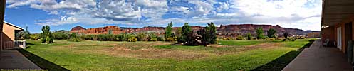
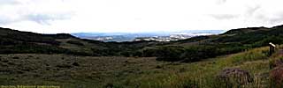
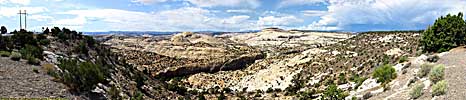
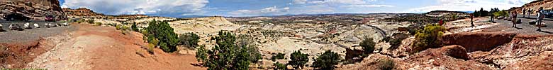
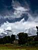
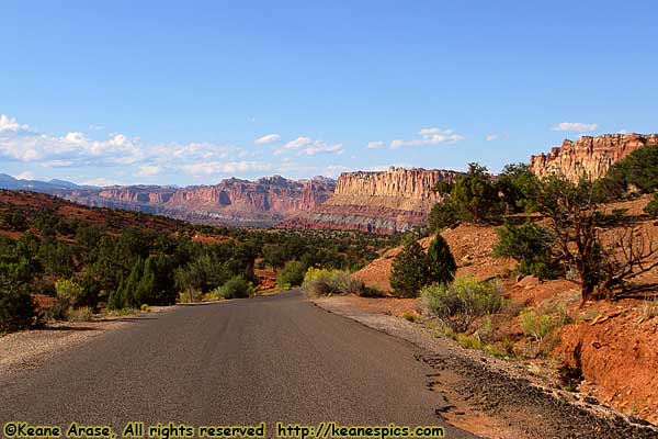 |
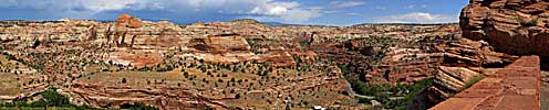
| It's hard to put the vistas in perspective. Capitol Reef National Park, UT. |
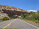
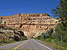
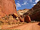
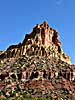
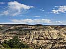
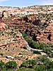
Early pioneers called it a reef because of the near impassable cliffs that just jut up into the sky. We take the Notom road for a few miles. Nothing to see, we get to the Notom site, and there isn't even a sign marking the spot. Back to Utah-24 and stop at the Schoolhouse, can't find the rock I sat on once. Bummer.
Go to the visitors center and get a map. The last time we were here, the Scenic Drive was closed due to some flash floods. This time, the road is open to the end.
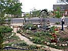
We stop at the Gifford Homestead, where we pick up a couple jars of jam, an 8" peach pie they had baked that morning (they were out of apple) and Jo needed her ice cream fix. Handmade. The Jam was for gifts at home, the peach pie for an after dinner desert, and Jo ate her ice cream there.
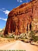
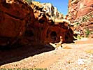
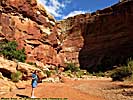
Capitol Reef National Park, part 1


Capitol Reef National Park, Part 2
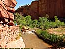
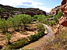
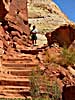
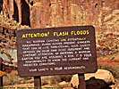
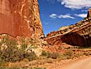
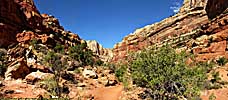
We get to the campground, which is the furthest we were allowed in 1997, and it's easy to see in places why the road would wash out. No soil and sparse vegetation, there's nothing to stop water from going from high to low, and taking everything along the way with it.We stop at the Grand Wash, a streambed that's cut it's was completely through Capitol reef, from Utah24 to the Scenic Drive. After reading the signs of doom, we walk a mile or so into the Canyon. It's interesting to see the Waterpocket Fold close up, and what the power of water can do to the rock...
We take the Scenic Drive to the end, and on the way back find some great views of how far the Reef extends looking West.
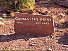
Stop at the goosenecks of Sulphur Creek on the way out to the hotel. There's actually a trail down there.
Capitol Reef National Park, part 2
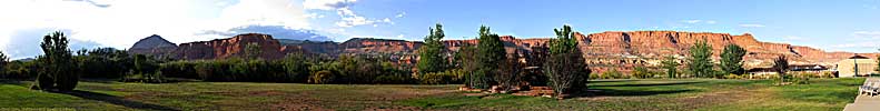
Torrey, Utah
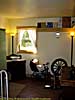
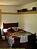
Go to the Best Western in Torrey and check in. We vote it's the best room so far. We have a two room suite; a bedroom and bathroom and a living area. The living area has a DVD player, TV, Fridge, Microwave, sofa, table, and sink, with glass doors in the back with a fantastic view of the "Reef".We ate at the Hotel Restaurant. It was hearty food, but I might try one of the other local places next time. The Polygamy Porter they had was excellent though. ("Bring some home for the Wives." Classic.)
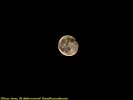
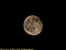
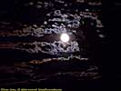
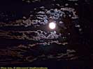
No sunset (blocked by the clouds), but a very pretty moonrise, close to the harvest moon. Too much light put out by the moon to see all the stars. They would have been spectacular out here.
Shower and room 10 of 10. I should point out that there are decidedly less modern rooms on site, and if you read any of the travel sites, you will see the disparity in reviews depending on the room you reserved. I'd definitely go with the suites.
End of day 5 miles: 1860.8. Hotel: Best Western at Torrey, Utah.
Day 6
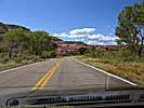
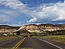
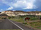
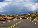
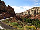
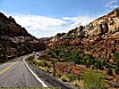
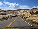
Scenic Route 12, UT - September 17
We have a microwave, so we eat the BBQ from Estes, CO for morning breakfast, rather than have it get too old. Tomatoes and BBQ. Mmmmmm. It was good, it was tasty, it was hearty, it was smoky, and it was way better than the typical breakfasts they have at these hotels.Got gas (for the car, not from the BBQ) and the car washed at the Texaco at Utah-24 & Scenic Route 12. We then took a small tour of Torrey (yes, intentionally) and headed South on Utah-12.
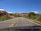
Scenic Route 12 is as amazing as I remember, as it steps down the staircase from Torrey to Escalante, and we will take the road from beginning to the end all the way to Red Canyon. I've noticed on some maps, Scenic Route 12 is being called "A Journey Through Time Byway", which is certainly true from a geologic standpoint, but the "Journey Through Time" starts in Colorado and ends in Arizona...
In 1997, we took the road in the opposite direction. We visited Cedar Breaks National Monument, all of Route 12 (including Bryce Canyon) and half of Capitol Reef in a day, all because I didn't know any better. This trip, we would take over two days just to do Utah-12 and the attractions on it.
It's one of my top 10 roads. If you ever have the chance to drive this road, don't pass it up.
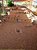
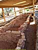
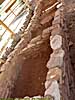
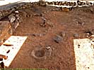
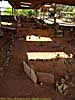
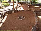
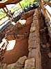
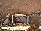
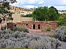
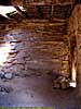
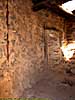
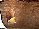
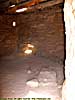
We stopped in at Anasazi Village State Park. It was somewhat of a disappointment, but it was a nice break, and allowed you to get out and stretch your legs and use the bathroom. Maybe it's because I've been to Mesa Verde and a dozens other Anasazi and Freemont Culture ruins across the Southwest, that these didn't impress me. Anyway if you're on your way to Grand Canyon (or vice versa) the ruins in Tusayan Village, on the South Rim Road, is very similar to Anasazi Village.
Scenic Route 12 - Torrey to Anasazi State Park

Scenic Route 12, UT, Part 2
Anasazi State Park is pretty where Scenic Route 12 enters the Grand Staircase-Escalante National Monument. Grand Staircase is huge, larger than the state of Delaware, and barely developed. Let's see if anything is done with it over the next few years.There is a good deal of controversy on why this place is a National Monument, and certainly controversy over whether the Antiquities Act can allow such a large land grab by the Federal Government (i.e. the President, without the will of the Congress or even the State in question). But I will leave that as an exercise to the reader...
Scenic Route 12 - Anasazi State Park to Escalante
Grand Staircase - Escalante National Monument - September 17
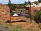
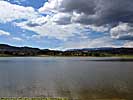
Got to Escalante (the city, which ironically, is not part of the National Monument) and stopped in at Petrified Forest SP, and had a picnic lunch with the last of the supplies and lunchmeat we brought with us from Chicago. The drought year had the reservoir 1/3 size it should have been, and we passed on the Petrified Forest trail when we found out we'd have to climb 200 feet first. Having already done that in Glenwood Springs, it was a deal breaker. :-)Went to Grand Staircase - Escalante National Monument (henceforth known as the GSENM) visitor center and got a map and information about Devil's Garden, one of the only places you didn't need a 4WD vehicle to get there. At least, that's what we were told. It was 14 miles down Hole In The Rock road.
Next step was to check into Circle D. It was the cheapest hotel on our trip, if you don't count the comp'd room late in the trip. Got recommendations for dinner, and decided to take the drive to Devil's Garden. About 7 miles in the road became so wash boarded that we aborted the trip. No way I'm doing that to my car for 14 miles. The bottom half of my car is Utah Dirt Red. Glad I washed the car.
Ate at Georgie's Corner Cafe & Deli, which the hotel owner recommended. It is neither a cafe, nor a deli, but it is some of the best scratch made Mexican I ever ate. It is in a converted house, and if you didn't know it was a restaurant, might just pass it by. She has five tables, four if you don't count the one outside.
We had the Guacamole (with deep fried flour tortillas), I had a Black Bean Tostada with tres leches cake for dessert, Jo had the grilled tacos and a strawberry sundae. We voted it the best meal of the trip.
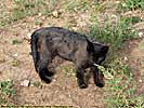
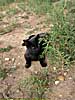
Back to Circle D, it's warm enough to keep the door and windows open. Jo, of course, finds a cat to play with. His name is Rufus, and he's one of the residents of the hotel. Say hello if you're in the neighborhood.
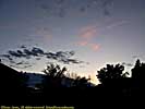
We play a game of scrabble waiting for the sunset. I win, but it's a crappy sunset. The shower was mediocre, but there is a drought here. A drought. In a desert. Who'da thunk it. (Well, we did hear at Georgie's that it was a particularly bad year.) The bed was hard as rock. The Flintstones hard.
As nice as the area is, if I had to do it again, I would have booked two nights at the Best Western at Ruby's Inn. But then too, we wouldn't have eaten at Georgie's, and the food at Ruby's in is okay at best. The owner only recently acquired the place, and was upgrading the rooms, so perhaps it's better now. Circle D Hotel, 2 of 5 stars.
Escalante / Grand Staircase National Monument


End of day 6 miles: 1959.4. Hotel: Circle D at Escalante, UT.
End 2008 Southwest Vacation - Part 2.
| Jump to: | Part 1 | Part 2 | Part 3 | Part 4 | Part 5 | Part 6 | Part 7 | Part 8 | Part 9 | Part 10 |
|---|
- 02/25/2009 - Initial Deployment
- 08/15/2013 - Update to v3.11
- 08/31/2014 - Update to v3.2
- September 2022 - Upgrade to v5.0.
| Help! | About This Site | Contact Me |