
Bryce Canyon National Park
|
| Click to go directly to the slideshow... |
The area became an attraction of sorts, and people referred to the place as Bryce's Canyon. Eb eventually left in 1880, due to a prolonged drought that affected the area.
In the late 1910's, Ruby Syrett bought land in the area, and established guide services and started a hotel. That foresight paid off. While Ruby had to give up some land inside the park, the Syrett family still owns all of the properties right outside the park, from the gas stations to the restaurants, shops and hotels.
Bryce Canyon National Monument was established in 1923.
Congress authorized the National Park in 1928.
|
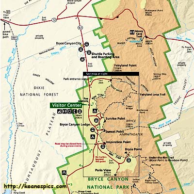
| Cropped map of Bryce Canyon National Park. Click on the map for a full map. |
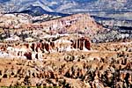
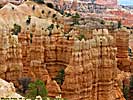
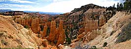
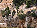
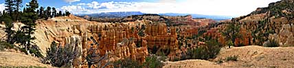
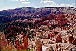
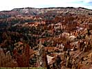
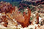
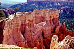
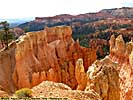
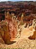
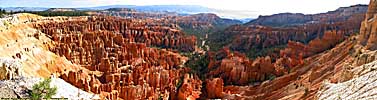
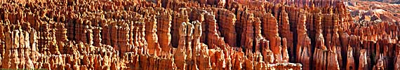
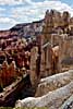
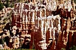
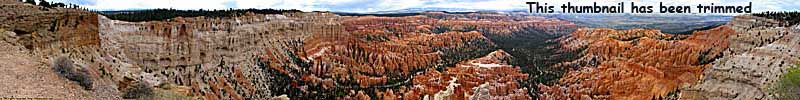
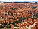
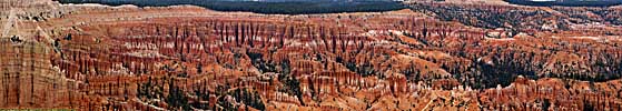
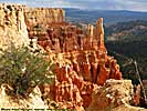
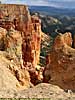
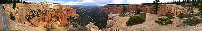
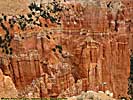
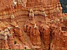
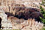
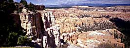
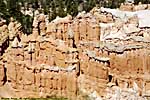
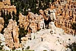
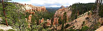
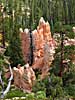
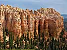
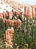
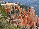
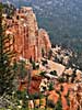
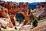
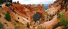
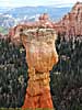
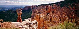
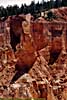
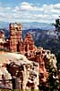
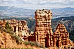
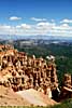
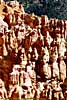
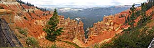
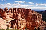
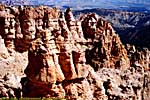
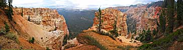
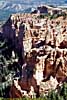
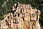
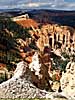
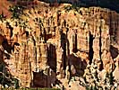
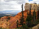
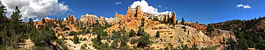
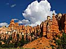
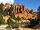
Bryce Canyon is probably the premier showcase of this erosion, forming vertical columns that often looked carved rather than eroded, locally known as Hoodoos. (Cedar Breaks National Monument, just down the road to the West, shows this same type of erosion on the other side of the plateau.)
I listed Bryce as my second favorite National Park, due to the majestic sandstone formations, easy access via the park road, and managable crowds (at least when I visit in September). The hostle nature of Southern Utah may keep it that way, but it might become the overflow park for places like Zion. (Zion these days is reported to be a zoo...)
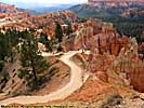
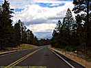
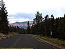
Another highlight, is the park is on one of my favorite roads...
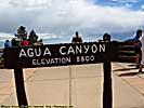
One still has to keep in mind that that most of the park is over 7,000 feet, so if you're not used to the altitude, plan on some extra time getting around...
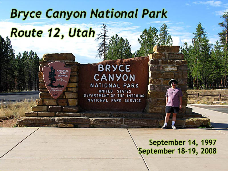
I had visited the park in September 1997 and September 2008.
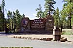
Entrance
Even in 1997, I commented that putting a garbage can in front of the entrance sign was a really thoughtless. There are probably 1000's of photo albums with a picture of the entrance sign... and a garbage can. By 2008, not only did they build a small plaza in front of the sign so stupid tourists could pose (gosh, like me), but put in a small parking area.It's also interesting to note the only tree still recognizable in the background is the one behind the sign.
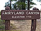
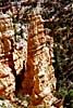
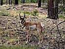
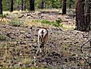
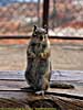
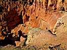
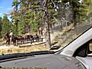
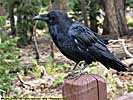
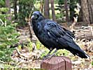
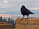
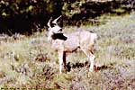
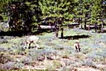
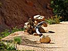
Fairyland Canyon is actually inside the park boundaries, but outside the fee area. I suppose it's the free preview before you have to pay to see it, lol. I'll add that I just love wildlife that's so unconcerned that you're there that they turn their back on you...
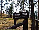
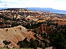
I have to confess, I've never been here at Sunrise. At least it was a nice day!
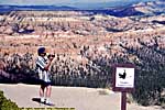
Sunrise Point
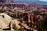
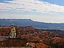
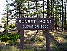
Well, I've never been here at sunset, either.
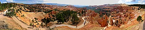
Sunset Point
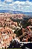
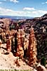
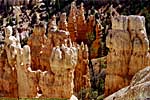
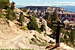
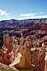
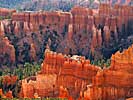
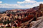
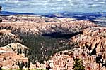
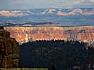
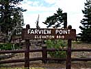
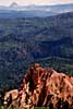
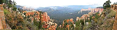
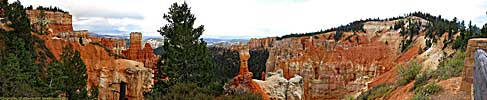
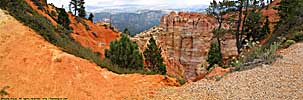
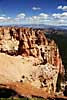
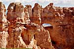
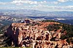
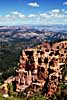
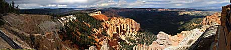
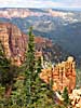
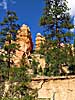
If Sunrise and Sunset Points didn't showcase Bryce's hoodoos enough, Inspiration Point might have some of the best hoodoos in the park.
Inspiration Point
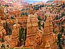
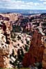
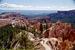
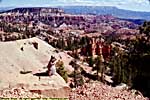
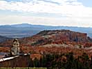
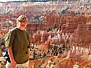
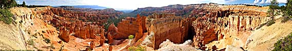
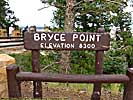
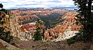
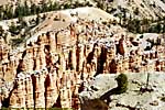
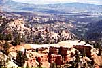
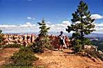
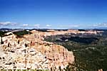
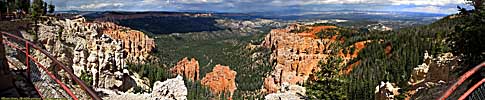
I guess it's only fitting that the best and most majestic amphitheater in the park is named after the Mormon who settled here. There is a hike up to the viewpoints from the parking area, which would be a piece of cake if you weren't at 8300 feet. I found it tough at that altitude, lol...
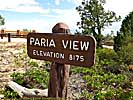
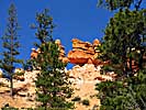
Bryce Point
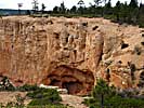
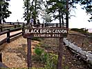
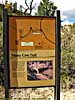
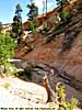
The Mossy Cave unit is off of Utah-12, four or five miles from the turn off to the main part of the park. Jo was going to go horseback riding, so we didn't hike all the way to the cave. Of course, being 7,000 feet above sea level could have had something to do with it...
Related Links
| Rubys Inn | |
|---|---|
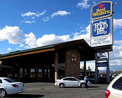 |
Ruby's Inn is named after Ruby Syrett, who promoted the area in 1910, years before Bryce Canyon became a park. As a matter of fact, the Syrett family still owns the land right outside the park, as well as the two hotels, both gas stations, the restaurants, all the gift shops and grocery store. Only the original Best Western existed when I was there, and I stayed in a brand new room with a whirlpool tub right next to the pool atrium. It was rough, but someone had to do it... |
| Near Bryce Canyon National Park, Utah / 25 Images. Visited Sep 2008. | |
| Utah State Route 12 | |
|---|---|
|
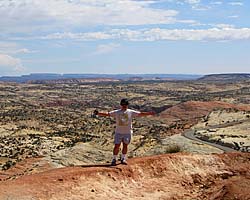
Utah State Route 12 (also named as the "Journey Through Time Byway") is my favorite road in America. The 124 mile road starts at a unnamed junction with US-89 and ends in Torrey, Utah, pretty much connecting Bryce Canyon to Capitol Reef National Park. In-between are a couple of those spectacular Utah State Parks, a National Monument and some jaw-dropping landscapes just off the side of the road. |
| Utah / 67 Images. Visited Sep 1997, Sep 2008. | |
| US-89 | |
|---|---|
|
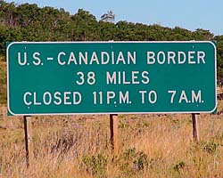
US-89 is a remarkable road that follows some of the most scenic areas of the West from Canada to Arizona, and along the way passes through (or comes within a few miles of) over a half dozen major Western Parks. Glacier to Yellowstone to Grand Teton, Bryce, Zion, Glen Canyon and Grand Canyon. I've actually frequented this road quite a bit, but in a disjointed, non-continuous fashion. |
| Visited Various | |
| Grand Staircase-Escalante National Monument | |
|---|---|
|
Grand Staircase-Escalante National Monument is actually larger than the state of Delaware, but has a population close to the number of visitors in the park. The GSENM page starts with an overview of what the Grand Staircase actually is, a geologic wonderland stretching from the Aquaritus Plateau at Bryce Canyon to the bottom of the Grand Canyon. This 8,000 foot drop in elevation in almost discreet steps holds some of the most breathtaking scenery in America. |
| Near Escalante, Utah / 33 Images Visited Sept 1997, Sep 2008. | |
Bryce Canyon Trip Reports: Sep 1997, Sep 2008.
| Return to: | State Index | Utah State Page | National Parks |
|---|
- 04/30/2016 - Initial deployment
- April 2017 - Upgrade to v3.4.
- August 2022 - Upgrade to v5.0.
| Help! | About This Site | Contact Me |