
2006 Pacific Northwest, Part 1
July 23 to August 12
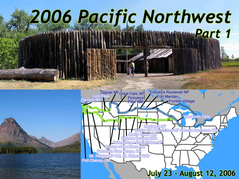 |
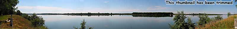
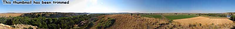
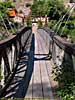
| 2006 Pacific Northwest Vacation - 21 days, 6700 miles. Days 1 to 4, Home to Glacier National Park. |
Background / Planning
Who: Me and Jo.Where: The Pacific Northwest.
When: July 23 to August 12, 2006.
My destination this trip was the Pacific Northwest. Almost the farthest Northwest you can go in the continental United States. It could have technically be called my Grand Teton Vacation, since I'd be staying in Teton for three nights, much closer to the middle of the trip than Washington and Oregon, but I'd been there before. That's why this Road Trip was called my Pacific Northwest Vacation, but in reality it's a misnomer.
This trip was mostly about Lewis and Clark.
I never meant to take a long vacation in 2006. I had just done one in 2005, and
was still digesting that one. But not three months after surviving the
Desert Southwest, I got a call from Jo saying she'd be
in Seattle that July for a conference, and she knew my other planned trip went
right through that area. Hmmm...
Now the last really big empty space on my travel map in early 2005, was the entire West coast from Mexico to Canada. When deciding where to go on vacation in 2005, I was mulling over two choices. One was the Desert Southwest, with visits to Tombstone, Disneyland, Death Valley and Yosemite. The other, would be to follow The Corps Of Discovery's route, more or less. I wasn't going to be travelling by canoe, nor would I be crossing the Bitterroots on foot; but I was reading Undaunted Courage by Steven Ambrose, it was the bicentennial of Lewis & Clark's epic journey West to the Pacific Ocean, and I could still visit a lot of the sites by car.
Inevitably, the Desert Southwest won, which filled in the Southwest part of the United States on my map. My Lewis and Clark trip was postponed, I had thought for a couple of years.
But now, I was looking at six (maybe it was seven) months. Really, the only thing standing in my way was... Nothing. The trip got the green light, and I started looking at a route and to get together a plan.
It would be the longest Jo would get away with not having to drive through fly-over country, and the first leg of my trip would be over 2000 miles by myself, all the way to Seattle.
This Road Trip would be the trip of Great Experiments.
Experiment 1: Staying on-site. Well, staying inside the park boundaries as much as possible.
Experiment 2: Hi-Def video. I now had a camcorder that shot 1080i, with an add
on wide angle lens.
Experiment 3: Go during tourist season. Late July/Early August. Almost all of
our other major road trips were after Labor Day, so the crowds would be thinner.
I was on my own until I got to Seattle. A cross country drive by my lonesome. Well, it's not like I haven't travelled by myself before, and I'm a pretty well seasoned traveler. I checked the places I wanted to stop, figured out a timetable, and gave myself five days to get there. I should have given myself six. I always underestimate the sights to see across this country.
The must-stop-at-places I was going to visit on the way West were:
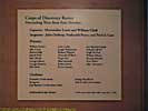
- Fort Mandan, where the Corps wintered in 1804-1805.
- Pompeys Pillar National Monument, the only physical evidence of the Corps cross-country journey.
- Great Falls, Montana, where the reality of the land dashes the expectations of the journey.
- Glacier National Park, because I could.
- The Northwest Passage Scenic Byway, the closest you can come to crossing the Bitterroots without having to cross the Bitterroots.
Then I'd meet Jo in Seattle.
After looking at the preliminary route, it became apparent that it was my 2001 trip extended another 400 miles West. There's only so many main routes across the country, and would overlap a little, under some better circumstances. I would exit the 2001 Trip at Glacier, and rejoin it at Pendleton, Oregon. Well, I already knew what to see on the way home, I just had to plan Washington and Oregon...
I started making some hard reservations. Note that some dates we figured we could improvise on, but some places required reservations.
- 7/28 - Scenic View room at Kalaloch Lodge in Olympic National Park. This was the preferred choice.
- 7/29 - Nisqually Lodge just outside of Mt. Rainier. I actually stayed at Mountain Meadows Inn Bed & Breakfast. I was supposed to stay at Nisqually Lodge, but it's the only time -- EVER -- that a hotel lost my reservation. Actually, it was worse. They had my reservation, but they didn't have a room, yet they did for the tour bus that arrived just before I did. It gets worse, but I'll get to that. Heh.
- 7/30 - Comfort Inn in Kelso, Washington. We just needed a place to stay that night, and Kelso looked like the best (and maybe only) place.
- 8/3 - Jackson Lake Lodge, Scenic View Room. We were going to spend three nights at Grand Teton National Park. And the Teton Lodge had the only availability six months out during tourist season. I could only get a room with a scenic view for the first night...
- 8/4 and 8/5 - Jackson Lake Lodge, Not-So-Scenic View Room. But it was cheaper. On the other hand, the scenic view room is worth the expense.
- 8/6 - Pioneer Cabin, Canyon, Yellowstone National Park. This was the cheapest room for the entire trip, and the only room I could get in Yellowstone on the East side of the park.
This trip, we were packing my Canon G2, Jo's G5, and a Sony HC-3 Mini-DV 1080i
Camcorder. Interestingly, the video gives quite a detailed record
of where I was down to the minute, many times with (spoken) odometer
readings and time checks.
Much of this trip's verbiage has been rewritten as everything on the site gets updated to the new version, and as part of the upgrade, the number of images for this trip grew from 554 to 1034. About half the increase, was to include signs. Now, with digital photography and images costing fractions of a cent, rather than the substantial cost of film, I take a lot of pictures of signs. Not only do they place me where I am in the trip, but they have a lot of interesting information on 'em, otherwise, they wouldn't be there, would they? Heh.
(The truth is I didn't want to put over 1,000 images on the site for this trip, because when I started the site in 2007, disk space was still a consideration.)
Jo had a head start, since her conference started before I left...
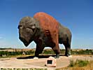
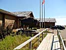
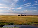
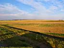
Frontier Village / North Dakota - July 23
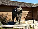
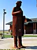
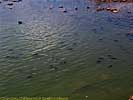
Day one, like most of my Road Trips, was to get as far away from Chicago as possible. By late afternoon, I was in Jamestown, North Dakota, where I stopped for the night. It was only about 725 miles, but rather than drive the 100 miles to Bismarck, I'd stop and get video of Frontier Village.Frontier Village is a charming, little tourist trap which features the World's Largest Buffalo, and a bunch of old buildings from the North Dakota plains. In 1996, this place was my introduction to the Western Interstate Tourist Attraction, the entrepreneurs who stake out a claim along the interstates and try to make a few tourist bucks.
Since I was last there, the National Buffalo Museum had been built, and they had an albino buffalo on property named White Cloud.
Very cool. A good omen, in just about every Native American culture.
Frontier Village / North Dakota
Fort Mandan - July 24
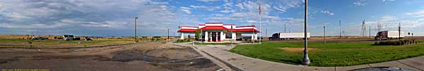
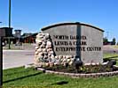
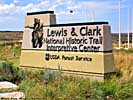
I got on the road at 7am, under the assumption Fort Mandan would be open by 9am. It wasn't the 100 miles on I-94 that slowed me down, as much as the road to Washburn, where the North Dakota Lewis and Clark Interpretive Center is located.2006 was still the bicentennial of the Corps of Discovery's historic trip. By 1806, Lewis and Clark and company were already making their way back, but that hasn't stopped all of the sites from cashing in on the three year long bicentennial.
I was reading Stephen Ambrose's Undaunted Courage and pretty much knew all the places I wanted to go. (If you want an excellent overview of The Corps of Discovery's journey, Undaunted Courage is an excellent read.) To do it right would take months, but I could probably do the high points in a few days. I could, after all, travel a hundred times faster, and in more comfort than William or Meriwether could ever fathom.
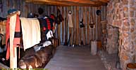
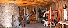
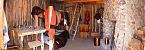
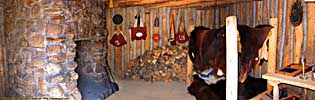
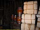
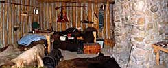
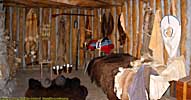
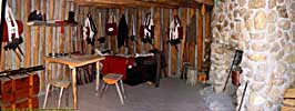
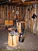
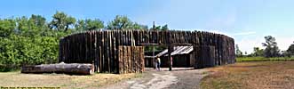
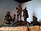
The first stop I had on the Lewis and Clark Trail, was Fort Mandan, an accurate reproduction (but in an approximate location) of the fort The Corps used during their first winter in 1804-1805. I just can't imagine not having indoor plumbing when it's 30 below zero outside. Yeah, I'm a wimp.
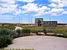
Now, it's a Monday morning, and I'm 30 miles North of Bismarck, North Dakota, and I finally find the North Dakota Lewis & Clark Interpretive Center. You'd think this place would be empty. But there's a tour bus of some sort here, and you can barely get through the Visitors center. But, like the weather, you wait 15 minutes, and all those pesky tourists are gone.
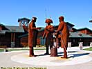
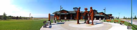
I ask the girl at the gift shop if the bus went to the fort. Yes. So, I hang back, buy a souvenir, take some pictures, and then drive down to the fort. The bus group is out at the fort, and I start at the fort's visitors center by watching an introductory movie with... Ken Burns, Dayton Duncan and Steven Ambrose!
During the movie, you can hear the bus tourists shuffle back into the visitors center, and it gets quiet. After the movie ends, it's a few minutes before a guide is ready, and I get a private tour of the fort. Tour bus, foiled again! Talking with the guide, he'd seen the uptick in Lewis and Clark followers, but none that had arrived by canoe or keelboat.
Interestingly enough, I had only learned to do close-quarter panoramics (like the interiors of rooms) in 2011 or 2012. Going through the photos, I realized I could stitch together all the room photos into panoramics....
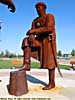
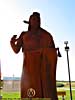
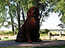
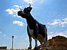
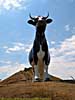
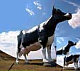
Salem Sue, New Salem, North Dakota - July 24
I had seen this creature twice before, in 1998 and 2001. I finally kept my wits about me and looked for it, and got off the interstate to get a better look. I even paid a dollar to see it.I could get nightmares from this thing. But I've seen it, and I can prove it. :-) Her name (and it is a her) is Salem Sue, and at 38 feet high and 50 feet long, she's the World's Largest Holstein Cow, weighing in at 12,000 pounds. She was erected in 1974, at a cost of $40,000. There's a half dozen facts you probably didn't know this morning, and your life is probably richer for it.
On the other hand, just before I left, three girls pulled up and wanted their picture taken with Sue. No problem. I took the picture and gave the camera back, and the girl thanked me for not stealing her camera....
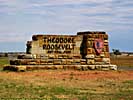
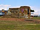
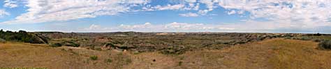
Theodore Roosevelt National Park - July 24
This was the third time through Theodore Roosevelt National Park (having passed through in both 1996 and 2001,) which is easy, since I-94 passes right through the park. This time through, I actually got inside Cross Cabin, the actual cabin (but moved from another location) that TR himself slept in. I only have video of the interiors, but there are pictures of the cabin itself on my 2001 West Trip page...After leaving the park, I continued West on I-94 until I stopped in at a Comfort Inn in Miles City, Montana at 5pm local time.
Theodore Roosevelt National Park
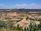
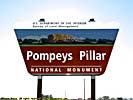
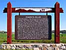
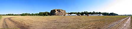
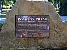
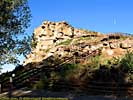
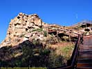
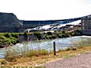
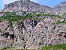
Pompeys Pillar National Monument - July 25
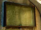
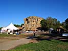
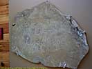
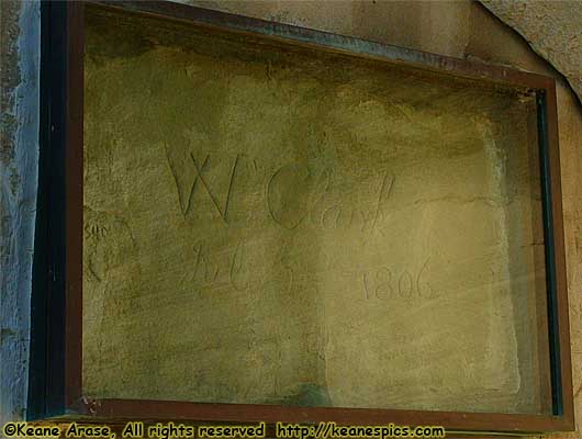 |
| Graffiti left by William Clark 200 years ago. Pompeys Pillar National Monument. |
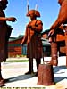
About a third of the way down the Yellowstone, William Clark and party encountered a solitary 200 foot high rock, allowing views for miles in every direction.
He named the rock "Pompy's Tower" for Sacagawea's son Jean Baptiste, who was nicknamed Pompy by the Corps. Over the years the name morphed into Pompeys Pillar, like some 200 year old game of telephone. While climbing to the top, Clark scratched his name and date, July 25, 1806, into the side of the rock, the only physical evidence that exists today of the Corps journey out West.
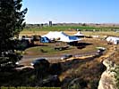
This place was on my list of sites to see, but purely by accident, I arrived at the rock on July 25, 2006, the bi-centennial of the event. Welcome to the circus. I drove to the parking area, only to find tents and that parking had been moved to a neighboring corn field.
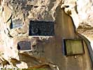
Anyway, they have a new visitor's center, that has a neat floor. It's a representation of the Yellowstone River, with markings of the Corps of Discovery's journey in that July, 200 years ago...
I am sure, that off-roading in my car in that corn field was the start of a crack in my exhaust pipe, which grew steadily worse throughout the trip. By the time I was in Seattle, the car was getting pretty darn loud.
Pompeys Pillar National Monument
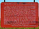
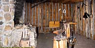
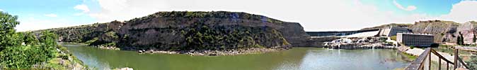
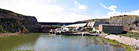
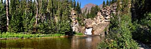
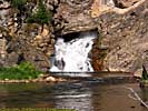
Lewis & Clark Interpretive Center, Great Falls, MT - July 25
Great Falls and the associated chain of waterfalls was an enormous obstacle for the Corps, who had to portage thousands of pounds of canoes and supplies over rough terrain that was covered with prickly pear cactus. Now, the river is dammed, and the falls are...gone. It was probably the second worse part of Lewis and Clark's journey. What they thought would only take a couple of days, took three months.I stayed in a Quality Inn in Great Fall for the night. Now, you'd think that there was an exit named "Central Avenue", and when you got off the expressway the street signs said "Central Avenue", that if you stayed on that street, you would stay on Central Avenue, right?
Incorrect.
For absolutely no apparent reason, once you cross the Missouri River, there is an absolute disconnect, and Central Avenue magically morphs into 1st Ave N. If you have local knowledge, then you know Central Avenue jumps one block South for absolutely no reason, but without local knowledge, you still think you're on Central Avenue, and not only is the hotel not there, there's no evidence of it ever being there. It got me lost for a quarter hour, trying to find the hotel. They could have put a sign up that tells you Central Avenue will no longer be Central Avenue. Sheesh.
Had dinner at a Mexican place (in the hotel) that wasn't bad...
Lewis & Clark Interpretive Center, (not so) Great Falls, MT
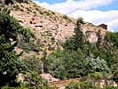
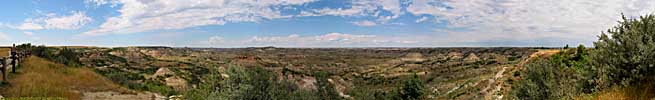
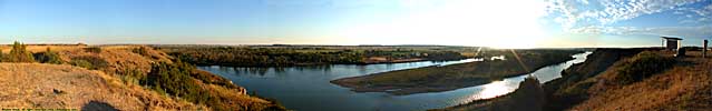
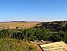
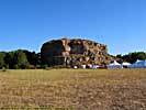
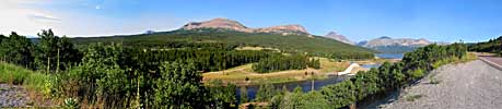
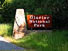
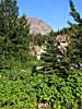
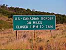
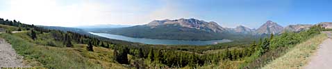
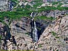
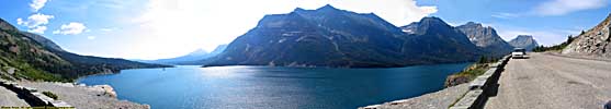
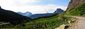
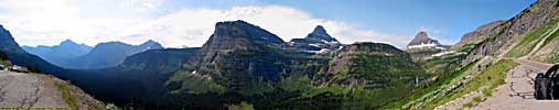
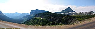
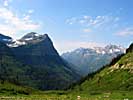
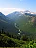
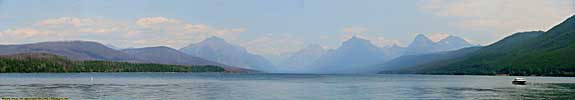
Glacier National Park - July 26
I had a choice between Three Forks, another Lewis and Clark site where the Missouri River is formed at the confluence of the Jefferson, Madison and Gallatin Rivers. Or, I could go to Glacier National Park. Three Forks was sorta on my way to Lolo Pass, where the Corps crossed the Bitterroot Mountains. Glacier National Park, however, was 100 miles out of my way.But, as some smart guy once wrote, "What's a hundred miles in Montana?"
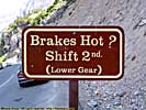
Glacier National Park is a magnificent park. I was here for two days back in September 2001. On July 26th, I would be there for 4.5 hours. A quick trip across the park, down The Going To The Sun road, and back down South to Missoula, Montana.
Might have been stupid, but I got some beautiful images...
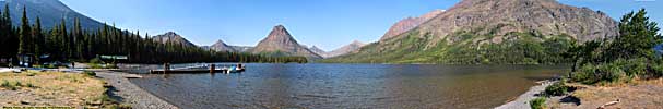
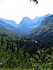
Glacier National Park, Part 1 - Two Medicine
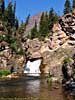
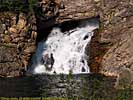
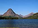
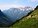
Glacier National Park, Part 2
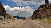
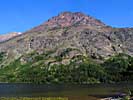
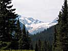
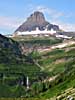
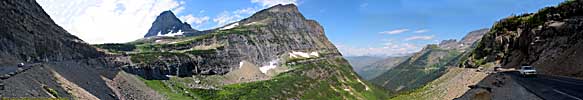
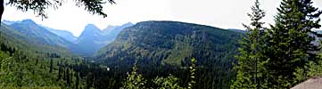
Along Going To The Sun Road, toward Logan Pass. I got to Logan Pass, only to find all the parking taken, with about a dozen cars circling the parking lot like vultures. I took a couple of passes around the lot, and nothing opened up, so I split. Who wants to go hiking at 7000 feet anyway? (And the grapes were probably sour, too.)Now, I supposed to be fair, I should point out that it was the tourist season, and Park Officials recommend taking the buses that run the Going to the Sun road, so you won't have to find parking at Logan Pass. But that's awfully hard to do when you're entering the park from the East side, and will exit the park on the West side...
Glacier National Park, Part 2 - Going to the Sun Road East
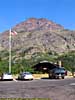
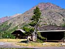
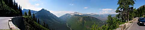
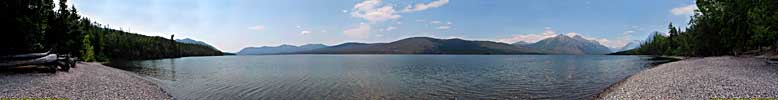
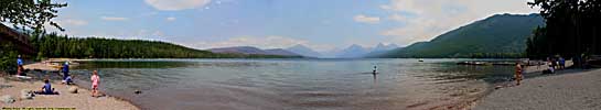
Glacier National Park, Part 3
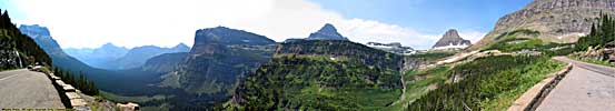
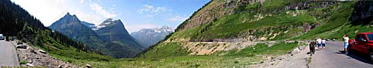
Along Going To The Sun Road, descending the Western slopes toward Lake McDonald and Apgar Village. Once again, the perfect day made for some great images.I left the park, and also left my 2001 route. Rather than crossing the thin part of Idaho into Washington, I took US-93 South toward Missoula, Montana. US-93 was undergoing some exceptional construction, so I used the stop time to call the Quality Inn in Missoula for reservations.
I passed right by The Big Sky Brewing, the makers of that wonderful Moose Drool Ale, but it was already past 5pm, so I didn't even stop in to see if I could get a factory tour...
The next morning, my final day alone, I would drive US-12 across the Bitterroots.
Glacier National Park, Part 3 - Going to the Sun Road West
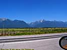
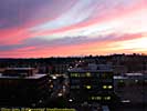
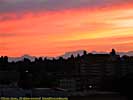
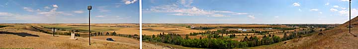
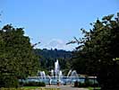
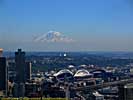
Meanwhile, back in Seattle, Mt. Rainier floats above the city like a UFO...
Jo pic in Seattle, July 26
End 2006 Pacific Northwest - Part 1 of 8.
| Jump to: | Part 1 | Part 2 | Part 3 | Part 4 | Part 5 | Part 6 | Part 7 | Part 8 |
|---|
- 09/16/2013 - Finished update to v3.11
- 08/31/2014 - Update to v3.2
- September 2022 - Upgrade to v5.0.
| Help! | About This Site | Contact Me |