
2006 Pacific Northwest, Part 2
July 23 to August 12
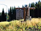
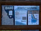
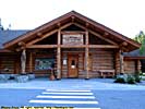
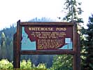
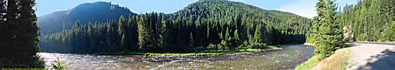
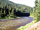
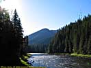
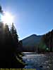
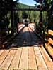
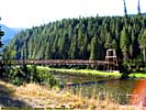
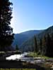
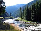
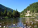
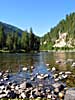
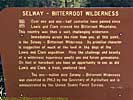
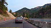
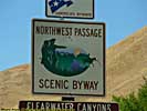
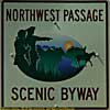
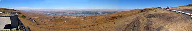
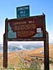
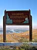
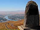
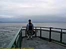
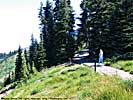
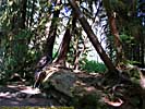
Lolo Pass, Northwest Passage Scenic Byway, Idaho
- July 27
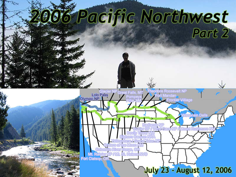 |
| 2006 Pacific Northwest Vacation - 21 days, 6700 miles. Days 5 & 6, Northwest Passage Scenic Byway to Olympic National Park. |
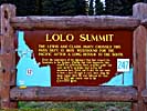
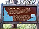
Back in 1805, Meriwether Lewis approached what he thought was the continental divide, the spine of mountains where on one side, all the water flowed East to the Mississippi River, and the other to the Pacific Ocean. He thought he would see what he had already travelled, a gentle slope to the West, to the Columbia River, and there was even a chance he could see the Pacific Ocean. An easy portage of perhaps a day, where he could float the canoes to the sea. That's what all the geographers of the day told him, and what everyone believed.
He reached the top of the ridge... And saw more mountains. Mountain after mountain after mountain. Mountains with permanent snowpacks. Mountains that dwarfed the mountains of the East. At that moment the hope and belief of man since the time of Columbus, of an easy passage between Europe and Asia, died.
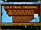
Now if you were reading back in Great Falls, and was wondering about the worst part of the Corps journey, here it is. Lolo Pass, and crossing the Bitterroot Mountains. Patrick Gass, described the Bitterroots in his journal as "The most terrible mountains that I ever beheld."
Worse, when after they befriended the Shoshone, they followed the Bitterroot River to the point to cross the Bitterroot Mountains. They were then told that from this point, they could reach the Missouri in four days. By following the Missouri it's source, it took them 53.
It was September, and Joseph Whitehouse, one of the journal keepers on the trip, was concerned that even though the days were still warm, there was still snow on the peaks of the mountains.
In retrospect, they were completely unprepared for the late fall crossing, nor did it help that their guide, a guy named Old Toby, got lost several times. The Corps nearly died during that stretch to starvation, only to be found and befriended by the Nez Perce on the Western side of the mountains.
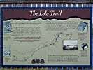
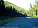
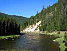
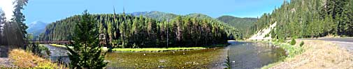
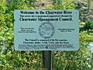
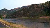
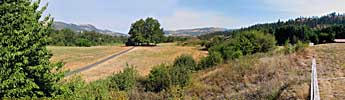
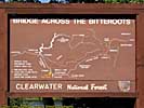
Today, US-12 somewhat parallels the Lolo Trail, just a few miles to the South. It mainly uses the channels cut out by the rivers through the mountains, and while scenic over Lolo Pass, becomes a National Geographic special as it follows the Lochsa River for 60 miles before merging with the Selway River to form the Middle Fork of the Clearwater River.
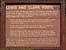
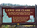
US-12 has several names through this area, The Lewis and Clark Trail, The Northwest Passage Scenic Byway, and The Nez Pierce Trail. Of course, US-12 didn't exist back in 1805. Pity. It would have made the journey so much easier...
Lolo Pass, Northwest Passage Scenic Byway, Idaho, Part 1
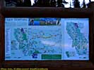
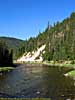
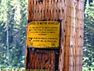
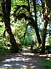
Northwest Passage Scenic Byway, Idaho, Part 2
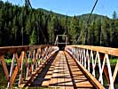
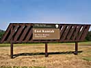
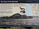
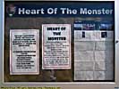
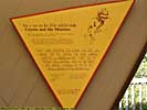
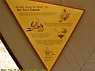
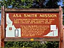
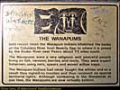
US-12 now follows the Middle Fork of the Clearwater River, and joins with the South Fork to become the Clearwater River, just a few miles before Kamiah, Idaho.The Kamiah Unit of the Nez Perce National Historical Park is here, who's centerpiece is the Heart of the Monster, the legendary birth place of the Nez Perce people.
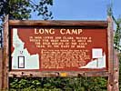
Also along the way is Canoe Camp, where the Corps spent 11 days making 5 dugout canoes for their journey to the Pacific Ocean. When Old Toby learned they were going to canoe the Columbia River, he fled, and was never heard from again.
My travels up US-12 ended at Lewiston. It was already 1:30pm, and I needed to be in Seattle that night, 335 miles away...
I'm glad I came this way. US-12 though the Bitterroots is a beautiful drive, ironic since it was the worst part of the Corps entire trip. I'd probably put it in my top 10 drives. Definitely in my top 25 drives. I'll let you know when I come up with a list.
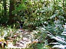
Lolo Pass, Northwest Passage Scenic Byway, Idaho, Part 2

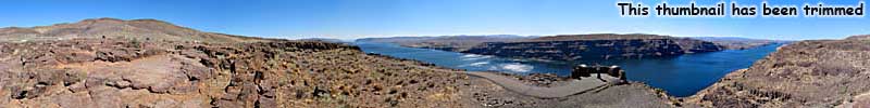
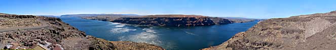
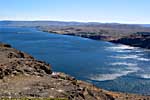
Columbia River Gorge, Washington - July 27
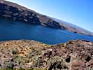
This is the Columbia River Gorge. No, not that Columbia River Gorge. This one is in Washington alone, and is actually a power generation lake. It's immense.I-90 before the Columbia River is straight as an arrow for 70 miles, when suddenly it takes a turn to the Southwest, 5 miles before the river, then due South following the river until it finally crosses near Vantage, Washington. Almost like they didn't know where to cross the Columbia. But I digress.
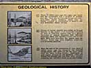
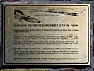
Driving across Washington to Seattle did show me one thing. The amount of volcanic activity that occurred in this region. Across the river from this point is Ginkgo Petrified Forest State Park, where the trees were entombed in once-molten lava dating back 15 million years. I should have stopped, but I was out of time. As I said earlier, I should have taken six days to cross the country, not five...
Columbia River Gorge, Washington
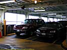
Edmonds / Kingston Ferry - July 28
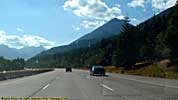
Got up and left the next morning, and the weather was crappy. In Seattle. Imagine that.You have two choices leaving Seattle to get to Olympic National Park. You can drive South around Puget Sound, about a 50 mile detour, or you could take a Ferry.
We took the Ferry. The first time my car has been on a boat over water since it was delivered from Japan five years earlier. I wonder if it realized that. :-)
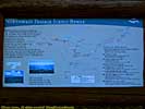
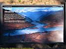
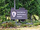
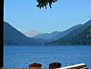
Olympic National Park / Hurricane Ridge - July 28
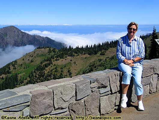 |
| Hurricane Ridge, Olympic National Park. |
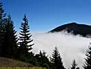
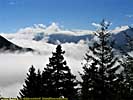
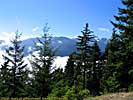
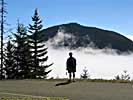
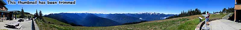
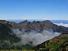
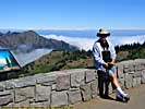
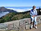
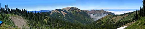
Our first foray into Olympic National Park was up Hurricane Ridge, one of the more popular roads into the park. In some 17 miles, the road climbs from 400 to over 5200 feet, and offers views of the Olympic chain.
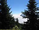
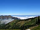
It was one of those magical drives. It started with the sky overcast, it had rained off and on all morning. As the road climbed, it climbed into the clouds, and the fog was so thick that sometimes visibility could be described in yards.
Then we passed through a tunnel that went through the Klahhane Ridge, and burst into sunlight, above the clouds, where we could look down at them and watch them engulf nearby peaks. We were on top of the world...
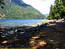
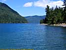
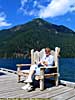
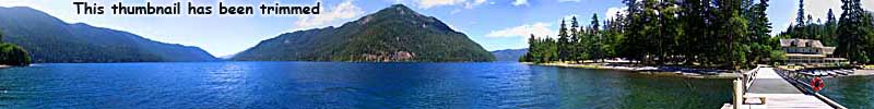
After leaving Hurricane Ridge, we followed US-101 West to Lake Crescent, where we stopped for lunch, and took a few pictures. It's one of those deep, clear, mountain lakes...
Olympic National Park, Hurricane Ridge

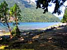
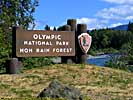
Olympic National Park / Hoh Rain Forest - July 28
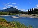
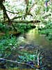
The Hoh relate a tale of an epic struggle between the Thunderbird and the Whale. The Thunderbird is a large bird of monstrous size, and when he opens and shuts his eyes, he makes lightning; when he flaps his wings, he makes thunder and great winds.As you look up the blue-grey Hoh river, you can see Mount Olympus in the background. You'd just better hope you don't see the Thunderbird.
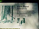
Our next stop was the Hoh Rain forest, named after the Hoh Indian Tribe, next to the Hoh River, on the Upper Hoh Road. I apologize for making a Hoh joke the 10th time we crossed the Hoh River.
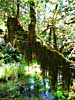
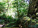
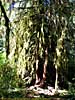
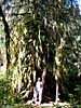
The rain forest is a wonderful place to visit. Of course, it was sunny and bright the day I was there. Leaving the visitors center, a sign 12 feet off the ground has a line on it, showing the annual rainfall the forest receives. But not when I was there.
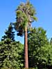
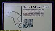
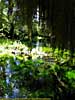
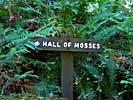
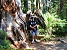
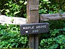
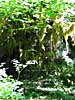
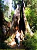
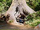
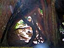
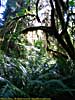
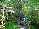
We walked the Hall of Mosses trail, a mile loop that takes you through the rain forest. Maple, hemlock, spruce, cedar and cottonwood make up the forest, some as tall as 300 feet and 20 feet in circumference. There are some big trees here, some national champions.
The Hoh River, like many glacial rivers, is an opaque grey-blue, due to the "glacial flour", formed from the grinding of rock beneath the weight of the ice.
Olympic National Park, Hoh Rain Forest
End 2006 Pacific Northwest - Part 2.
| Jump to: | Part 1 | Part 2 | Part 3 | Part 4 | Part 5 | Part 6 | Part 7 | Part 8 |
|---|
- 09/16/2013 - Finished update to v3.11
- 08/31/2014 - Update to v3.2
- September 2022 - Upgrade to v5.0.
| Help! | About This Site | Contact Me |