Welcome to Backroad's Website!
(Formerly keanespics, or Keane's Pictures)
 |
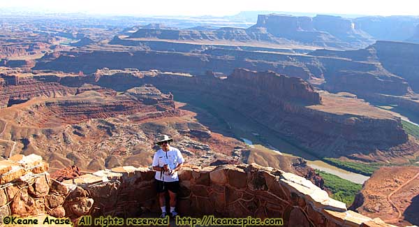
| That's me in Dead Horse Point State Park, Utah |
Introduction
All right, let's get right into it. What creds do I have?
None! Well, that was easy.
I have taken pictures since I was a kid, and in the '90's I started to fulfilled my travel bug and visited a lot of places. I admit, that's not a whole lot to put on the CV, lol.
(To be fair, my career was in computers, but photography has been a serious hobby longer than my career.)
Otherwise, what you see is what you get. But I do have another philosophy. If you want to take amazing photos, go to places that you can't help but take amazing photos. Take Dead Horse Point in the photo above, for example. You could have taken that image with a potato, and it would have looked amazing. Beyond that, you're on your own, but I do have some notes available...
This Website - Things to know
 |
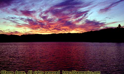
| Sunset, Superior National Forest, Minnesota. September 1995. |
This place for the last couple of decades, has been known as keanespics.com, or Keane's Pictures. However, everything changed all at once. Not only how the website worked internally with a new user interface, but a new hosting service, so I decided to just set up a new domain.
That's why this is version 5.0 of an apparently new website. If you want to know more, see About This Site, where you'll get more information than you probably wanted.
If you were looking for a page that was on Keanespics, it's someplace here on this site. The structure of the site has changed, but the content should be all there. If you can't find it, contact me. With that out of the way...
This is a picture website. Anything else is a bonus. The entire site is based on "Places". The criteria needed to be a "Place"?
1. I was there.
2. I took a few pictures.
Well, that was easy.
But there are some rules. (These aren't the only ones. There are more later.)
This is not Backroad's Information Site. Some of these images are over 30 years old, before places and events could be forever recorded on the Internet. So any added information may be how I remember things, not necessarily how it really was. (Hey! At least I'm honest about it.)
Non-faulty memory events also occur. Forests have burned down, hurricanes have changed the landscape, buildings have be built or razed, and businesses haven't survived and dissolved long ago.
So the information on this site is as accurate as I could research it, or as I remember it. Some information is accurate as it was when I was there. For instance, a couple of National Monuments have been promoted to National Parks. I may refer to them as National Monuments, because they were National Monuments when I was there.- While I've tried to make this site small-screen-friendly, viewing this site on at least a 1280x1024px display is recommended. Most images are 800x600px (digital) or 900x600px (35mm). Panoramics are usually horizontal, 600px high, but have no fixed width. Placing your browser in full screen while looking at slideshows might help. (F11 on most browsers.)
- I've tried to make the site usage intuitive, but in case you can't figure something out, try the help pages to explain the controls. (There is a Help Button at the bottom of every Place Page.)
- If you scroll enough down or to the right (enough to hide any navigation buttons), a "Home" button will appear. (You should see it now.) Clicking this (or the "H" key) will take you back to the top-left part of the page.
Site Organization
There's something like 18,000 images on this site, but it's not as overwhelming as you might think. By default, the images are grouped as follows.
- Every image is grouped into a Place.
- A Place can be a National Park, a Theme Park, a Historic Site, a City or even a Road.
- Each Place usually has its own page (or pages) that has some descriptive text and links to the respective slide show. I refer to these as "Place Pages" in the documentation.
- Every Place is grouped into a "Type". A Type is a group of related Places. For instance all National Parks are grouped for what they are, National Parks. The same is true for Theme Parks, State Parks, Historic Sites, Roads, etc.
That means by default, the entire site is grouped by type. So no matter how you got to that page, it will be in the "Places by Type" hierarchy.
There are, however, three... maybe four ways the Places are indexed.
- Places by Name. This is an alphabetical list of all the Places by name, regardless of location or type. This index is useful if you know the name of the place you're looking for.
- Places By State. This index groups Places by state, so it's a useful index by location. There are also state maps and the routes I took through them, and pictures that didn't fit in any category, or didn't have enough images for its own page.
- Places By Type. This is the default grouping. There are currently 11 "types". Each Type has its own introduction page.
- The fourth way the images are presented are by my Road Trip reports. (The Theme Park equivalent is the Trip or Event Report.) These are images (and recollections) of a trip from the start to finish, and don't involve using any place pages. Usually included is how the Road or Theme Park Trip was planned. This is probably the equivalent of an electronic photo album of a trip.
So here are some more rules. Or at least some more guidelines.
- All of the navigation links are at the top of the page, and Help and other information is available at the bottom of the page.
- If a Place is integral to another place, it will not have its own page. For instance, the Going To The Sun Road is integral to Glacier National Park, so it's in Glacier's page instead of being listed on its own page. Similarly, Goulding's Lodge is in Monument Valley, so it appears on Monument Valley's page rather than it's own. Ruby's Inn on the other hand, is right outside of Bryce Canyon but has its own page because it's not part of the park.
- Links in italics are those places that reside on another place page.
- Maps are provided whenever possible. I will try to provide the source of the maps, which is generally the website promoting the Place.
- All state and US maps were sourced from nationalatlas.gov, who no longer seems to exist. I downloaded these in 2015. All of the National Park System maps were sourced from the excruciatingly slow (maybe not anymore) NPS map site. Road map type maps are probably sourced from programs like Microsoft's Streets and Trips or Google Maps. Credit is given when due.
All the video that used to be on this site is slowly being re-rendered. The finished ones will be on my video page, as well as on my YouTube Page.
And (almost) finally, I did try to make an effort to be a bit coherent. Let me know if I failed someplace...
If you want to read about the history of this site, the equipment I use, how to decode the filenames and other stuff you probably don't want to read, click on the About This Site button at the bottom of all the Place Pages.
And finally, send a comment! Feedback, good or bad, is the only way to improve the site: [email protected]. Alternately, there should be a link on how to contact me at the bottom of each page...
Legal stuff
I own all the pictures and images on this site (unless otherwise noted.) Anyone is free to link to my site, but please use the html page, not the image itself.
You do not have my permission to use any of my images on another web site or any other publication. There is a "Contact Me" link on every page.
Enjoy!
Keane
| Help! | About This Site | Contact Me |
